skip to navigation
|
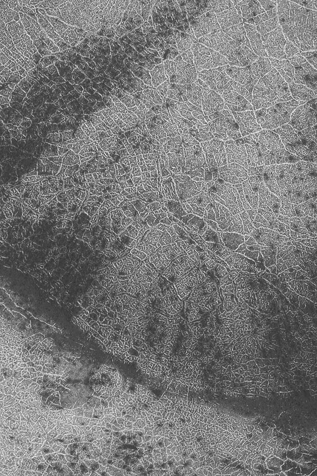
Martian City Map
- Click the image above for a larger view
- Full-Res JPEG (627 x 941) (215.1 kB)
- Full-Res TIFF (627 x 941) (590.8 kB)
Caption:
30 May 2004
Seasonal frost can enhance the view from orbit of polar polygonal patterns on the surface of Mars. Sometimes these patterns look something like a city map, or the view from above a city lit-up at night. This Mars Global Surveyor (MGS) Mars Orbiter Camera (MOC) image shows an example from the south polar region near 80.7°S, 70.6°W. Polar polygons on Mars are generally believed, though not proven, to be the result of freeze/thaw cycles of ice occurring within the upper few meters (several yards) of the martian subsurface. The image shown here covers an area about 3 km (1.9 mi) across; sunlight illuminates the scene from the upper left.
Cataloging Keywords:
| Name | Value | Additional Values |
|---|---|---|
| Target | Mars | |
| System | ||
| Target Type | Planet | |
| Mission | Mars Global Surveyor (MGS) | |
| Instrument Host | Mars Global Surveyor | |
| Host Type | Orbiter | |
| Instrument | Mars Orbiter Camera (MOC) | |
| Detector | ||
| Extra Keywords | Grayscale, Map | |
| Acquisition Date | ||
| Release Date | 2004-05-30 | |
| Date in Caption | 2004-05-30 | |
| Image Credit | NASA/JPL/Malin Space Science Systems | |
| Source | photojournal.jpl.nasa.gov/catalog/PIA06289 | |
| Identifier | PIA06289 | |