
|
Titan’s Surface
- Click the image above for a larger view
- Full-Res JPEG (1541 x 1571) (181.2 kB)
- Full-Res TIFF (1541 x 1571) (2.4 MB)
Caption:
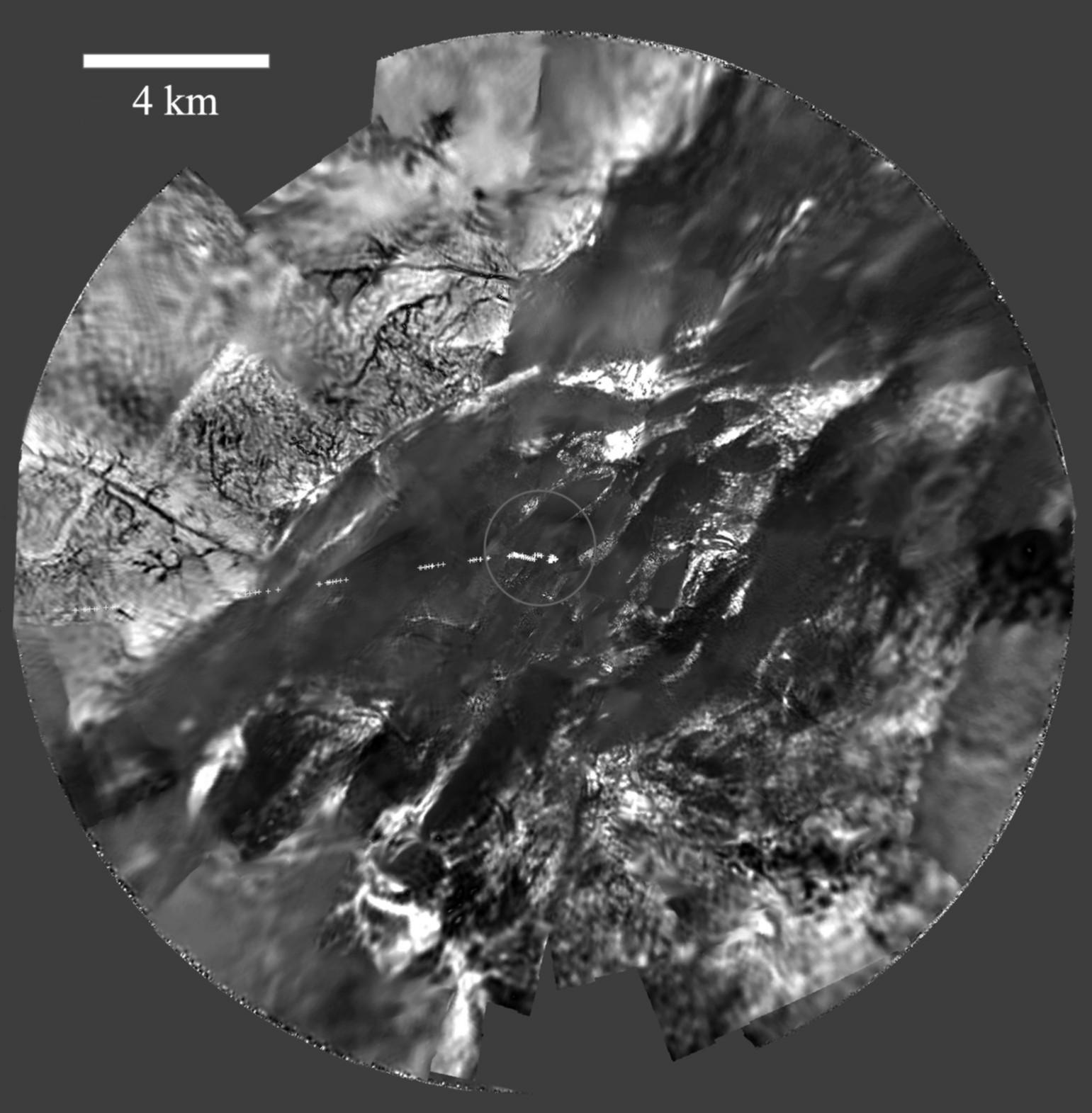
Images recorded by the European Space Agency's Huygens probe descent imager/spectral radiometer between 11 and 5 miles (17 and 8 kilometers) were assembled to produce this panoramic mosaic. The probe ground track is indicated as points in white. North is up. Narrow dark linear markings, interpreted as channels, cut through the brighter terrain. The complex channel network implies precipitation (likely as methane "rain") and possibly springs. The circle indicates the outline of the low-altitude panorama shown in PIA06439 ).
Background Info:
The Huygens probe was delivered to Saturn's moon Titan by the Cassini spacecraft, which is managed by NASA's Jet Propulsion Laboratory, Pasadena, Calif. NASA supplied two instruments on the probe, the descent imager/spectral radiometer and the gas chromatograph mass spectrometer.
The Cassini-Huygens mission is a cooperative project of NASA, the European Space Agency and the Italian Space Agency. The Jet Propulsion Laboratory, a division of the California Institute of Technology in Pasadena, manages the mission for NASA's Science Mission Directorate, Washington, D.C.
For more information about the Cassini-Huygens mission visit http://saturn.jpl.nasa.gov .
Cataloging Keywords:
| Name | Value | Additional Values |
|---|---|---|
| Target | Titan | |
| System | Saturn | |
| Target Type | Satellite | |
| Mission | Cassini-Huygens | |
| Instrument Host | Huygens Probe | |
| Host Type | Probe | Lander |
| Instrument | Descent Imager/Spectral Radiometer (DISR) | |
| Detector | ||
| Extra Keywords | Grayscale, Methane | |
| Acquisition Date | ||
| Release Date | 2005-11-30 | |
| Date in Caption | ||
| Image Credit | ESA/NASA/JPL/University of Arizona | |
| Source | photojournal.jpl.nasa.gov/catalog/PIA06438 | |
| Identifier | PIA06438 | |