skip to navigation

|
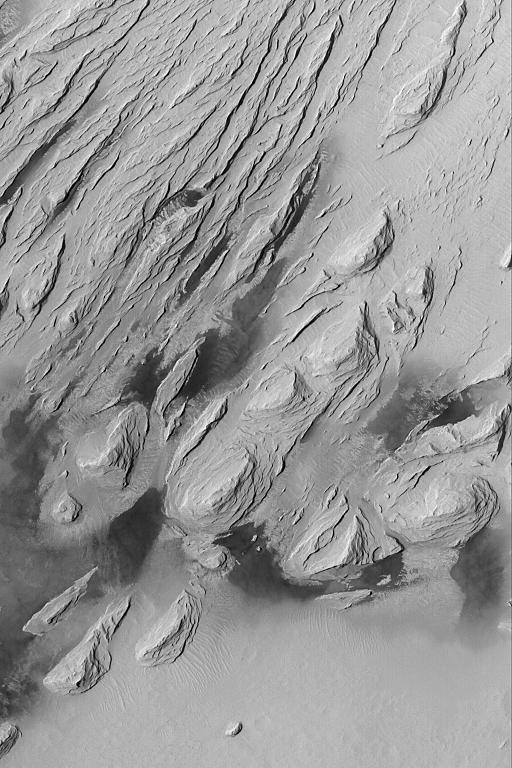
Wind Erosion in Aeolis
- Click the image above for a larger view
- Full-Res JPEG (512 x 768) (89.4 kB)
- Full-Res TIFF (512 x 768) (393.8 kB)
Caption:
09 August 2004
This Mars Global Surveyor (MGS) Mars Orbiter Camera (MOC) image shows the effects of severe wind erosion of layered sedimentary rock in the Aeolis region of Mars. The sharp ridges formed by wind movement from the lower left (southwest) toward top/upper right (northeast) are known as
yardangs.
The dark patches in the lower half of the image are sand dunes. This scene is located near 5.0°S, 203.7°W, and covers an area about 3 km (1.9 mi) across. Sunlight illuminates the terrain from the left/upper left.
Cataloging Keywords:
| Name | Value | Additional Values |
|---|---|---|
| Target | Mars | |
| System | ||
| Target Type | Planet | |
| Mission | Mars Global Surveyor (MGS) | |
| Instrument Host | Mars Global Surveyor | |
| Host Type | Orbiter | |
| Instrument | Mars Orbiter Camera (MOC) | |
| Detector | ||
| Extra Keywords | Dune, Grayscale | |
| Acquisition Date | ||
| Release Date | 2004-08-09 | |
| Date in Caption | 2004-08-09 | |
| Image Credit | NASA/JPL/Malin Space Science Systems | |
| Source | photojournal.jpl.nasa.gov/catalog/PIA06798 | |
| Identifier | PIA06798 | |