skip to navigation

|
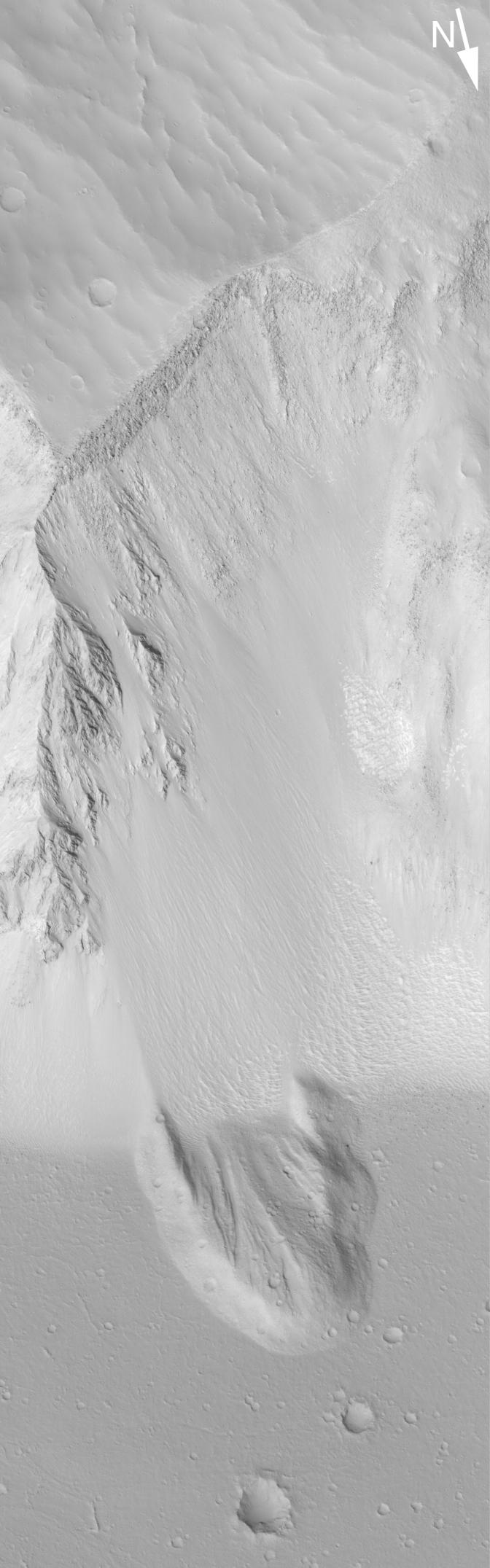
Landslide in Sirenum
- Click the image above for a larger view
- Full-Res JPEG (672 x 2151) (136.2 kB)
- Full-Res TIFF (672 x 2151) (1.3 MB)
Caption:
27 August 2004
This Mars Global Surveyor (MGS) Mars Orbiter Camera (MOC) image shows a landslide deposit in a deep trough in Terra Sirenum near 26.1°S, 140.0°W. After the landslide occurred, subsequent erosion of the slope produced talus that covers part of the landslide deposit. This area is about 3 km (1.9 mi) across; sunlight illuminates the scene from the lower left.
Cataloging Keywords:
| Name | Value | Additional Values |
|---|---|---|
| Target | Mars | |
| System | ||
| Target Type | Planet | |
| Mission | Mars Exploration Rover (MER) | Mars Global Surveyor (MGS) |
| Instrument Host | Mars Global Surveyor | |
| Host Type | Orbiter | |
| Instrument | Mars Orbiter Camera (MOC) | |
| Detector | ||
| Extra Keywords | Grayscale | |
| Acquisition Date | ||
| Release Date | 2004-08-27 | |
| Date in Caption | 2004-08-27 | |
| Image Credit | NASA/JPL/Malin Space Science Systems | |
| Source | photojournal.jpl.nasa.gov/catalog/PIA06834 | |
| Identifier | PIA06834 | |