skip to navigation
|
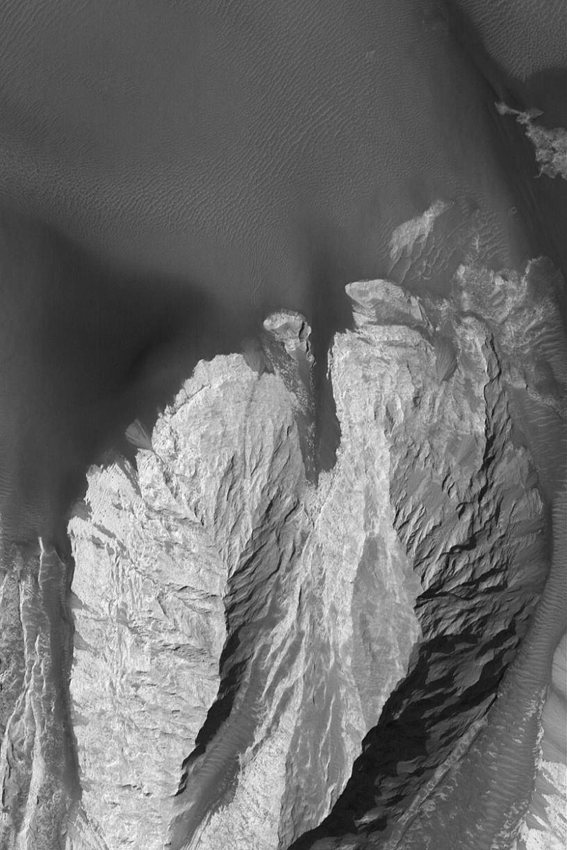
Landforms in East Candor
- Click the image above for a larger view
- Full-Res JPEG (836 x 1254) (170.0 kB)
- Full-Res TIFF (836 x 1254) (1.1 MB)
Caption:
29 October 2004
This Mars Global Surveyor (MGS) Mars Orbiter Camera (MOC) image shows steep slopes of light-toned rock and dark windblown sand in eastern Candor Chasma, part of the vast Valles Marineris trough system. The rock is probably sedimentary. In a few places, rock has broken down and slid downslope to create a narrow chute and a pile of talus where the slope meets the adjacent dark, dune-covered plain. This image is located near 7.8°S, 64.9°W. The picture covers an area about 3 km (1.9 mi) wide. Sunlight illuminates the scene from the upper left.
Cataloging Keywords:
| Name | Value | Additional Values |
|---|---|---|
| Target | Mars | |
| System | ||
| Target Type | Planet | |
| Mission | Mars Global Surveyor (MGS) | Mariner |
| Instrument Host | Mars Global Surveyor | |
| Host Type | Orbiter | Flyby Spacecraft |
| Instrument | Mars Orbiter Camera (MOC) | |
| Detector | ||
| Extra Keywords | Dune, Grayscale | |
| Acquisition Date | ||
| Release Date | 2004-10-29 | |
| Date in Caption | 2004-10-29 | |
| Image Credit | NASA/JPL/Malin Space Science Systems | |
| Source | photojournal.jpl.nasa.gov/catalog/PIA06975 | |
| Identifier | PIA06975 | |