skip to navigation

|
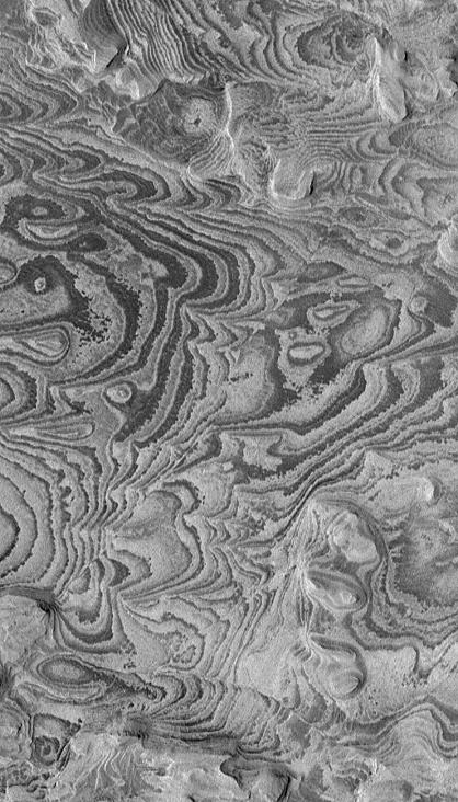
Becquerel’s Bands
- Click the image above for a larger view
- Full-Res JPEG (418 x 732) (84.6 kB)
- Full-Res TIFF (418 x 732) (306.5 kB)
Caption:
30 January 2004
This Mars Global Surveyor (MGS) Mars Orbiter Camera (MOC) image shows alternating light- and dark-toned bands--layers of sedimentary rock exposed by erosion in Becquerel Crater. Becquerel is located in western Arabia Terra near 4.1°N, 111.5°W, and might have once been the site of a lake. A few straight, narrow fault lines can be seen in the image; they cut the rock in trends that run from upper right toward lower left (northeast-southwest). This picture covers an area about 1.5 km (0.9 mi) wide and is illuminated by sunlight from the left.
Cataloging Keywords:
| Name | Value | Additional Values |
|---|---|---|
| Target | Mars | |
| System | ||
| Target Type | Planet | |
| Mission | Mars Global Surveyor (MGS) | |
| Instrument Host | Mars Global Surveyor | |
| Host Type | Orbiter | |
| Instrument | Mars Orbiter Camera (MOC) | |
| Detector | ||
| Extra Keywords | Crater, Grayscale | |
| Acquisition Date | ||
| Release Date | 2005-01-30 | |
| Date in Caption | 2004-01-30 | |
| Image Credit | NASA/JPL/Malin Space Science Systems | |
| Source | photojournal.jpl.nasa.gov/catalog/PIA07312 | |
| Identifier | PIA07312 | |