|
Cassini’s Close Look at Tethys
- Click the image above for a larger view
- Full-Res JPEG (1260 x 893) (113.4 kB)
- Full-Res TIFF (1260 x 893) (3.4 MB)
Caption:
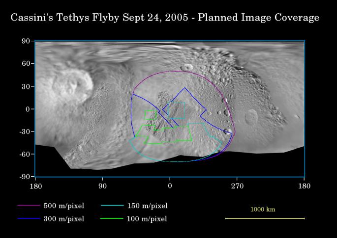
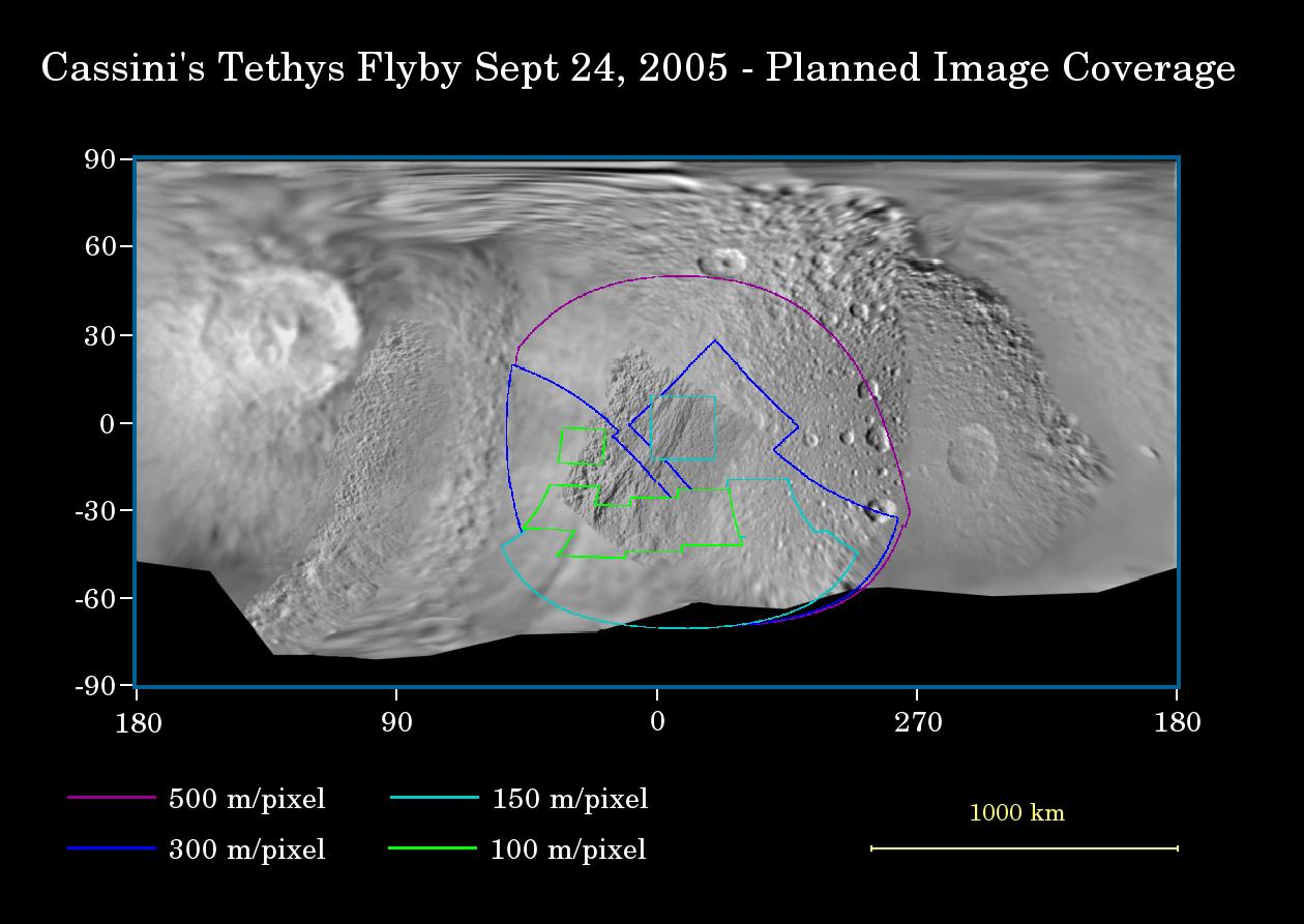
This map of the surface of Saturn's moon Tethys illustrates the regions that will be imaged by Cassini during the spacecraft's close flyby of the moon on Sept. 24, 2005. At closest approach, the spacecraft is expected to pass approximately 1,500 kilometers (930 miles) above the moon's surface. Tethys is 1,071 kilometers (665 miles) across.
The colored lines delineate the regions that will be imaged at differing resolutions, listed in the legend at bottom.
The new high-resolution coverage will reveal details on the Saturn-facing hemisphere of Tethys, including parts of the giant Ithaca Chasma canyon system. Imaging scientists also are hoping to obtain images of an ancient ridge east of Ithaca Chasma, as well as a section of terrain just west of the giant rift that appeared to be unusually smooth in NASA Voyager images.
This flyby is also focused on gathering high-resolution imaging data of the moon's southern polar region.
The map was made from images obtained by both the Cassini and Voyager spacecraft.
Background Info:
The Cassini-Huygens mission is a cooperative project of NASA, the European Space Agency and the Italian Space Agency. The Jet Propulsion Laboratory, a division of the California Institute of Technology in Pasadena, manages the mission for NASA's Science Mission Directorate, Washington, D.C. The Cassini orbiter and its two onboard cameras were designed, developed and assembled at JPL. The imaging operations center is based at the Space Science Institute in Boulder, Colo.
For more information about the Cassini-Huygens mission visit http://saturn.jpl.nasa.gov . For additional images visit the Cassini imaging team homepage http://ciclops.org .
Cataloging Keywords:
| Name | Value | Additional Values |
|---|---|---|
| Target | Tethys | Saturn |
| System | Saturn | |
| Target Type | Satellite | Planet |
| Mission | Cassini-Huygens | Voyager |
| Instrument Host | Cassini Orbiter | Voyager 1 |
| Host Type | Orbiter | Flyby Spacecraft |
| Instrument | Imaging Science Subsystem (ISS) | |
| Detector | ||
| Extra Keywords | Color, Map | |
| Acquisition Date | ||
| Release Date | 2005-09-20 | |
| Date in Caption | ||
| Image Credit | NASA/JPL/Space Science Institute | |
| Source | photojournal.jpl.nasa.gov/catalog/PIA07733 | |
| Identifier | PIA07733 | |