|
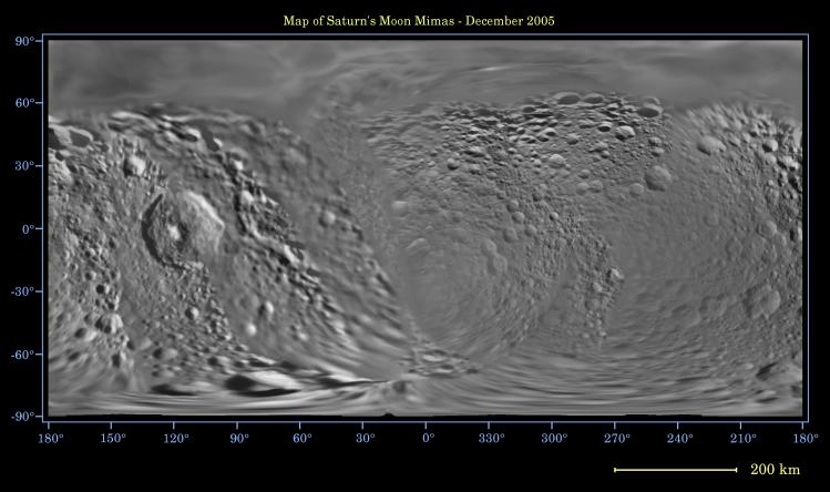
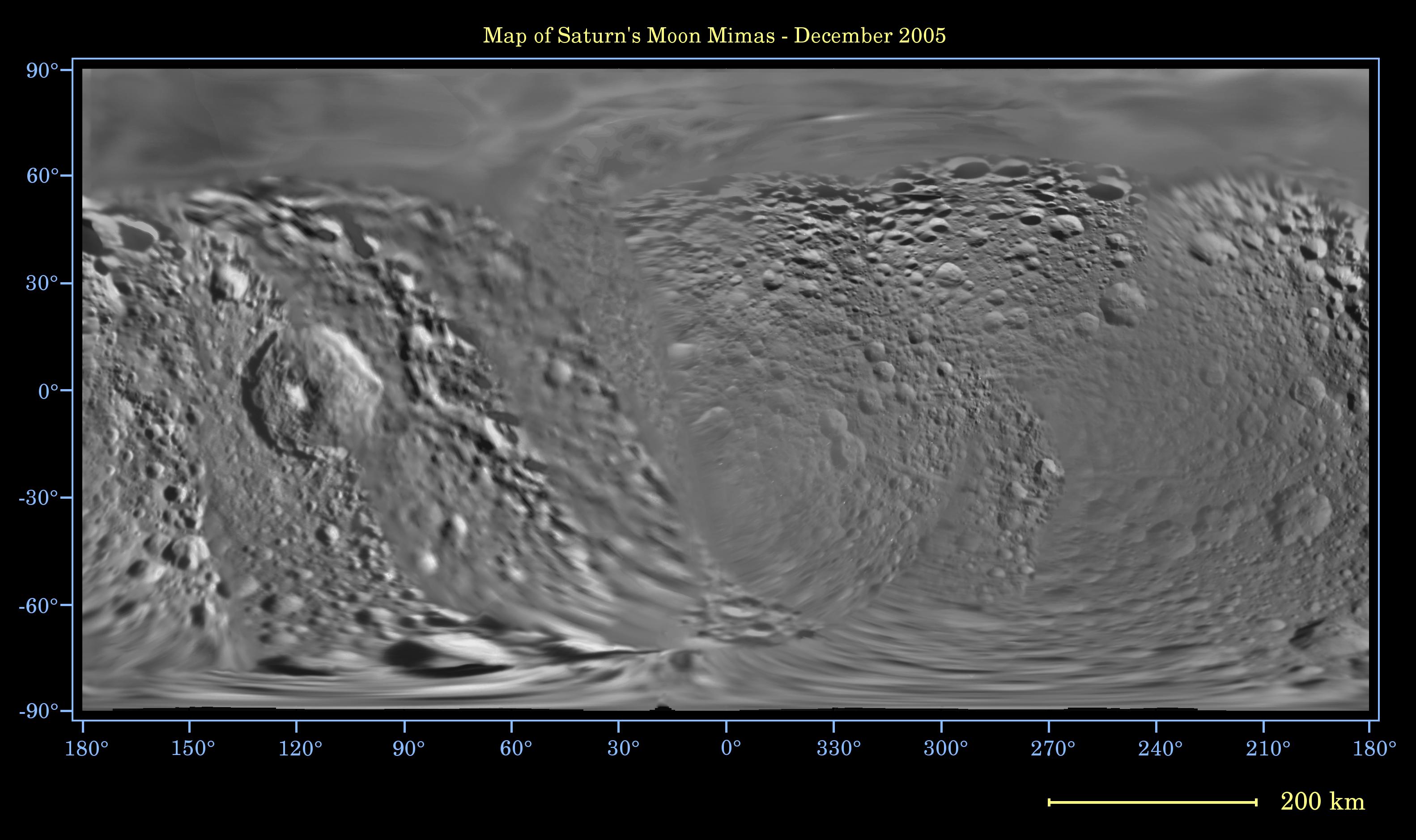
Map of Mimas – December 2005
- Click the image above for a larger view
- Full-Res JPEG (3165 x 1878) (421.0 kB)
- Full-Res TIFF (3165 x 1878) (17.8 MB)
Caption:
This global digital map of Saturn's moon Mimas was created using data taken during Cassini and Voyager spacecraft flybys. The map is an equidistant projection and has a scale of 434 meters (1,424 feet) per pixel.
The mean radius of Mimas used for projection of this map is 199 kilometers (124 miles). The resolution of the map is 8 pixels per degree.
Background Info:
The Cassini-Huygens mission is a cooperative project of NASA, the European Space Agency and the Italian Space Agency. The Jet Propulsion Laboratory, a division of the California Institute of Technology in Pasadena, manages the mission for NASA's Science Mission Directorate, Washington, D.C. The Cassini orbiter and its two onboard cameras were designed, developed and assembled at JPL. The imaging operations center is based at the Space Science Institute in Boulder, Colo.
For more information about the Cassini-Huygens mission visit http://saturn.jpl.nasa.gov . The Cassini imaging team homepage is at http://ciclops.org .
Cataloging Keywords:
| Name | Value | Additional Values |
|---|---|---|
| Target | Mimas | |
| System | Saturn | |
| Target Type | Satellite | |
| Mission | Cassini-Huygens | Voyager |
| Instrument Host | Cassini Orbiter | |
| Host Type | Orbiter | Flyby Spacecraft |
| Instrument | Imaging Science Subsystem (ISS) | |
| Detector | ||
| Extra Keywords | Color, Map | |
| Acquisition Date | ||
| Release Date | 2005-12-22 | |
| Date in Caption | ||
| Image Credit | NASA/JPL/Space Science Institute | |
| Source | photojournal.jpl.nasa.gov/catalog/PIA07779 | |
| Identifier | PIA07779 | |