|
The Edge
- Click the image above for a larger view
- Full-Res JPEG (836 x 1863) (253.6 kB)
- Full-Res TIFF (836 x 1863) (1.6 MB)
Caption:
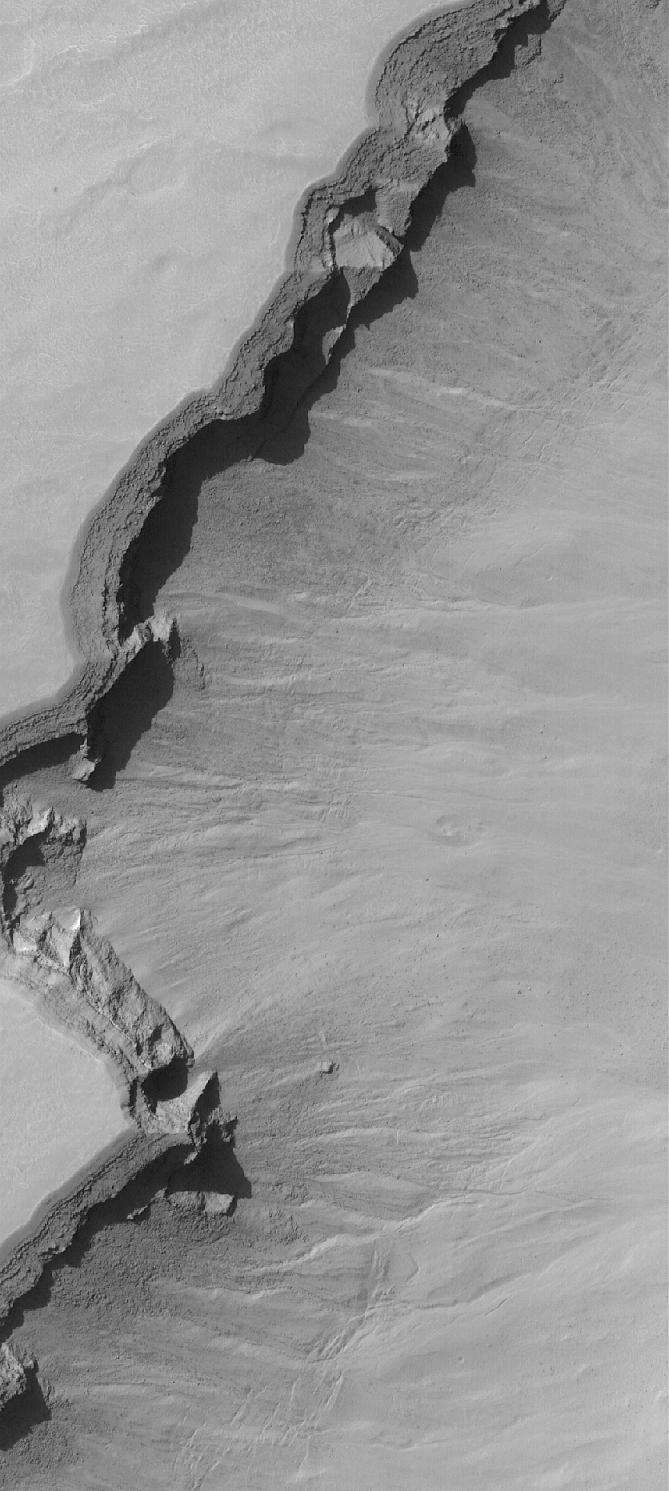
6 April 2006
This Mars Global Surveyor (MGS) Mars Orbiter Camera (MOC) image shows the edge (running diagonally from the lower left to the upper right) of a trough, which is part of a large pit crater complex in Noachis Terra. This type of trough forms through the collapse of surface materials into the subsurface, and often begins as a series of individual pit craters. Over time, continued collapse increases the diameter of individual pits until finally, adjacent pits merge to form a trough such as the one captured in this image. The deep shadowed area is caused in part by an overhang; layered rock beneath this overhang is less resistant to erosion, and thus has retreated tens of meters backward, beneath the overhang. A person could walk up inside this "cave" formed by the overhanging layered material.
Location near
: 47.0°S, 355.7°W
Image width
: ~3 km (~1.9 mi)
Illumination from
: upper left
Season
: Southern Summer
Cataloging Keywords:
| Name | Value | Additional Values |
|---|---|---|
| Target | Mars | |
| System | ||
| Target Type | Planet | |
| Mission | Mars Global Surveyor (MGS) | |
| Instrument Host | Mars Global Surveyor | |
| Host Type | Orbiter | |
| Instrument | Mars Orbiter Camera (MOC) | |
| Detector | ||
| Extra Keywords | Crater, Grayscale, Shadow | |
| Acquisition Date | ||
| Release Date | 2006-04-06 | |
| Date in Caption | 2006-04-06 | |
| Image Credit | NASA/JPL/Malin Space Science Systems | |
| Source | photojournal.jpl.nasa.gov/catalog/PIA08045 | |
| Identifier | PIA08045 | |