|
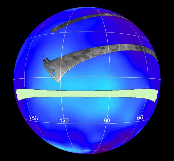
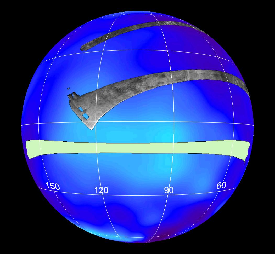
Titan (T13) Viewed by Cassini’s Radar
- Click the image above for a larger view
- Full-Res JPEG (1051 x 972) (81.1 kB)
- Full-Res TIFF (1051 x 972) (3.1 MB)
Caption:
This set of images shows the areas mapped so far on Saturn's moon Titan by the Cassini radar mapper using its synthetic aperture radar imaging mode.
Labels represent the approximate longitude of each globe. The radar swaths are superimposed on a false-color image made from observations by NASA's Hubble Space Telescope.
The swath shown in light green represents the area to be imaged in the upcoming April 30, 2006, flyby. It will go right across an optically bright region of Titan known as Xanadu. See PIA08100 for a flat map view.
Cassini's radar has revealed a variety of geologic features, including impact craters, wind-blown deposits, channels and cryovolcanic features.
Background Info:
The Cassini-Huygens mission is a cooperative project of NASA, the European Space Agency and the Italian Space Agency. The Jet Propulsion Laboratory, a division of the California Institute of Technology in Pasadena, manages the mission for NASA's Science Mission Directorate, Washington, D.C. The Cassini orbiter was designed, developed and assembled at JPL. The radar instrument was built by JPL and the Italian Space Agency, working with team members from the United States and several European countries.
For more information about the Cassini-Huygens mission visit http://saturn.jpl.nasa.gov/home/index.cfm .
Cataloging Keywords:
| Name | Value | Additional Values |
|---|---|---|
| Target | Titan | |
| System | Saturn | |
| Target Type | Satellite | |
| Mission | Cassini-Huygens | Hubble Space Telescope (HST) |
| Instrument Host | Cassini Orbiter | Hubble Space Telescope |
| Host Type | Orbiter | Space Telescope |
| Instrument | Radar Mapper | |
| Detector | ||
| Extra Keywords | Color, Crater, Impact, Map, Radar, Volcano | |
| Acquisition Date | ||
| Release Date | 2006-04-27 | |
| Date in Caption | 2006-04-30 | |
| Image Credit | NASA/JPL-Caltech/ASI | |
| Source | photojournal.jpl.nasa.gov/catalog/PIA08099 | |
| Identifier | PIA08099 | |