|
Russell Extravaganza
- Click the image above for a larger view
- Full-Res JPEG (1024 x 1656) (166.1 kB)
- Full-Res TIFF (1024 x 1656) (1.7 MB)
Caption:
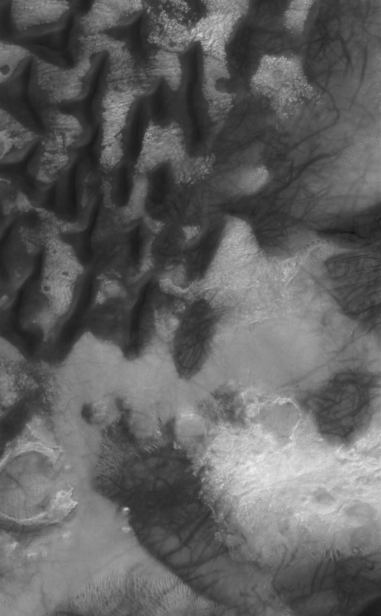
26 April 2006
This Mars Global Surveyor (MGS) Mars Orbiter Camera (MOC) image shows dark-toned sand dunes on the floor of Russell Crater in south-central, Noachis Terra. A dune at the right (east) edge of the image is host to several small gullies whose channels extend predominantly to the west-southwest. The formation of these features is not well-understood, but they might result from a combination of downslope movement of sand and a lubricating agent, perhaps carbon dioxide gas or water that had been trapped in the dune as ice. The randomly-oriented dark streaks seen on the dunes and on the interdune surfaces were created by the passage of spring and summertime dust devils.
Location near
: 54.7°S, 347.4°W
Image width
: ~3 km (~1.9 mi)
Illumination from
: upper left
Season
: Southern Summer
Cataloging Keywords:
| Name | Value | Additional Values |
|---|---|---|
| Target | Mars | |
| System | ||
| Target Type | Planet | |
| Mission | Mars Global Surveyor (MGS) | |
| Instrument Host | Mars Global Surveyor | |
| Host Type | Orbiter | |
| Instrument | Mars Orbiter Camera (MOC) | |
| Detector | ||
| Extra Keywords | Crater, Dune, Dust, Grayscale, Water | |
| Acquisition Date | ||
| Release Date | 2006-04-25 | |
| Date in Caption | 2006-04-26 | |
| Image Credit | NASA/JPL/Malin Space Science Systems | |
| Source | photojournal.jpl.nasa.gov/catalog/PIA08102 | |
| Identifier | PIA08102 | |