|
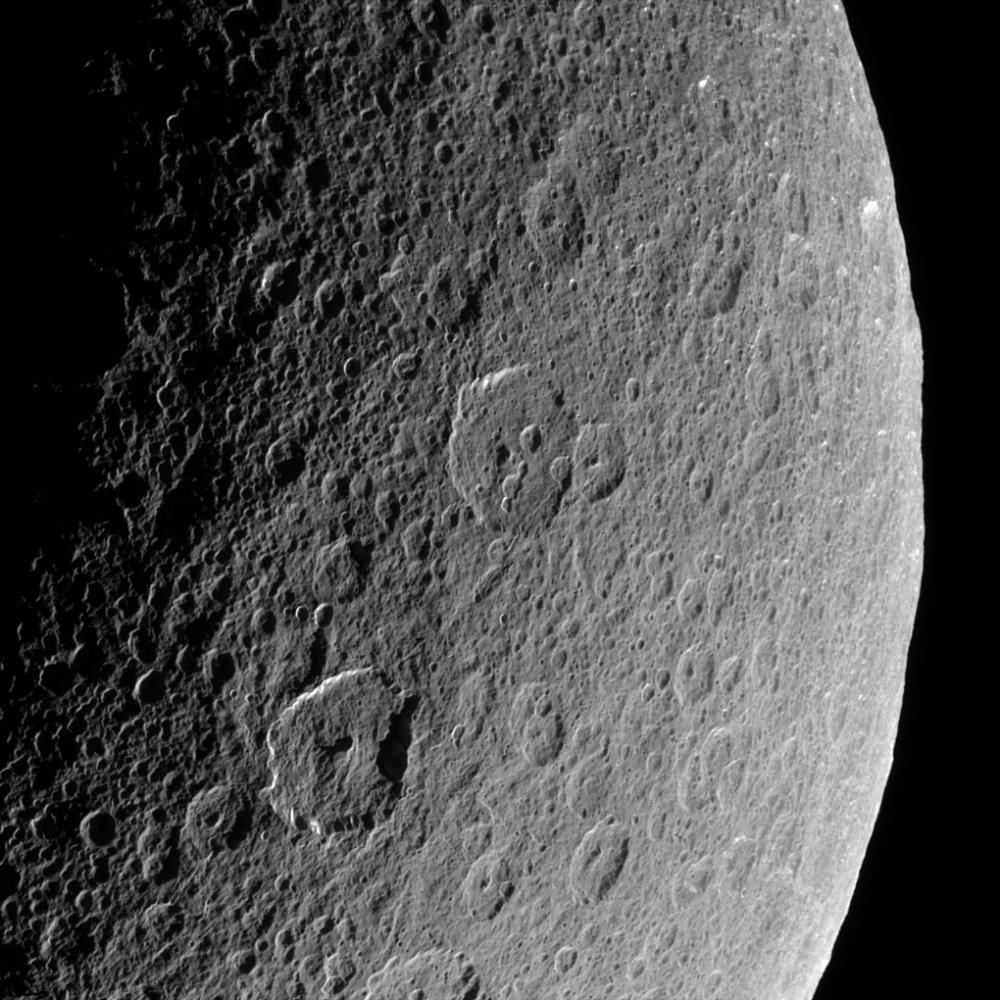
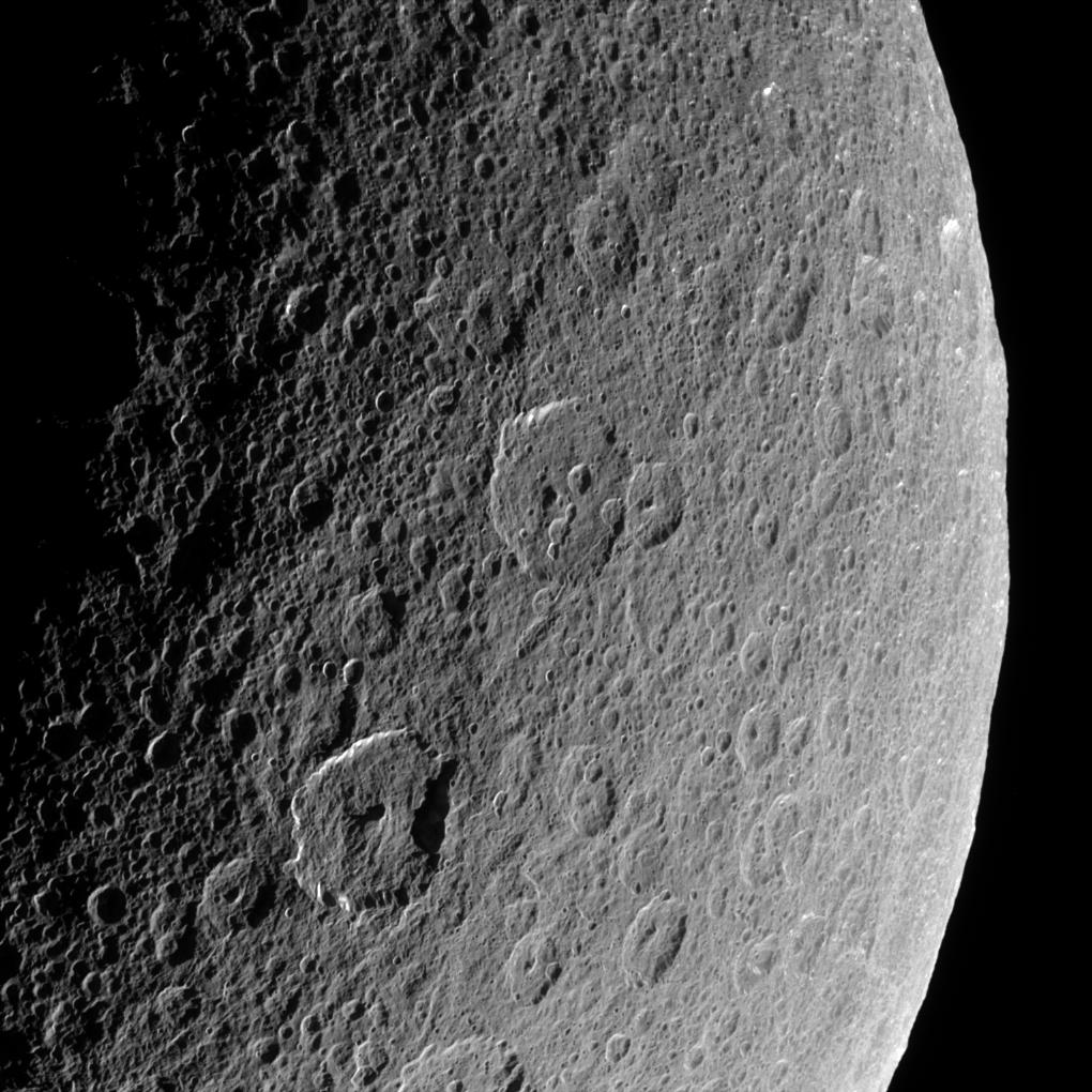
The Record of Rhea
- Click the image above for a larger view
- Full-Res JPEG (1020 x 1020) (184.1 kB)
- Full-Res TIFF (1020 x 1020) (1.0 MB)
Caption:
Cassini looks down upon Rhea, whose cratered surface was already ancient before any complex life developed on Earth. The terrain seen here has probably changed little in the past billion years.
This view shows terrain on the Saturn-facing hemisphere of Rhea (1,528 kilometers, or 949 miles across). North is up.
The image was taken in visible light with the Cassini spacecraft narrow-angle camera on March 21, 2006 at a distance of approximately 94,000 kilometers (59,000 miles) from Rhea and at a Sun-Rhea-spacecraft, or phase, angle of 109 degrees. Image scale is 558 meters (1,832 feet) per pixel.
Background Info:
The Cassini-Huygens mission is a cooperative project of NASA, the European Space Agency and the Italian Space Agency. The Jet Propulsion Laboratory, a division of the California Institute of Technology in Pasadena, manages the mission for NASA's Science Mission Directorate, Washington, D.C. The Cassini orbiter and its two onboard cameras were designed, developed and assembled at JPL. The imaging operations center is based at the Space Science Institute in Boulder, Colo.
For more information about the Cassini-Huygens mission visit http://saturn.jpl.nasa.gov/home/index.cfm . The Cassini imaging team homepage is at http://ciclops.org .
Cataloging Keywords:
| Name | Value | Additional Values |
|---|---|---|
| Target | Rhea | Saturn |
| System | Saturn | |
| Target Type | Satellite | Planet |
| Mission | Cassini-Huygens | |
| Instrument Host | Cassini Orbiter | |
| Host Type | Orbiter | |
| Instrument | Imaging Science Subsystem (ISS) | |
| Detector | Narrow Angle Camera | |
| Extra Keywords | Crater, Grayscale, Visual | |
| Acquisition Date | ||
| Release Date | 2006-05-08 | |
| Date in Caption | 2006-03-21 | |
| Image Credit | NASA/JPL/Space Science Institute | |
| Source | photojournal.jpl.nasa.gov/catalog/PIA08173 | |
| Identifier | PIA08173 | |