|
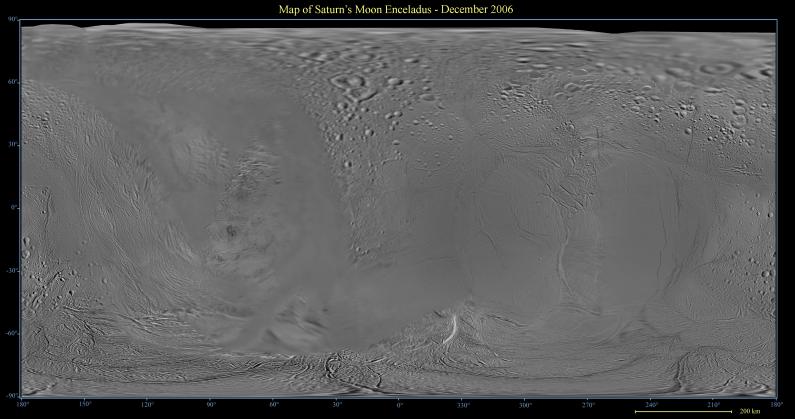
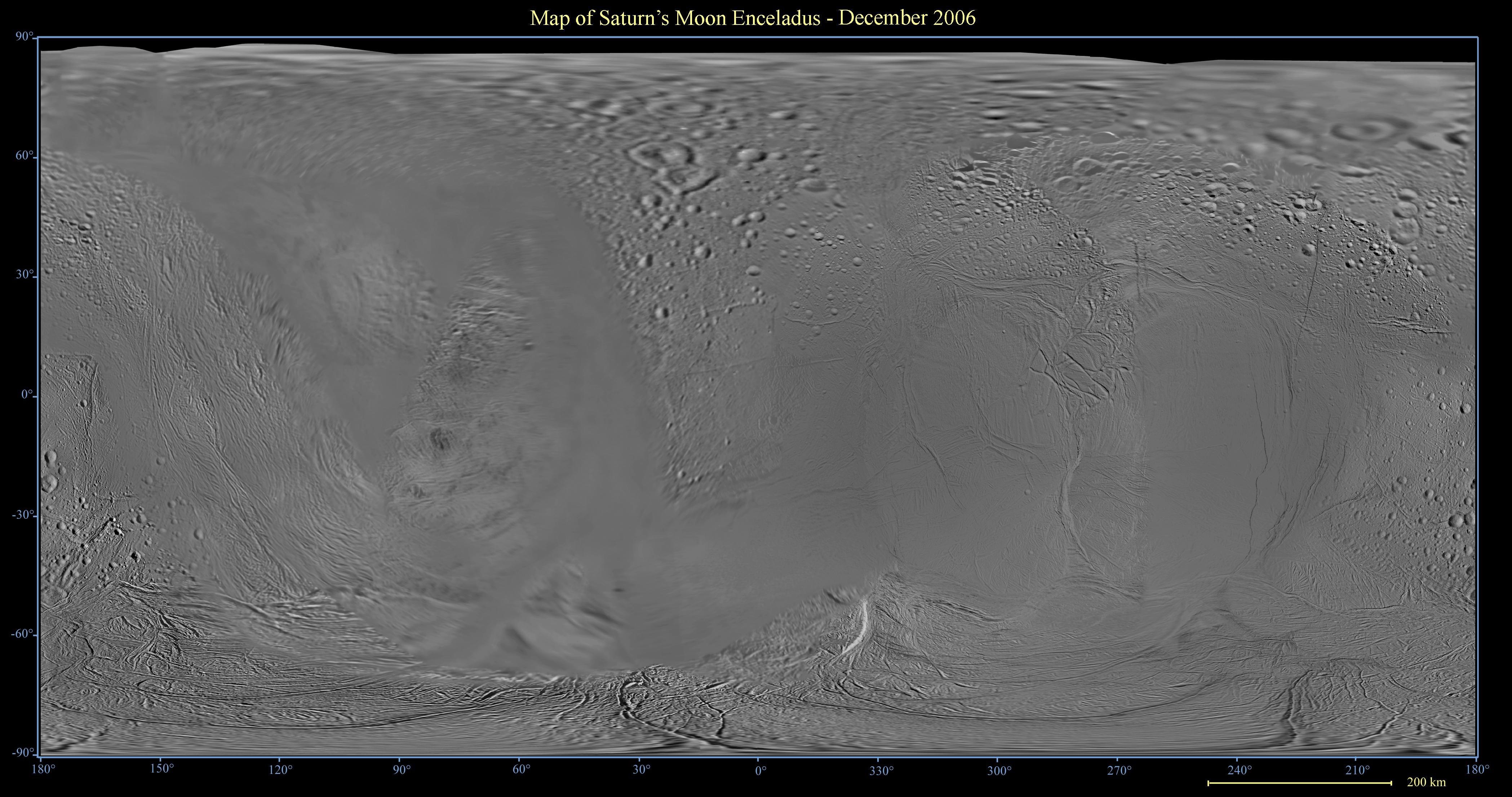
Map of Enceladus - December 2006
- Click the image above for a larger view
- Full-Res JPEG (4195 x 2211) (985.5 kB)
- Full-Res TIFF (4195 x 2211) (27.8 MB)
Caption:
This global digital map of Saturn's moon Enceladus was created using data taken by the Cassini spacecraft, with gaps in coverage filled in by NASA Voyager spacecraft data. The map is an equidistant projection and has a scale of 300 meters (980 feet) per pixel. Equidistant projections preserve distances on a body, with some distortion of area and direction.
The mean radius of Enceladus used for projection of this map is 252 kilometers (157 miles).
This map is an update to the version released in December 2005. See PIA07777 .
Background Info:
The Cassini-Huygens mission is a cooperative project of NASA, the European Space Agency and the Italian Space Agency. The Jet Propulsion Laboratory, a division of the California Institute of Technology in Pasadena, manages the mission for NASA's Science Mission Directorate, Washington, D.C. The Cassini orbiter and its two onboard cameras were designed, developed and assembled at JPL. The imaging operations center is based at the Space Science Institute in Boulder, Colo.
For more information about the Cassini-Huygens mission visit http://saturn.jpl.nasa.gov/home/index.cfm . The Cassini imaging team homepage is at http://ciclops.org .
Cataloging Keywords:
| Name | Value | Additional Values |
|---|---|---|
| Target | Enceladus | |
| System | Saturn | |
| Target Type | Satellite | |
| Mission | Cassini-Huygens | Voyager |
| Instrument Host | Cassini Orbiter | |
| Host Type | Orbiter | Flyby Spacecraft |
| Instrument | Imaging Science Subsystem (ISS) | |
| Detector | ||
| Extra Keywords | Color, Map | |
| Acquisition Date | ||
| Release Date | 2006-12-29 | |
| Date in Caption | ||
| Image Credit | NASA/JPL/Space Science Institute | |
| Source | photojournal.jpl.nasa.gov/catalog/PIA08342 | |
| Identifier | PIA08342 | |