
|
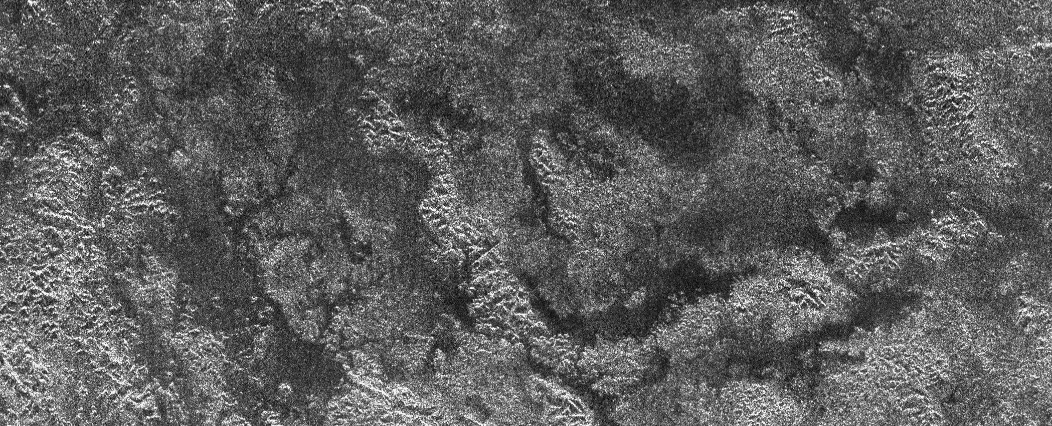
Titan’s Land-o-Lakes
- Click the image above for a larger view
- Full-Res JPEG (2098 x 851) (614.8 kB)
- Full-Res TIFF (2098 x 851) (1.8 MB)
Caption:
The Cassini spacecraft's Titan Radar Mapper instrument imaged this area atop Xanadu, the bright area of Titan, on April 30, 2006. The picture is roughly 150 kilometers (93 miles) wide by 400 kilometers (249 miles) long, and shows features as small as 350 meters (1148 feet). Chains of hills or mountains are revealed by the radar beam, which is illuminating their northern sides (in this image, north is up). Interspersed between the chains of hills are darker areas where topographic features are absent or partly buried. The darkest areas could contain liquids, which tend to reflect the radar beam away from Cassini in the absence of winds, making the area appear quite dark. At Titan's icy conditions, these liquids would be methane and/or ethane. Stubby drainage features can be see faintly between the chains of hills, suggesting flow of the liquid across parts of the region.
Background Info:
The Cassini-Huygens mission is a cooperative project of NASA, the European Space Agency and the Italian Space Agency. The Jet Propulsion Laboratory, a division of the California Institute of Technology in Pasadena, manages the mission for NASA's Science Mission Directorate, Washington, D.C. The Cassini orbiter was designed, developed and assembled at JPL. The radar instrument was built by JPL and the Italian Space Agency, working with team members from the United States and several European countries.
For more information about the Cassini-Huygens mission visit http://saturn.jpl.nasa.gov/home/index.cfm .
Cataloging Keywords:
| Name | Value | Additional Values |
|---|---|---|
| Target | Titan | |
| System | Saturn | |
| Target Type | Satellite | |
| Mission | Cassini-Huygens | |
| Instrument Host | Cassini Orbiter | |
| Host Type | Orbiter | |
| Instrument | Radar Mapper | |
| Detector | ||
| Extra Keywords | Grayscale, Methane, Mountain, Radar | |
| Acquisition Date | ||
| Release Date | 2006-05-09 | |
| Date in Caption | 2006-04-30 | |
| Image Credit | NASA/JPL-Caltech/ASI | |
| Source | photojournal.jpl.nasa.gov/catalog/PIA08448 | |
| Identifier | PIA08448 | |