skip to navigation

|
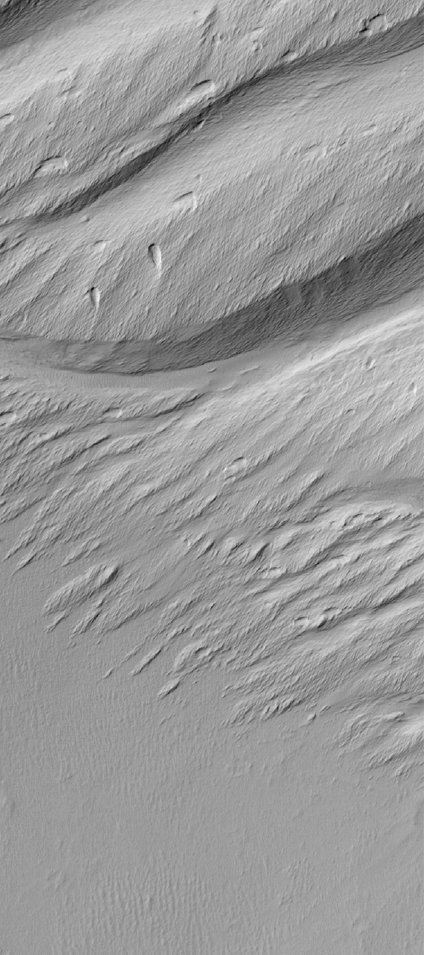
Memnonia Landscape
- Click the image above for a larger view
- Full-Res JPEG (836 x 1882) (256.9 kB)
- Full-Res TIFF (836 x 1882) (1.6 MB)
Caption:
28 June 2006
This Mars Global Surveyor (MGS) Mars Orbiter Camera (MOC) image shows a contact between a dust-covered plain and a dust-mantled, textured upland in the Memnonia Sulci region of Mars. The dominant landforms in this scene are yardangs-they are the product of extensive wind erosion of a relatively poorly-consolidated, sand-bearing material (e.g., deposits of volcanic ash or poorly cemented sedimentary rocks).
Location near
: 9.3°S, 172.9°W
Image width
: ~3 km (~1.9 mi)
Illumination from
: upper left
Season
: Southern Autumn
Cataloging Keywords:
| Name | Value | Additional Values |
|---|---|---|
| Target | Mars | |
| System | ||
| Target Type | Planet | |
| Mission | Mars Global Surveyor (MGS) | |
| Instrument Host | Mars Global Surveyor | |
| Host Type | Orbiter | |
| Instrument | Mars Orbiter Camera (MOC) | |
| Detector | ||
| Extra Keywords | Dust, Grayscale, Volcano | |
| Acquisition Date | ||
| Release Date | 2006-06-28 | |
| Date in Caption | 2006-06-28 | |
| Image Credit | NASA/JPL/Malin Space Science Systems | |
| Source | photojournal.jpl.nasa.gov/catalog/PIA08568 | |
| Identifier | PIA08568 | |