
|
Buried Ends
- Click the image above for a larger view
- Full-Res JPEG (836 x 2227) (407.9 kB)
- Full-Res TIFF (836 x 2227) (1.9 MB)
Caption:
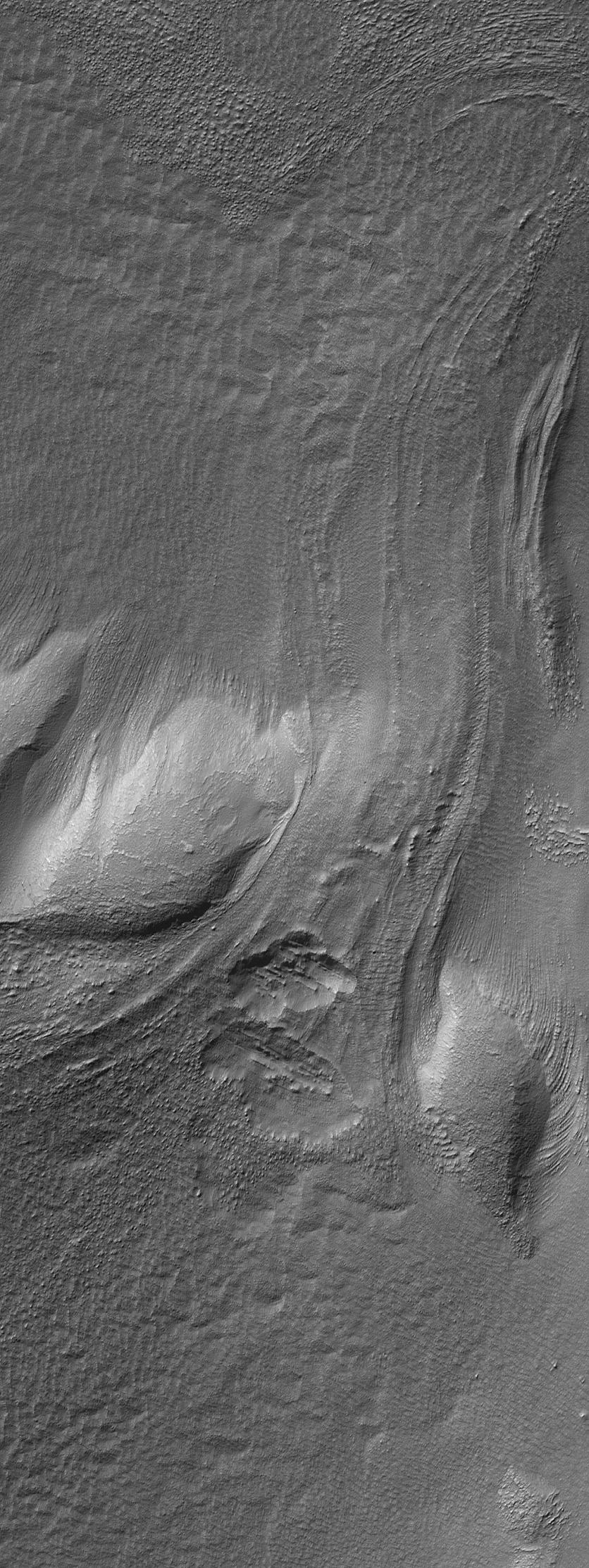
7 August 2006
This Mars Global Surveyor (MGS) Mars Orbiter Camera (MOC) image shows a flow or landslide feature on a hillslope facing north (toward top/upper right) that is buried on both ends. Both the uphill portion of the slide (just below the center of the image) and the bottom end of the slide, or flow feature (near the upper right corner of the image), is buried. Whether this partially buried landform was formed by simple, dry mass movement (a landslide) or by flow of an ice-rich material, is unclear. The features in this image occur among the massifs located east of the Hellas basin.
Location near
: 45.6°S, 248.5°W
Image width
: ~3 km (~1.9 mi)
Illumination from
: upper left
Season
: Southern Autumn
Cataloging Keywords:
| Name | Value | Additional Values |
|---|---|---|
| Target | Mars | |
| System | ||
| Target Type | Planet | |
| Mission | Mars Global Surveyor (MGS) | |
| Instrument Host | Mars Global Surveyor | |
| Host Type | Orbiter | |
| Instrument | Mars Orbiter Camera (MOC) | |
| Detector | ||
| Extra Keywords | Grayscale | |
| Acquisition Date | ||
| Release Date | 2006-08-07 | |
| Date in Caption | 2006-08-07 | |
| Image Credit | NASA/JPL/Malin Space Science Systems | |
| Source | photojournal.jpl.nasa.gov/catalog/PIA08663 | |
| Identifier | PIA08663 | |