
|
Closing in on ‘Victoria Crater’
- Click the image above for a larger view
- Full-Res JPEG (2080 x 2652) (508.0 kB)
- Full-Res TIFF (2080 x 2652) (16.6 MB)
Caption:
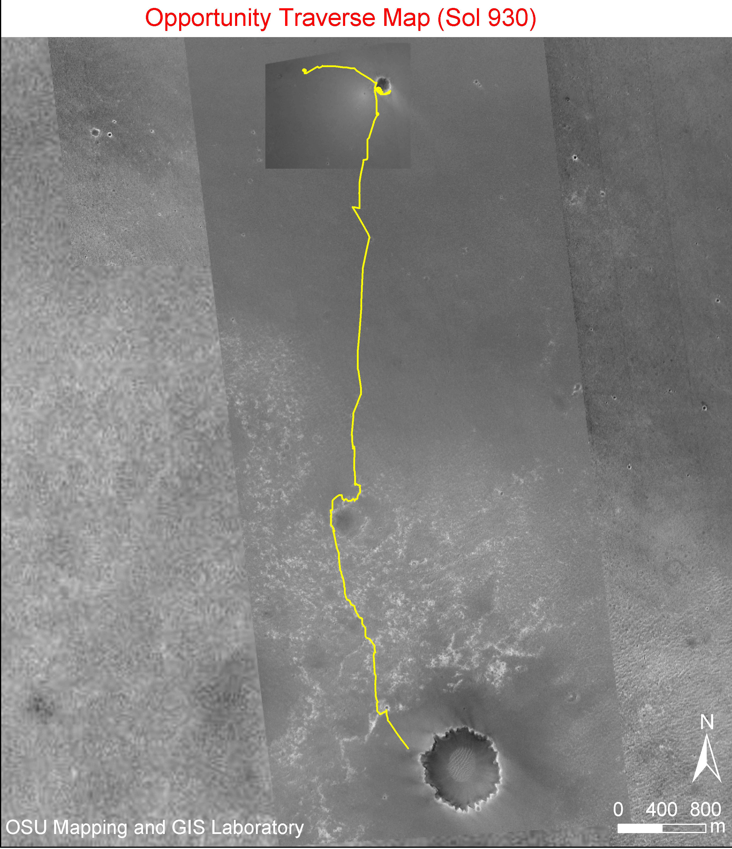
Figure 1
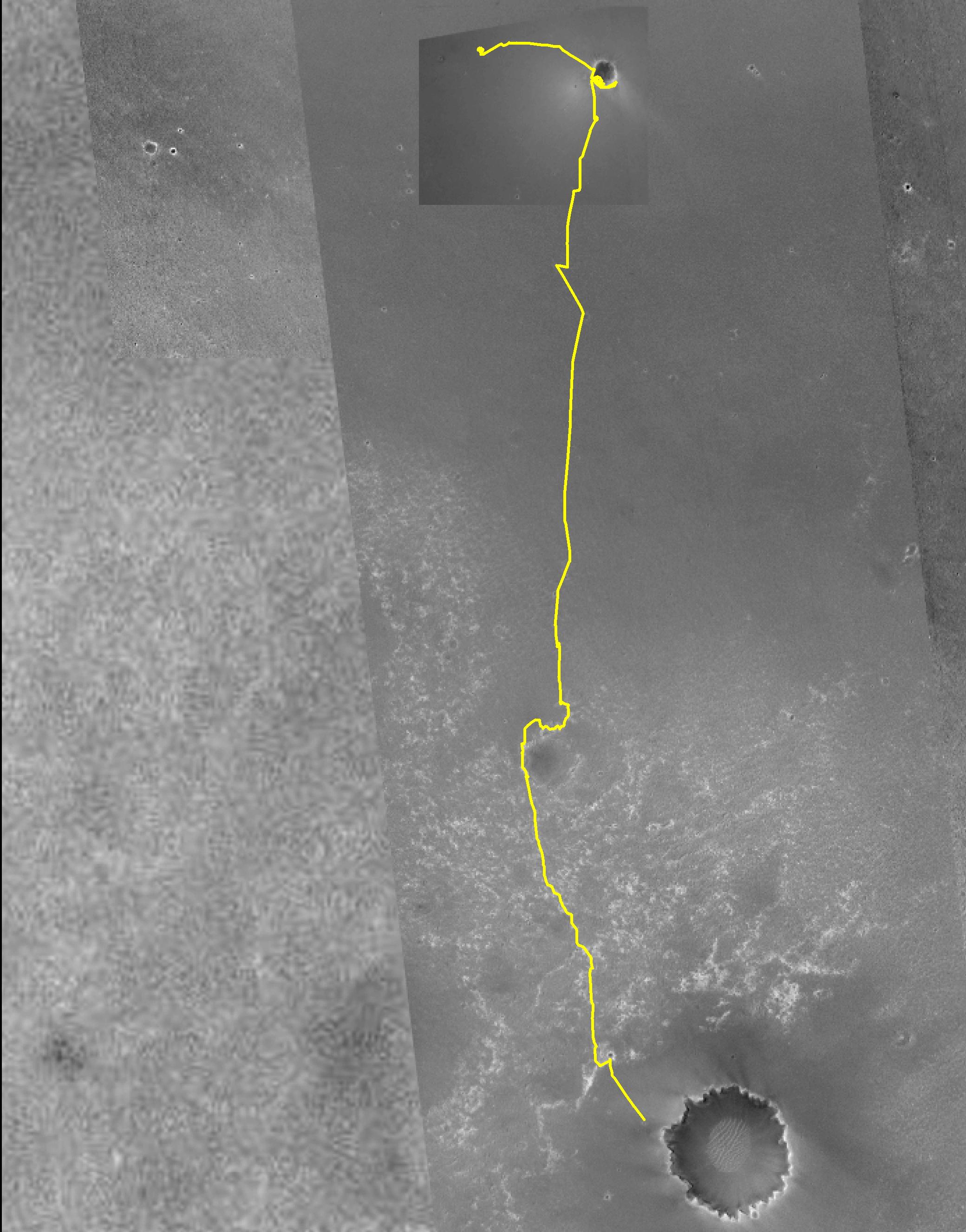
The team managing NASA's Mars Exploration Rover Opportunity had set 'Victoria Crater' as a long-term destination even before the rover climbed out of 'Endurance Crater' in December 2004. As of early September 2006, Opportunity has driven more than 7.2 kilometers (4.5 miles) since leaving Endurance and is approaching Victoria.
Victoria is the large crater near the bottom of this map made from images taken by the Mars Orbiter Camera on NASA's Mars Global Surveyor. The gold line traces Opportunity's path eastward then southward from "Eagle Crater," where it landed, to Endurance Crater, where it spent six months, and nearly to Victoria. The south end of the line indicates Opportunity's location as of the rover's 930th Martian day, or sol, (Sept. 5, 2006). Victoria is about 750 meters (0.47 mile) in diameter, or about six times wider than Endurance and about 35 times wider than Eagle. The scale bar at lower right shows the length of 800 meters (0.50 mile). North is up.
Cataloging Keywords:
| Name | Value | Additional Values |
|---|---|---|
| Target | Mars | |
| System | ||
| Target Type | Planet | |
| Mission | Mars Global Surveyor (MGS) | Mars Exploration Rover (MER) |
| Instrument Host | Mars Global Surveyor | Opportunity (MER-B) |
| Host Type | Orbiter | Rover |
| Instrument | Mars Orbiter Camera (MOC) | |
| Detector | ||
| Extra Keywords | Color, Crater, Map | |
| Acquisition Date | ||
| Release Date | 2006-09-06 | |
| Date in Caption | ||
| Image Credit | NASA/JPL/MSSS/Ohio State University | |
| Source | photojournal.jpl.nasa.gov/catalog/PIA08731 | |
| Identifier | PIA08731 | |