
|
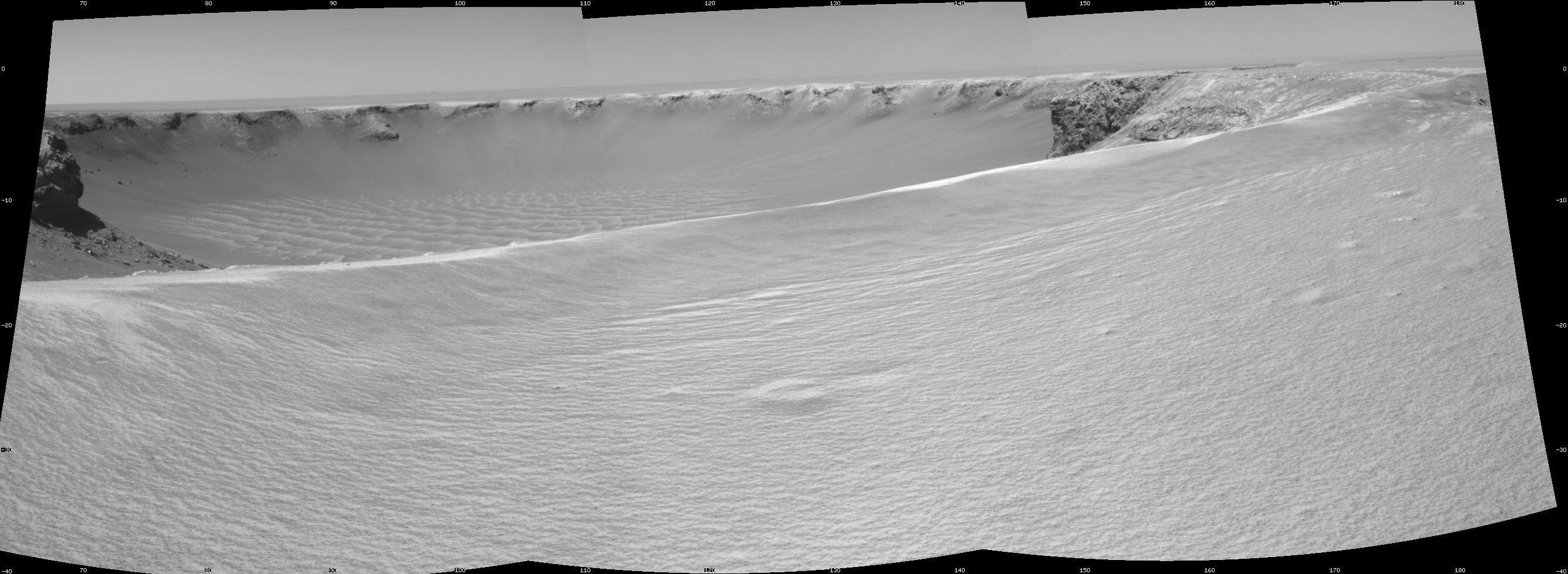
On the Rim of ‘Victoria Crater’
- Click the image above for a larger view
- Full-Res JPEG (2680 x 982) (287.8 kB)
- Full-Res TIFF (2680 x 982) (2.6 MB)
Caption:
NASA's Mars rover Opportunity reached the rim of "Victoria Crater" in Mars' Meridiani Planum region with a 26-meter (85-foot) drive during the rover's 951st Martian day, or sol (Sept. 26, 2006). After the drive, the rover's navigation camera took the three exposures combined into this view of the crater's interior. This crater has been the mission's long-term destination for the past 21 Earth months.
A half mile in the distance one can see about 20 percent of the far side of the crater framed by the rocky cliffs in the foreground to the left and right of the image. The rim of the crater is composed of alternating promontories, rocky points towering approximately 70 meters (230 feet) above the crater floor, and recessed alcoves. The bottom of the crater is covered by sand that has been shaped into ripples by the Martian wind.
The position at the end of the sol 951 drive is about six meters from the lip of an alcove called "Duck Bay." The rover team planned a drive for sol 952 that would move a few more meters forward, plus more imaging of the near and far walls of the crater.
Victoria Crater is about five times wider than "Endurance Crater," which Opportunity spent six months examining in 2004, and about 40 times wider than "Eagle Crater," where Opportunity first landed.
This view is presented as a cylindrical projection with geometric seam correction.
Cataloging Keywords:
| Name | Value | Additional Values |
|---|---|---|
| Target | Mars | |
| System | ||
| Target Type | Planet | |
| Mission | Mars Exploration Rover (MER) | |
| Instrument Host | Opportunity (MER-B) | |
| Host Type | Rover | |
| Instrument | Navigation Camera (Navcam) | |
| Detector | ||
| Extra Keywords | Crater, Grayscale | |
| Acquisition Date | ||
| Release Date | 2006-09-27 | |
| Date in Caption | ||
| Image Credit | NASA/JPL-Caltech | |
| Source | photojournal.jpl.nasa.gov/catalog/PIA08779 | |
| Identifier | PIA08779 | |