|
Titan: Larger and Larger Lakes
- Click the image above for a larger view
- Full-Res JPEG (1571 x 958) (404.4 kB)
- Full-Res TIFF (1571 x 958) (1.5 MB)
Caption:
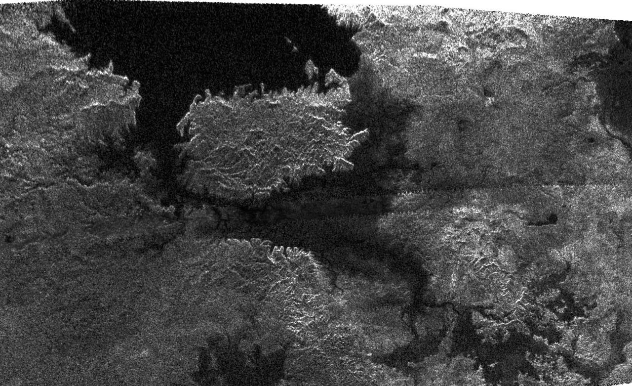
This radar image, obtained by Cassini's radar instrument during a near-polar flyby on Feb. 22, 2007, shows a big island smack in the middle of one of the larger lakes imaged on Saturn's moon Titan. This image offers further evidence that the largest lakes are at the highest latitudes.
The island is about 90 kilometers (62 miles) by 150 kilometers (93 miles) across, about the size of Kodiak Island in Alaska or the Big Island of Hawaii. The island may actually be a peninsula connected by a bridge to a larger stretch of land. As you go farther down the image, several very small lakes begin to appear, which may be controlled by local topography.
This image was taken in synthetic aperture mode at 700 meter (2,300 feet) resolution. North is toward the left. The image is centered at about 79 north degrees north and 310 degrees west.
Background Info:
The Cassini-Huygens mission is a cooperative project of NASA, the European Space Agency and the Italian Space Agency. The Jet Propulsion Laboratory, a division of the California Institute of Technology in Pasadena, manages the mission for NASA's Science Mission Directorate, Washington, D.C. The Cassini orbiter was designed, developed and assembled at JPL. The radar instrument was built by JPL and the Italian Space Agency, working with team members from the United States and several European countries.
For more information about the Cassini-Huygens mission visit http://saturn.jpl.nasa.gov/home/index.cfm .
Cataloging Keywords:
| Name | Value | Additional Values |
|---|---|---|
| Target | Titan | |
| System | Saturn | |
| Target Type | Satellite | |
| Mission | Cassini-Huygens | |
| Instrument Host | Cassini Orbiter | |
| Host Type | Orbiter | |
| Instrument | Radar Mapper | |
| Detector | ||
| Extra Keywords | Grayscale, Radar | |
| Acquisition Date | ||
| Release Date | 2007-02-27 | |
| Date in Caption | 2007-02-22 | |
| Image Credit | NASA/JPL-Caltech/ASI | |
| Source | photojournal.jpl.nasa.gov/catalog/PIA09180 | |
| Identifier | PIA09180 | |