|
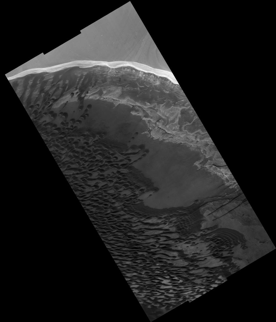
North Polar Scarp
- Click the image above for a larger view
- Full-Res JPEG (2048 x 2393) (272.0 kB)
- Full-Res TIFF (2048 x 2393) (4.9 MB)
Caption:
Image PSP_001341_2650 was taken by the High Resolution Imaging Science Experiment (HiRISE) camera onboard the Mars Reconnaissance Orbiter spacecraft on November 8, 2006. The complete image is centered at 85.0 degrees latitude, 150.4 degrees East longitude. The range to the target site was 318.8 km (199.3 miles). At this distance the image scale ranges from 63.8 cm/pixel (with 2 x 2 binning) to 127.6 cm/pixel (with 4 x 4 binning). The image shown here has been map-projected to 50 cm/pixel. The image was taken at a local Mars time of 1:30 PM and the scene is illuminated from the west with a solar incidence angle of 67 degrees, thus the sun was about 23 degrees above the horizon. At a solar longitude of 132.6 degrees, the season on Mars is Northern Summer.
Background Info:
NASA's Jet Propulsion Laboratory, a division of the California Institute of Technology in Pasadena, manages the Mars Reconnaissance Orbiter for NASA's Science Mission Directorate, Washington. Lockheed Martin Space Systems, Denver, is the prime contractor for the project and built the spacecraft. The High Resolution Imaging Science Experiment is operated by the University of Arizona, Tucson, and the instrument was built by Ball Aerospace and Technology Corp., Boulder, Colo.
Cataloging Keywords:
| Name | Value | Additional Values |
|---|---|---|
| Target | Mars | |
| System | ||
| Target Type | Planet | |
| Mission | Mars Reconnaissance Orbiter (MRO) | |
| Instrument Host | Mars Reconnaissance Orbiter | |
| Host Type | Orbiter | |
| Instrument | High Resolution Imaging Science Experiment (HiRISE) | |
| Detector | ||
| Extra Keywords | Grayscale, Map | |
| Acquisition Date | ||
| Release Date | 2006-12-20 | |
| Date in Caption | 2006-11-08 | |
| Image Credit | NASA/JPL/Univ. of Arizona | |
| Source | photojournal.jpl.nasa.gov/catalog/PIA09482 | |
| Identifier | PIA09482 | |