|
Stereo Anaglyphs of River Meanders in Eberswalde Delta
- Click the image above for a larger view
- Full-Res JPEG (2235 x 1500) (433.4 kB)
- Full-Res TIFF (2235 x 1500) (10.1 MB)
Caption:
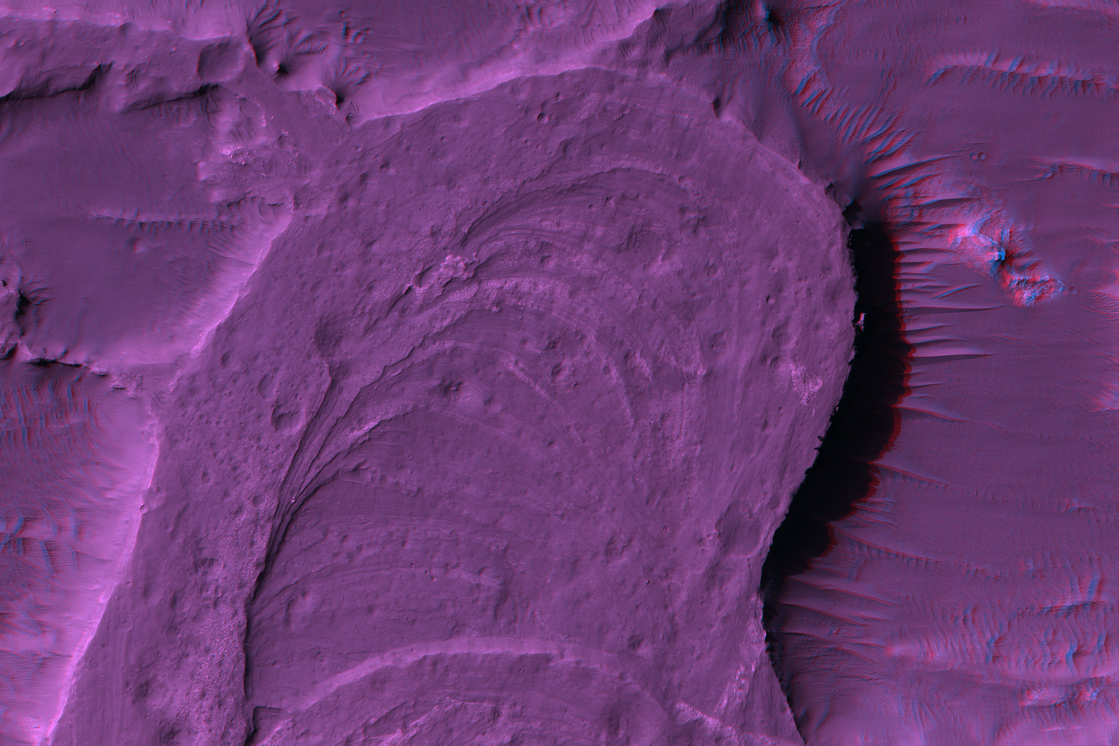
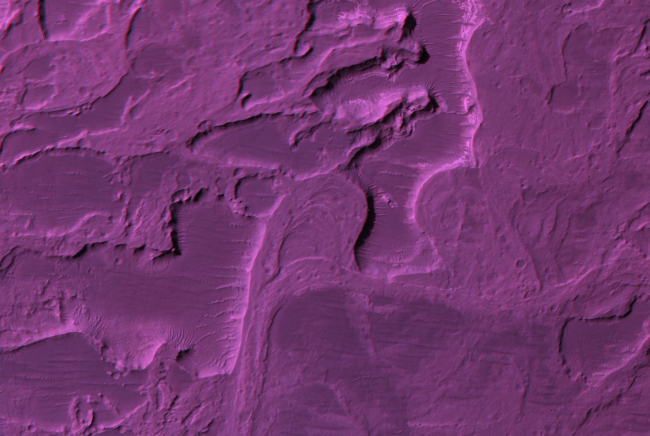
Figure 1
Click on image for larger version
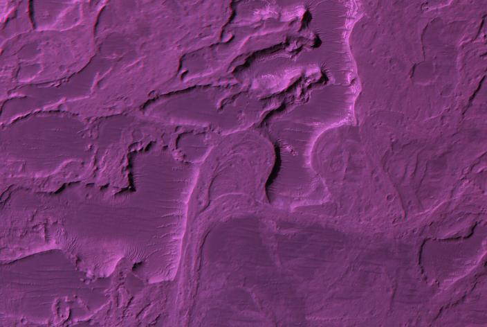
Eberswalde Delta contains river meanders, which indicate that flowing water was present for an extended period of time, not just the weeks required to explain the catastrophic flood channels.
Shown here are two red-blue color anaglyphs in which you can view the topography with red-blue glasses (blue filter over your right eye). This anaglyphs shows a relatively large area but with 3x reduction of spatial scale (75 cm/pixel), and figure 1 is a sample at full resolution (25 cm/pixel).
The former river channels are high rather than low, which is called inverted relief. Coarse gravel was deposited in the stream channel, which later proved more resistant to erosion than the materials outside the channel, creating this inverted relief.
Meanders are formed when a river channel gradually erodes the outer banks, increasing the curvature of the channel. Eventually the river decides to take a short cut, cutting off a meander, as shown here. This produces what are called oxbow lakes.
(We previously released image PSP_1334_1560, including color, but acquired a later image (PSP_1534_1560) over this same area but from a different viewing angle to provide stereo coverage.)
Observation Geometry Image PSP_001534_1560 was taken by the High Resolution Imaging Science Experiment (HiRISE) camera onboard the Mars Reconnaissance Orbiter spacecraft on 23-Nov-2006. The complete image is centered at -23.8 degrees latitude, 326.4 degrees East longitude. The range to the target site was 267.8 km (167.3 miles). At this distance the image scale is 26.8 cm/pixel (with 1 x 1 binning) so objects ~80 cm across are resolved. The image shown here has been map-projected to 25 cm/pixel and north is up. The image was taken at a local Mars time of 03:42 PM and the scene is illuminated from the west with a solar incidence angle of 67 degrees, thus the sun was about 23 degrees above the horizon. At a solar longitude of 139.9 degrees, the season on Mars is Northern Summer.
Background Info:
NASA's Jet Propulsion Laboratory, a division of the California Institute of Technology in Pasadena, manages the Mars Reconnaissance Orbiter for NASA's Science Mission Directorate, Washington. Lockheed Martin Space Systems, Denver, is the prime contractor for the project and built the spacecraft. The High Resolution Imaging Science Experiment is operated by the University of Arizona, Tucson, and the instrument was built by Ball Aerospace and Technology Corp., Boulder, Colo.
Cataloging Keywords:
| Name | Value | Additional Values |
|---|---|---|
| Target | Mars | |
| System | ||
| Target Type | Planet | |
| Mission | Mars Reconnaissance Orbiter (MRO) | |
| Instrument Host | Mars Reconnaissance Orbiter | |
| Host Type | Orbiter | |
| Instrument | High Resolution Imaging Science Experiment (HiRISE) | |
| Detector | ||
| Extra Keywords | Color, Map, Water | |
| Acquisition Date | ||
| Release Date | 2007-01-10 | |
| Date in Caption | ||
| Image Credit | NASA/JPL/Univ. of Arizona | |
| Source | photojournal.jpl.nasa.gov/catalog/PIA09558 | |
| Identifier | PIA09558 | |