|
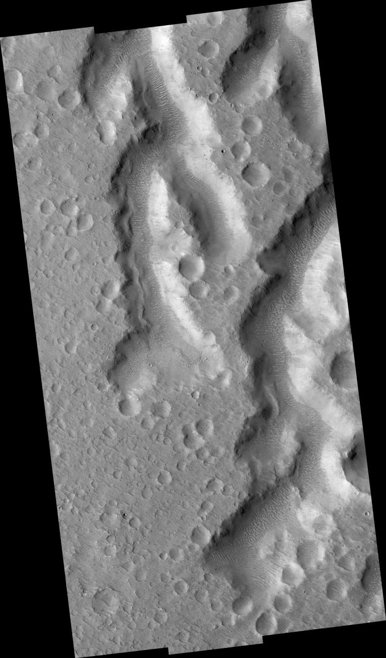
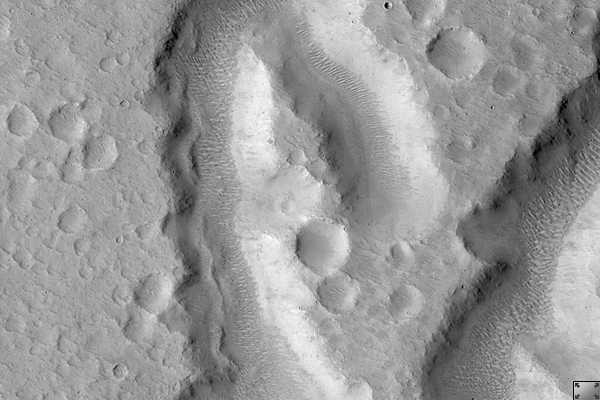
Nanedi Vallis: Tributaries and Albedo Changes
- Click the image above for a larger view
- Full-Res JPEG (2048 x 3486) (791.3 kB)
- Full-Res TIFF (2048 x 3486) (7.1 MB)
Caption:
Click on image for larger version
This HiRISE image ( PSP_001508_1850 ) shows a part of Nanedi Vallis, one of the Martian valley networks. The valley networks are thought to have formed by flowing water in the distant past when the climate on Mars was warmer and wetter than it is today.
Some scientists have suggested that the valley networks could have been produced in a climate like the dry, cold one of Mars today if the liquid water was protected by an overlying ice layer. Others think that glacial activity may be responsible for them, but the majority believe that the valley networks are evidence of ancient flowing water.
Valley networks are characterized by their blunt, theater-shaped heads and their approximately constant width along their reaches. They often have tributaries, as seen in this image, that connect with the main trunk of the valley.
Observation Geometry
Acquisition date:
11 November 2006
Local Mars time:
3:31 PM
Degrees latitude (centered):
5.0 °
Degrees longitude (East):
310.9 °
Range to target site:
269.3 km (168.3 miles)
Original image scale range:
from 26.9 cm/pixel (with 1 x 1 binning) to 107.8 cm/pixel (with 4 x 4 binning)
Map-projected scale:
25 cm/pixel and north is up
Map-projection:
EQUIRECTANGULAR
Emission angle:
2.3 °
Phase angle:
50.9 °
Solar incidence angle:
53 °, with the Sun about 37 ° above the horizon
Solar longitude:
138.9 °, Northern Summer
Background Info:
NASA's Jet Propulsion Laboratory, a division of the California Institute of Technology in Pasadena, manages the Mars Reconnaissance Orbiter for NASA's Science Mission Directorate, Washington. Lockheed Martin Space Systems, Denver, is the prime contractor for the project and built the spacecraft. The High Resolution Imaging Science Experiment is operated by the University of Arizona, Tucson, and the instrument was built by Ball Aerospace and Technology Corp., Boulder, Colo.
Cataloging Keywords:
| Name | Value | Additional Values |
|---|---|---|
| Target | Mars | |
| System | ||
| Target Type | Planet | |
| Mission | Mars Reconnaissance Orbiter (MRO) | |
| Instrument Host | Mars Reconnaissance Orbiter | |
| Host Type | Orbiter | |
| Instrument | High Resolution Imaging Science Experiment (HiRISE) | |
| Detector | ||
| Extra Keywords | Grayscale, Infrared, Map, Water | |
| Acquisition Date | ||
| Release Date | 2007-02-07 | |
| Date in Caption | 2006-11-11 | |
| Image Credit | NASA/JPL/Univ. of Arizona | |
| Source | photojournal.jpl.nasa.gov/catalog/PIA09588 | |
| Identifier | PIA09588 | |