
|
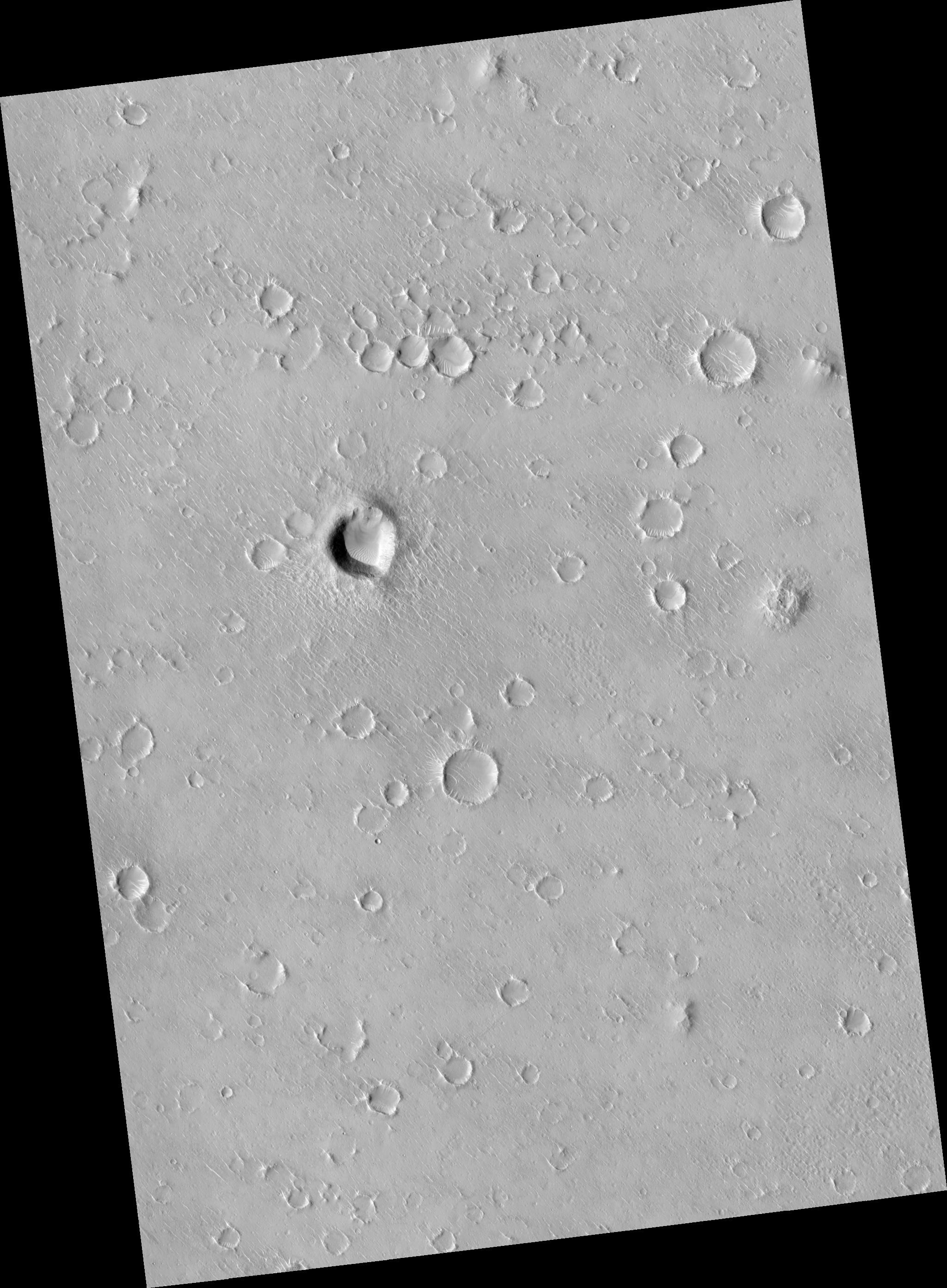
Portion of Isidis Planitia Near the Beagle 2 Landing Ellipse
- Click the image above for a larger view
- Full-Res JPEG (2048 x 2784) (575.8 kB)
- Full-Res TIFF (2048 x 2784) (5.7 MB)
Caption:
Click on image for larger version
This HiRISE image ( PSP_002136_1920 ) shows a portion of cratered plains in Isidis Planitia, near or perhaps within the landing ellipse for Beagle 2.
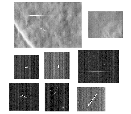
There are some interesting bright-pixel artifacts that are due to cosmic-ray events detected by the HiRISE camera, similar to those seen when imaging black sky during cruise to Mars.
The image shows two portions of the Isidis Planitia image with bright noise at top, and 6 examples of bright noise seen in the cruise images; all are from the original, unprocessed images.
Observation Geometry
Acquisition date:
1 January 2007
Local Mars time:
3:36 PM
Degrees latitude (centered):
11.8 °
Degrees longitude (East):
90.9 °
Range to target site:
277.5 km (173.5 miles)
Original image scale range:
27.8 cm/pixel (with 1 x 1 binning) so objects ~83 cm across are resolved
Map-projected scale:
25 cm/pixel and north is up
Map-projection:
EQUIRECTANGULAR
Emission angle:
1.0 °
Phase angle:
54.7 °
Solar incidence angle:
54 °, with the Sun about 36 ° above the horizon
Solar longitude:
164.1 °, Northern Summer
Background Info:
NASA's Jet Propulsion Laboratory, a division of the California Institute of Technology in Pasadena, manages the Mars Reconnaissance Orbiter for NASA's Science Mission Directorate, Washington. Lockheed Martin Space Systems, Denver, is the prime contractor for the project and built the spacecraft. The High Resolution Imaging Science Experiment is operated by the University of Arizona, Tucson, and the instrument was built by Ball Aerospace and Technology Corp., Boulder, Colo.
Cataloging Keywords:
| Name | Value | Additional Values |
|---|---|---|
| Target | Mars | |
| System | ||
| Target Type | Planet | |
| Mission | Mars Reconnaissance Orbiter (MRO) | Mars Express, Mars Express (MEX) |
| Instrument Host | Mars Reconnaissance Orbiter | Mars Express Lander |
| Host Type | Orbiter | Lander |
| Instrument | High Resolution Imaging Science Experiment (HiRISE) | |
| Detector | ||
| Extra Keywords | Crater, Grayscale, Infrared, Map | |
| Acquisition Date | ||
| Release Date | 2007-02-14 | |
| Date in Caption | 2007-01-01 | |
| Image Credit | NASA/JPL/University of Arizona | |
| Source | photojournal.jpl.nasa.gov/catalog/PIA09598 | |
| Identifier | PIA09598 | |