
|
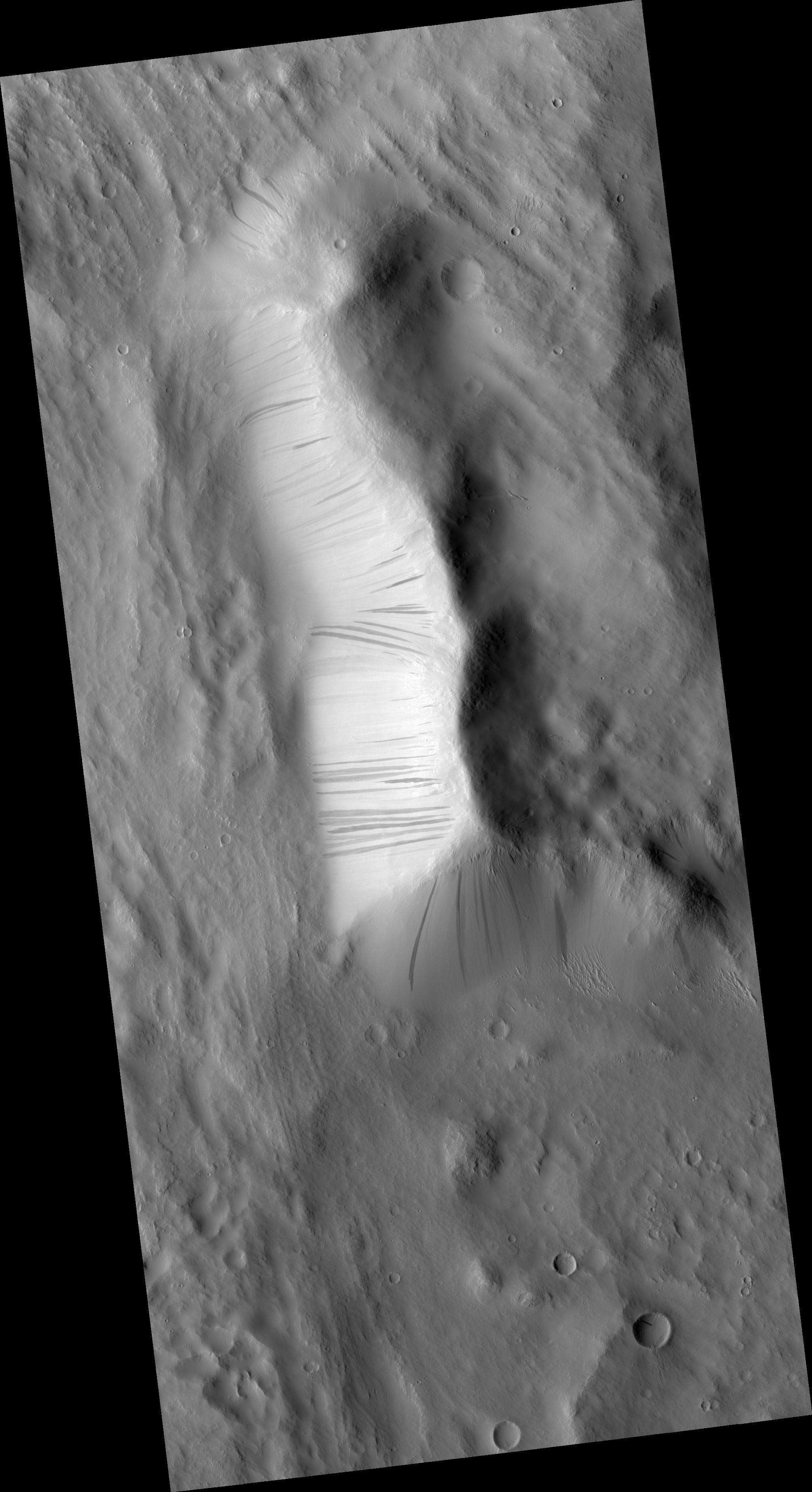
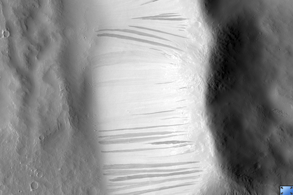
Newly-Formed Slope Streaks
- Click the image above for a larger view
- Full-Res JPEG (2048 x 3761) (506.5 kB)
- Full-Res TIFF (2048 x 3761) (7.7 MB)
Caption:
Click on image for larger version
HiRISE image ( PSP_002396_1900 ) features three newly-formed slope streaks. These are features which occur on crater walls, hills, and other slopes on Mars.
They always begin at a point source and widen downslope, sometimes weaving around existing topographic features (such as dunes or craters), but other times they flow over them. Many slope streaks do not show topographic relief in available images, and there are no observable deposits of displaced materials surrounding their borders.
In general, slope streaks tend to be many hundreds of meters long and less than 200 meters wide. They are observed in varying shades of darkness, where lighter-toned streaks appear to be older than darker ones. The formation mechanism responsible for slope streaks is still under debate; theories range from dry dust avalanches (most widely-accepted theory) to briney water seepage.
Slope streak formation is among the few surface processes known to be currently active on Mars, making slope streaks some of the youngest features on Mars. A comparison of this HiRISE image with the Mars Orbiter Camera (MOC) image E04-01817 shows that three new slope streaks have formed during the six years separating these images (2001-2007). The shortest time frame in which new slope streaks have been observed to form is six months (MOC images SP2-37303 and E02-02379), though it is not yet known how long it actually takes for a slope streak to form.
MOC image E04-01817 courtesy of NASA/JPL/Malin Space Science Systems.
Observation Toolbox
Acquisition date:
1 January 2007
Local Mars time:
3:40 PM
Degrees latitude (centered):
10.1°
Degrees longitude (East):
193.2°
Range to target site:
278.7 km (174.2 miles)
Original image scale range:
55.8 cm/pixel (with 2 x 2 binning) so objects ~167 cm across are resolved
Map-projected scale:
50 cm/pixel and north is up
Map-projection:
EQUIRECTANGULAR
Emission angle:
3.7°
Phase angle:
51.7°
Solar incidence angle:
55°, with the Sun about 35° above the horizon
Solar longitude:
175.2°, Northern Summer
Background Info:
NASA's Jet Propulsion Laboratory, a division of the California Institute of Technology in Pasadena, manages the Mars Reconnaissance Orbiter for NASA's Science Mission Directorate, Washington. Lockheed Martin Space Systems, Denver, is the prime contractor for the project and built the spacecraft. The High Resolution Imaging Science Experiment is operated by the University of Arizona, Tucson, and the instrument was built by Ball Aerospace and Technology Corp., Boulder, Colo.
Cataloging Keywords:
| Name | Value | Additional Values |
|---|---|---|
| Target | Mars | |
| System | ||
| Target Type | Planet | |
| Mission | Mars Reconnaissance Orbiter (MRO) | Mars Global Surveyor (MGS) |
| Instrument Host | Mars Reconnaissance Orbiter | Mars Global Surveyor |
| Host Type | Orbiter | |
| Instrument | High Resolution Imaging Science Experiment (HiRISE) | Mars Orbiter Camera (MOC) |
| Detector | ||
| Extra Keywords | Crater, Dune, Dust, Grayscale, Infrared, Map, Water | |
| Acquisition Date | ||
| Release Date | 2007-02-21 | |
| Date in Caption | 2007-01-01 | |
| Image Credit | NASA/JPL/University of Arizona | |
| Source | photojournal.jpl.nasa.gov/catalog/PIA09608 | |
| Identifier | PIA09608 | |