|
Signs of Eolian and Periglacial Activity at Vastitas Borealis
- Click the image above for a larger view
- Full-Res JPEG (2048 x 2001) (740.2 kB)
- Full-Res TIFF (2048 x 2001) (4.1 MB)
Caption:
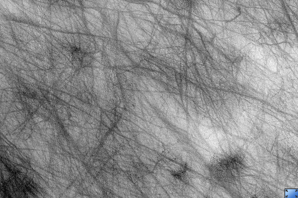
Click on image for larger version
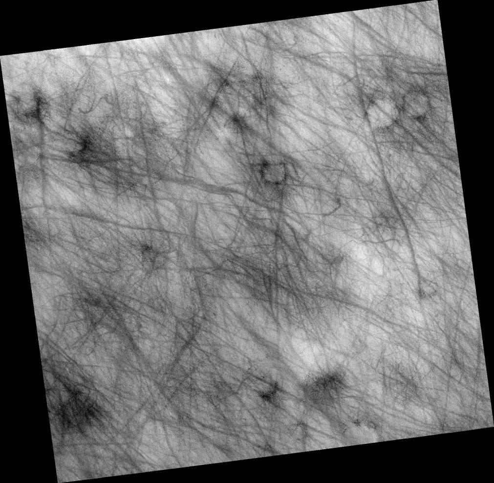
Image PSP_001481_2410 shows a region of approximately 7 x 7 km (4.4-by-4.4 miles) located in Vastitas Borealis, part of the Northern Plains.
The surface imaged is relatively young, as indicated by the lack of recent impact craters. Eolian and periglacial activity seem to be the dominant geological processes at work, as shown by numerous crisscrossing dust devil tracks and ubiquitous polygonal features, respectively.
Dust devils form when the sun warms up the air near a flat, dry surface. Warm air then rises quickly through the cooler air above and starts spinning, causing a forward motion. The spinning, forward-moving cell may pick up dust and sand as it advances, thus leaving behind a "clean" track. We infer from this image that a thin veneer of light-colored particles of dust and/or fine-grained sand cover relatively darker materials, apparent in the dust devil tracks.
The tracks pictured in this image are in many cases more than 30 meters (27 yards) wide and over 4 km (2.5 miles) long, surpassing the dimensions of average terrestrial dust devil tracks.
The polygons shown in this image's subset, which covers approximately 400 x 250 m (350 x 225 yards), are in the order of 10 m (0.9 yards) across; in some cases they are delimited by aligned rocks. Similar features in both shape and scale are found in terrestrial periglacial regions such as Antarctica, where ice is present at or near the surface.
Antarctica's polygons and rock alignments are produced by repeated expansion and contraction of the soil-ice mixture due to seasonal temperature oscillations; dry soil falling into the cracks form sand wedges and amplify this effect. This results in polygonal networks of stress fractures and in the resurfacing and sorting of rocks along these fractures.
(Thin diagonal lines are artifacts in the image).
Observation Toolbox
Acquisition date:
11 November 2006
Local Mars time:
3:13 PM
Degrees latitude (centered):
60.7°
Degrees longitude (East):
318.5°
Range to target site:
310.2 km (193.9 miles)
Original image scale range:
31.0 cm/pixel (with 1 x 1 binning) so objects ~93 cm across are resolved
Map-projected scale:
25 cm/pixel and north is up
Map-projection:
EQUIRECTANGULAR
Emission angle:
0.3°
Phase angle:
56.0°
Solar incidence angle:
84 56°, with the Sun about 34° above the horizon
Solar longitude:
137.9°, Northern Summer
Background Info:
NASA's Jet Propulsion Laboratory, a division of the California Institute of Technology in Pasadena, manages the Mars Reconnaissance Orbiter for NASA's Science Mission Directorate, Washington. Lockheed Martin Space Systems, Denver, is the prime contractor for the project and built the spacecraft. The High Resolution Imaging Science Experiment is operated by the University of Arizona, Tucson, and the instrument was built by Ball Aerospace and Technology Corp., Boulder, Colo.
Cataloging Keywords:
| Name | Value | Additional Values |
|---|---|---|
| Target | Mars | |
| System | ||
| Target Type | Planet | |
| Mission | Mars Reconnaissance Orbiter (MRO) | |
| Instrument Host | Mars Reconnaissance Orbiter | |
| Host Type | Orbiter | |
| Instrument | High Resolution Imaging Science Experiment (HiRISE) | |
| Detector | ||
| Extra Keywords | Crater, Dust, Grayscale, Impact, Infrared, Map, Rotation | |
| Acquisition Date | ||
| Release Date | 2007-02-21 | |
| Date in Caption | 2006-11-11 | |
| Image Credit | NASA/JPL/University of Arizona | |
| Source | photojournal.jpl.nasa.gov/catalog/PIA09610 | |
| Identifier | PIA09610 | |