|
Two Southern Hemisphere Craters
- Click the image above for a larger view
- Full-Res JPEG (2048 x 1571) (304.7 kB)
- Full-Res TIFF (2048 x 1571) (3.2 MB)
Caption:
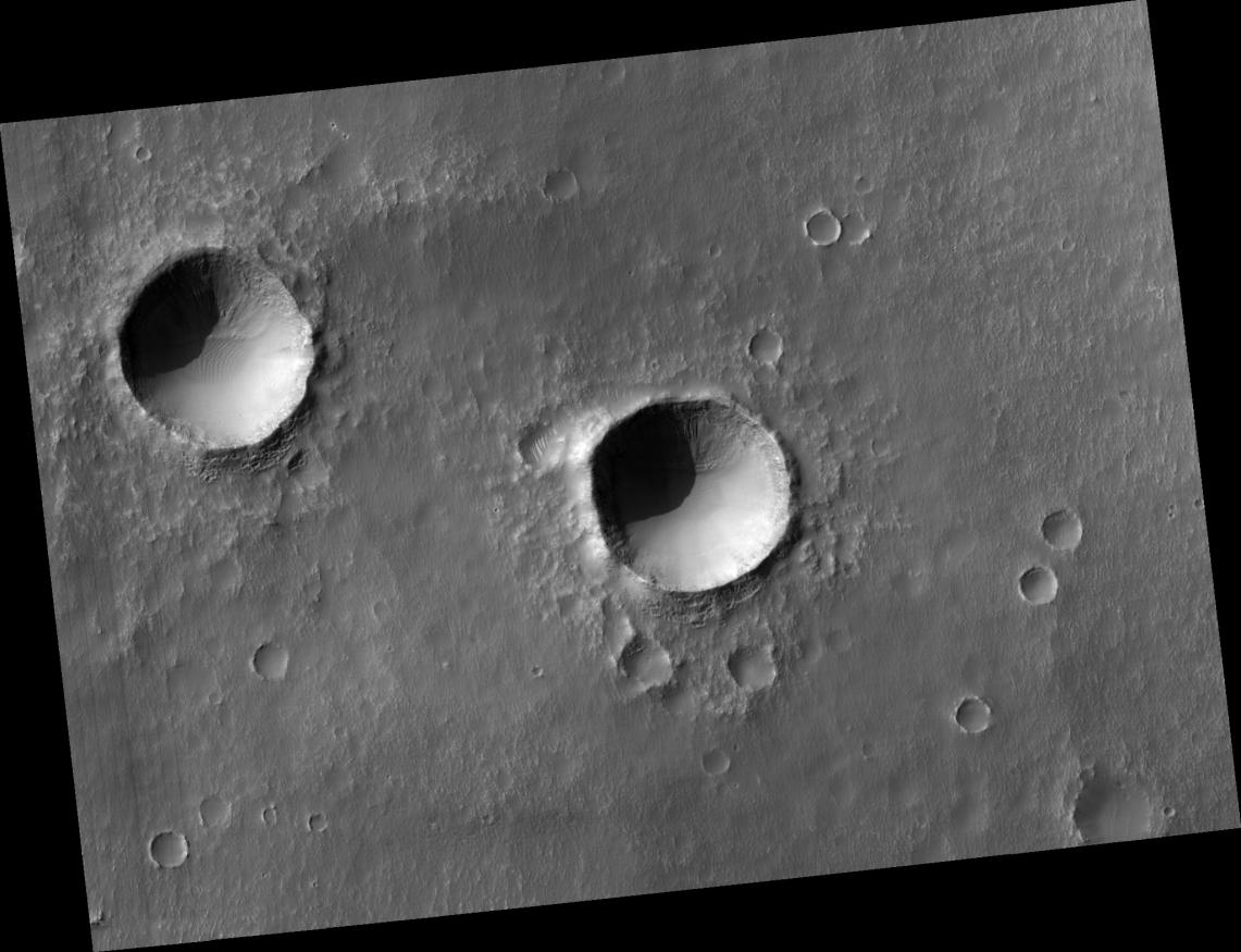
This HiRISE image ( PSP_001750_1425 ) shows two southern hemisphere craters. These craters are about the same size, approximately 800-900 meters in diameter, and appear to have experienced parallel histories. Both craters show dunes and gullies with similar orientations.
Several generations of dunes can be seen in the interior of these craters. The largest barchan dunes trend northwest-southeast with their slip faces facing the southeast, indicating that the winds forming them came from the northwest.
There are smaller dunes that superpose the large dunes with a different orientation. Different dune orientations are a sign of a changing dominant wind direction. Both craters have similar dune orientations, which is expected because of their proximity.
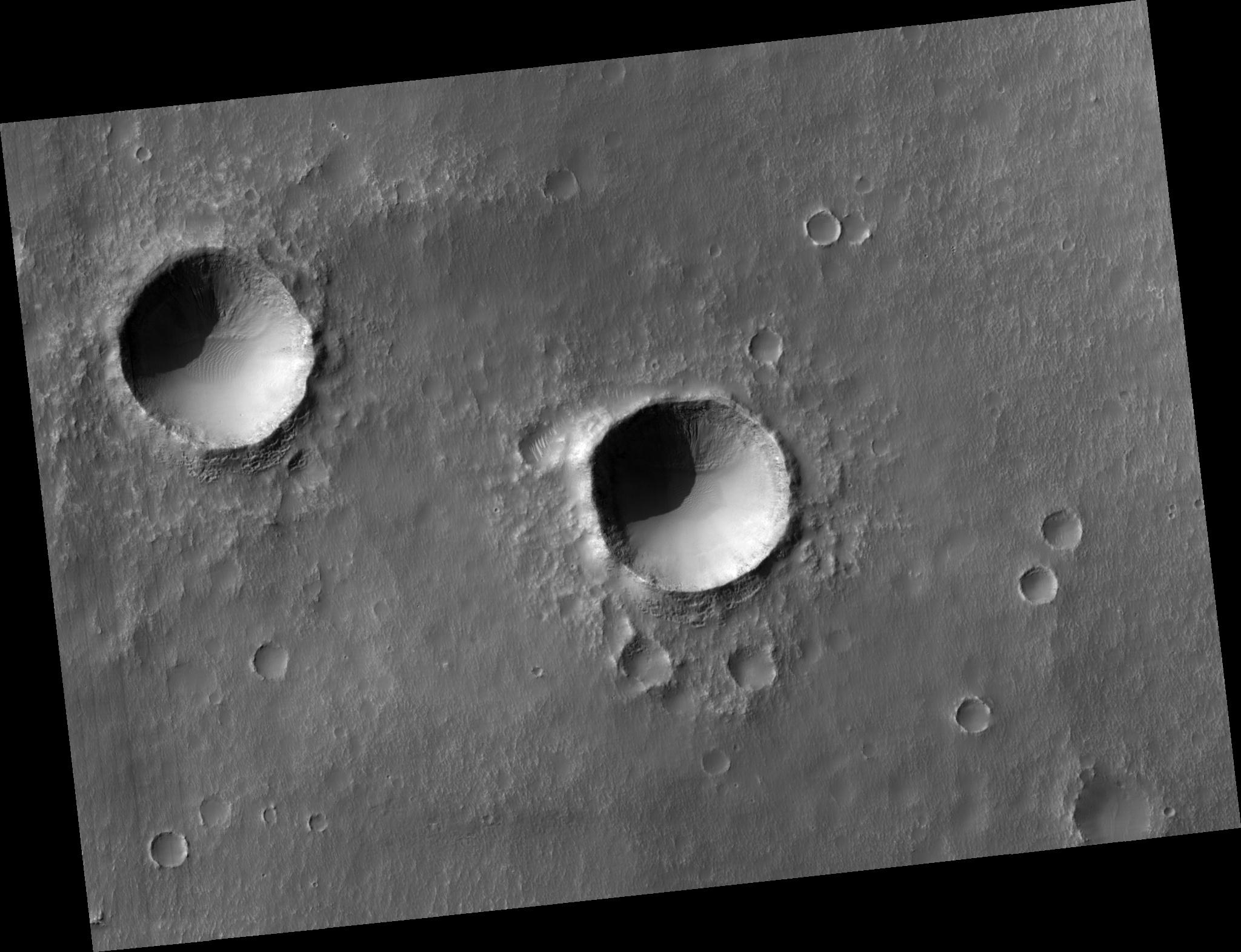
The two craters also both have gullies originating at layers on their south-facing walls. The gullies are mostly in shadow, but adjusting the brightness and contrast of the image allows them to be seen (see subimage ). The subimage is approximately 300 meters across and shows the gullies in the crater on the right. Gullies are thought to form by liquid water flowing down slopes, but the source of the water and how it is involved in gully erosion is often debated.
One theory proposes that near-surface ground ice melts to form the gullies. An important part of this theory is the direction and amount of insolation (sunlight) a slope receives. Since these craters are close to each other, they receive similar insolation, which could explain why the gullies are in the same location in them.
Another theory suggests that subsurface water from an aquifer forms the gullies. If an extensive aquifer existed, it would flow downslope. If the regional slope trends towards the south, that could explain why the gullies are where they are (the water would come from behind the slope to form the gullies).
HiRISE is showing us unprecedented details of the gullies and will no doubt bring us closer to understanding how these mysterious features form.
Observation Toolbox
Acquisition date:
12 December 2006
Local Mars time:
3:40 PM
Degrees latitude (centered):
-37.2°
Degrees longitude (East):
194.2°
Range to target site:
253.6 km (158.5 miles)
Original image scale range:
25.4 cm/pixel (with 1 x 1 binning) so objects ~76 cm across are resolved
Map-projected scale:
25 cm/pixel and north is up
Map-projection:
EQUIRECTANGULAR
Emission angle:
6.2°
Phase angle:
77.1°
Solar incidence angle:
72°, with the Sun about 18° above the horizon
Solar longitude:
148.4°, Northern Summer
Background Info:
NASA's Jet Propulsion Laboratory, a division of the California Institute of Technology in Pasadena, manages the Mars Reconnaissance Orbiter for NASA's Science Mission Directorate, Washington. Lockheed Martin Space Systems, Denver, is the prime contractor for the project and built the spacecraft. The High Resolution Imaging Science Experiment is operated by the University of Arizona, Tucson, and the instrument was built by Ball Aerospace and Technology Corp., Boulder, Colo.
Cataloging Keywords:
| Name | Value | Additional Values |
|---|---|---|
| Target | Mars | |
| System | ||
| Target Type | Planet | |
| Mission | Mars Reconnaissance Orbiter (MRO) | |
| Instrument Host | Mars Reconnaissance Orbiter | |
| Host Type | Orbiter | |
| Instrument | High Resolution Imaging Science Experiment (HiRISE) | |
| Detector | ||
| Extra Keywords | Crater, Dune, Grayscale, Infrared, Map, Shadow, Water | |
| Acquisition Date | ||
| Release Date | 2007-03-07 | |
| Date in Caption | 2006-12-12 | |
| Image Credit | NASA/JPL/University of Arizona | |
| Source | photojournal.jpl.nasa.gov/catalog/PIA09622 | |
| Identifier | PIA09622 | |