|
Sand Dune Field in Richardson Crater
- Click the image above for a larger view
- Full-Res JPEG (2048 x 7518) (670.8 kB)
- Full-Res TIFF (2048 x 7518) (15.4 MB)
Caption:
Click on image for larger version
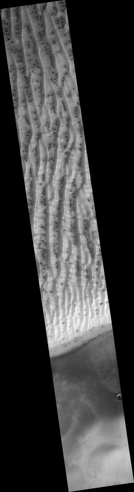
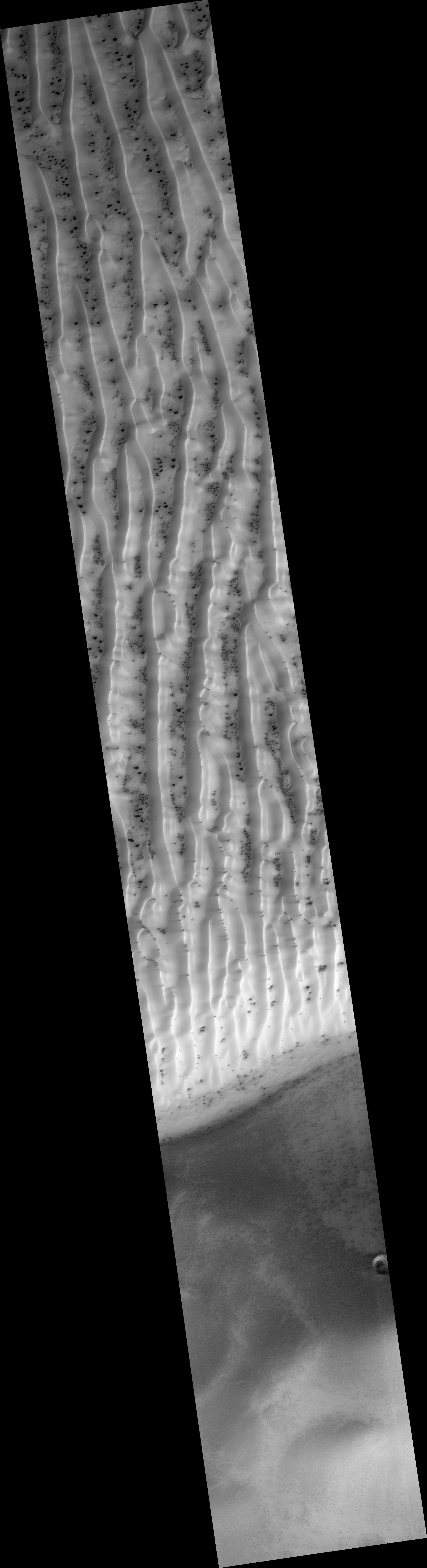
This HiRISE image ( PSP_002542_1080 ) is a view of the sand dune field in Richardson Crater covered with seasonal frost.
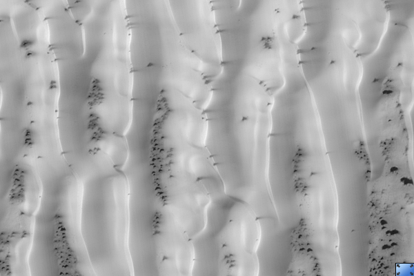
The subimage is a close-up view of defrosting patterns on the dunes. The frost is a combination of frozen carbon dioxide and some water ice that covers the dunes in the winter and spring. As the seasonal frost sublimes away, odd features such as spots, fans, and streaks form.
Small dark streaks on the dune slip face slopes may be where recent avalanches of sand, or perhaps wind, has moved the dark sand underlying the frost, or where frost has been removed to expose the sand. Alternatively, the dark streaks may be patches of coarse-grained ice that are clear enough so that the dark material below the ice is visible. The slip faces indicate that the general direction of sand transport is from the right to the left across the image.
It has been hypothesized that the dark spots and fans may be "geysers" or "cold gas jets" that form when sublimation processes trap gas at the bottom of the ice. The gas is released through cracks in the ice, entraining dust from below the ice and scattering it onto the surface to form the dark spots and fans.
The high resolution, stereo, and low light imaging capabilities of HiRISE has provided new insight into the processes that form these features. Repeated imaging in a variety of locations will provide a record of their development and evolution.
Observation Toolbox
Acquisition date:
2 February 2007
Local Mars time:
4:05 PM
Degrees latitude (centered):
-72.0°
Degrees longitude (East):
179.5°
Range to target site:
251.8 km (179.5 miles)
Original image scale range:
50.4 cm/pixel (with 2 x 2 binning) so objects ~151 cm across are resolved
Map-projected scale:
50 cm/pixel
Map-projection:
POLAR STEREOGRAPHIC
Emission angle:
9.2°
Phase angle:
88.5°
Solar incidence angle:
81°, with the Sun about 9° above the horizon
Solar longitude:
181.5 °, Northern Autumn
Background Info:
NASA's Jet Propulsion Laboratory, a division of the California Institute of Technology in Pasadena, manages the Mars Reconnaissance Orbiter for NASA's Science Mission Directorate, Washington. Lockheed Martin Space Systems, Denver, is the prime contractor for the project and built the spacecraft. The High Resolution Imaging Science Experiment is operated by the University of Arizona, Tucson, and the instrument was built by Ball Aerospace and Technology Corp., Boulder, Colo.
Cataloging Keywords:
| Name | Value | Additional Values |
|---|---|---|
| Target | Mars | |
| System | ||
| Target Type | Planet | |
| Mission | Mars Reconnaissance Orbiter (MRO) | |
| Instrument Host | Mars Reconnaissance Orbiter | |
| Host Type | Orbiter | |
| Instrument | High Resolution Imaging Science Experiment (HiRISE) | |
| Detector | ||
| Extra Keywords | Atmosphere, Crater, Dune, Dust, Grayscale, Map, Storm, Water | |
| Acquisition Date | ||
| Release Date | 2007-03-21 | |
| Date in Caption | 2007-02-02 | |
| Image Credit | NASA/JPL/Univ. of Arizona | |
| Source | photojournal.jpl.nasa.gov/catalog/PIA09631 | |
| Identifier | PIA09631 | |