
|
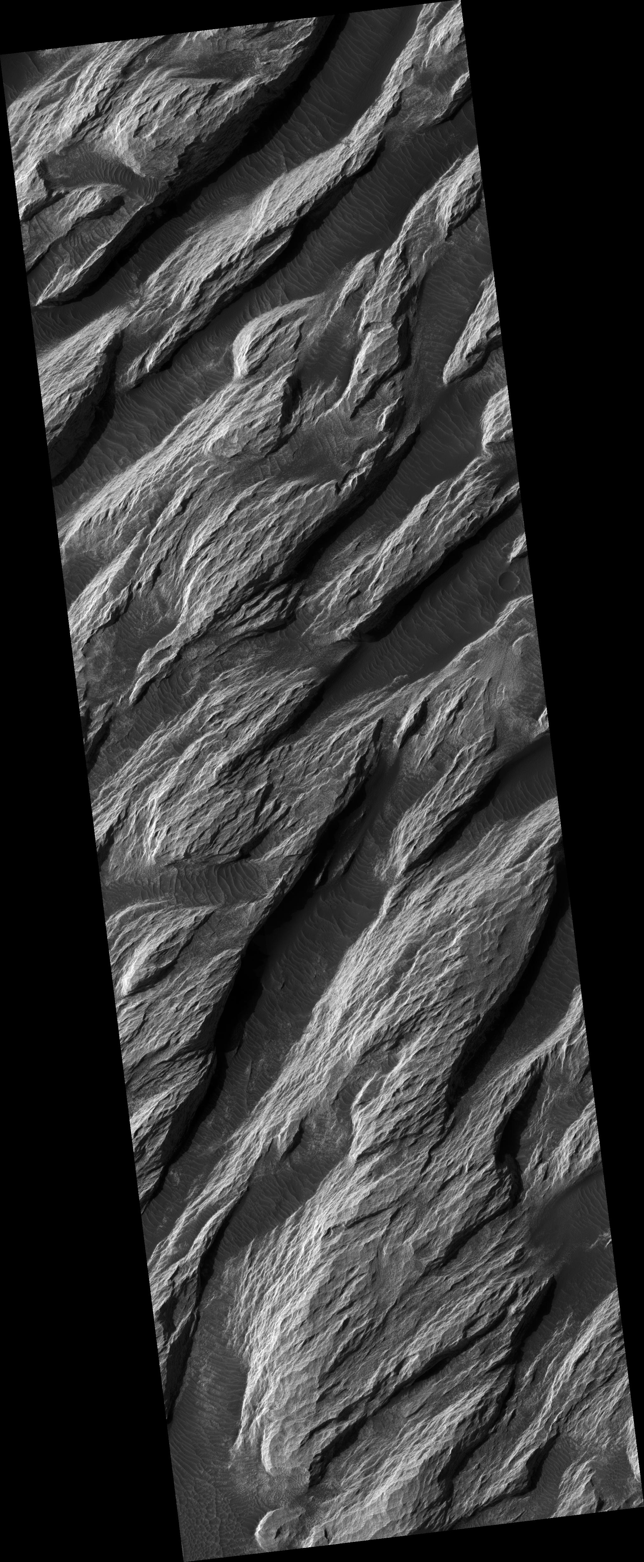
White Rock Landform in Pollack Crater
- Click the image above for a larger view
- Full-Res JPEG (2048 x 4966) (1.2 MB)
- Full-Res TIFF (2048 x 4966) (10.2 MB)
Caption:
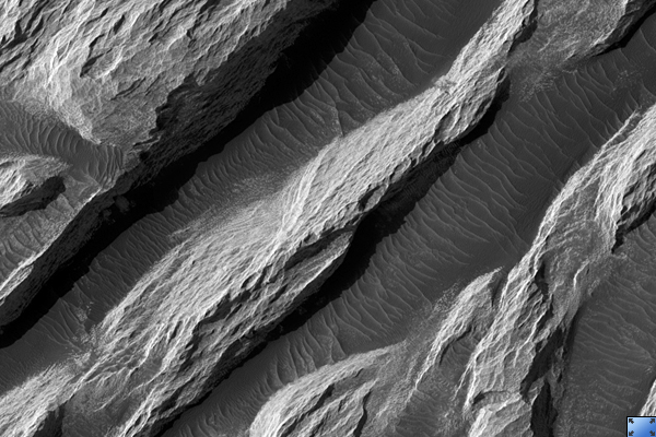
Click on image for larger version
This HiRISE image ( PSP_002244_1720 ) shows a portion of a relatively bright landform named "White Rock" on the floor of Pollack crater in the Sinus Sabaeus region of Mars.
Data from the Mars Global Surveyor Thermal Emission Spectrometer (TES) indicates that this landform is not anomalously bright, relative to other bright Martian regions. Further, the apparent brightness seen here is due to contrast with other materials on the crater floor.
Dunes and ripples are visible in the dark material between the bright ridges. Their orientations appear to be influenced by wind directionally channeled by the ridges. Material appears to have been shed from the white landform and deposited on the darker bedforms indicating that the light-toned outcrops break down into fine materials.
Its high albedo and location in a topographic basin have led to suggestions that White Rock is an erosional remnant of an ancient lacustrine evaporate deposit. Other interpretations include an eroded accumulation of compacted or weakly cemented aeolian sediment.
Observation Toolbox
Acquisition date:
1 January 2007
Local Mars time:
3:42 PM
Degrees latitude (centered):
-8.0°
Degrees longitude (East):
25.0°
Range to target site:
263.1 km (164.4 miles)
Original image scale range:
26.3 cm/pixel (with 1 x 1 binning) so objects ~79 cm across are resolved
Map-projected scale:
25 cm/pixel and north is up
Map-projection:
EQUIRECTANGULAR
Emission angle:
1.3°
Phase angle:
55.7°
Solar incidence angle:
57°, with the Sun about 33° above the horizon
Solar longitude:
168.7°, Northern Autumn
Background Info:
NASA's Jet Propulsion Laboratory, a division of the California Institute of Technology in Pasadena, manages the Mars Reconnaissance Orbiter for NASA's Science Mission Directorate, Washington. Lockheed Martin Space Systems, Denver, is the prime contractor for the project and built the spacecraft. The High Resolution Imaging Science Experiment is operated by the University of Arizona, Tucson, and the instrument was built by Ball Aerospace and Technology Corp., Boulder, Colo.
Cataloging Keywords:
| Name | Value | Additional Values |
|---|---|---|
| Target | Mars | |
| System | ||
| Target Type | Planet | |
| Mission | Mars Reconnaissance Orbiter (MRO) | Mars Global Surveyor (MGS) |
| Instrument Host | Mars Reconnaissance Orbiter | Mars Global Surveyor |
| Host Type | Orbiter | |
| Instrument | High Resolution Imaging Science Experiment (HiRISE) | |
| Detector | ||
| Extra Keywords | Crater, Dune, Grayscale, Infrared, Map, Thermal | |
| Acquisition Date | ||
| Release Date | 2007-03-28 | |
| Date in Caption | 2007-01-01 | |
| Image Credit | NASA/JPL/Univ. of Arizona | |
| Source | photojournal.jpl.nasa.gov/catalog/PIA09640 | |
| Identifier | PIA09640 | |