
|
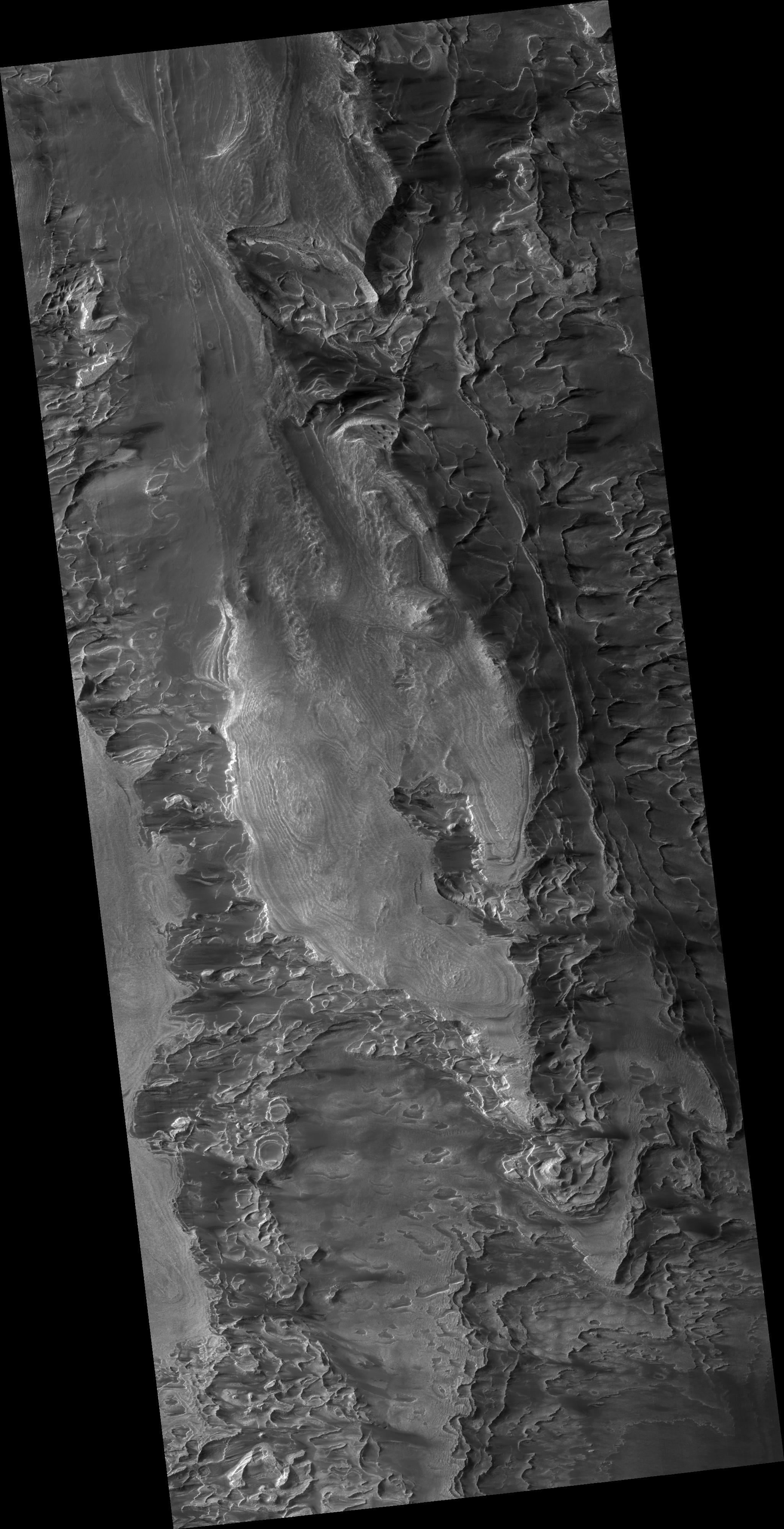
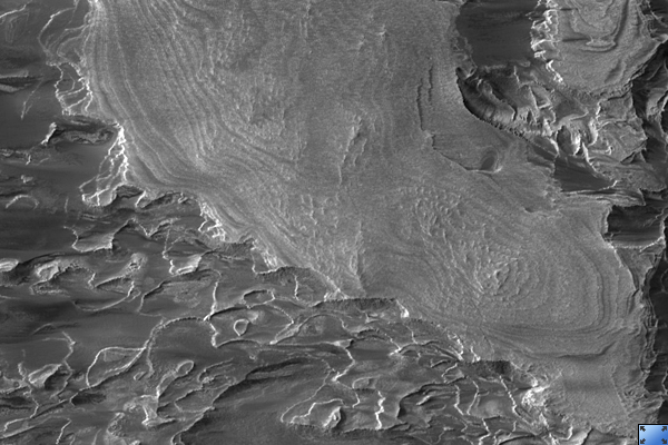
Layers in Galle Crater
- Click the image above for a larger view
- Full-Res JPEG (2048 x 3992) (785.2 kB)
- Full-Res TIFF (2048 x 3992) (8.2 MB)
Caption:
Click on image for larger version
This HiRISE image shows part of a large mass of layered rock in Galle Crater, in the southern cratered highlands of Mars.
At low resolution, layers appear as bands and swirls which are nearly horizontal. This causes them to interact dramatically with topography, producing the appearance of folds and loops wrapping around small hills much like lines on a contour map. Zooming in at higher resolution, some long cracks (hundreds of meters long) are cutting across the layers, generally trending northeast-southwest.
At full resolution ( PSP_002655_1280 ), details of the layers are often obscured by ripples of wind-blown dust or textured patterns of erosion now eroding the rock. In the best exposures, such as that in the cutout section, the layers are fractured into blocks. Some of the layers are relatively resistant, and appear as ridges or fins in the cutout, often with little material supporting them from below. Although this seems to indicate relatively strong, coherent material, few boulders are visible. The ridge-forming layers may be weak, but separated by material with virtually no cohesion.
Polygonal fracture patterns in the dark regolith between distinct layers could be due to ground ice, or regional tectonic stresses.
Observation Toolbox
Acquisition date:
2 February 2007
Local Mars time:
3:54 PM
Degrees latitude (centered):
-51.8°
Degrees longitude (East):
330.0°
Range to target site:
256.3 km (160.2 miles)
Original image scale range:
25.6 cm/pixel (with 1 x 1 binning) so objects ~77 cm across are resolved
Map-projected scale:
25 cm/pixel and north is up
Map-projection:
EQUIRECTANGULAR
Emission angle:
2.8°
Phase angle:
71.5°
Solar incidence angle:
69°, with the Sun about 21° above the horizon
Solar longitude:
186.6°, Northern Autumn
Background Info:
NASA's Jet Propulsion Laboratory, a division of the California Institute of Technology in Pasadena, manages the Mars Reconnaissance Orbiter for NASA's Science Mission Directorate, Washington. Lockheed Martin Space Systems, Denver, is the prime contractor for the project and built the spacecraft. The High Resolution Imaging Science Experiment is operated by the University of Arizona, Tucson, and the instrument was built by Ball Aerospace and Technology Corp., Boulder, Colo.
Cataloging Keywords:
| Name | Value | Additional Values |
|---|---|---|
| Target | Mars | |
| System | ||
| Target Type | Planet | |
| Mission | Mars Reconnaissance Orbiter (MRO) | |
| Instrument Host | Mars Reconnaissance Orbiter | |
| Host Type | Orbiter | |
| Instrument | High Resolution Imaging Science Experiment (HiRISE) | |
| Detector | ||
| Extra Keywords | Crater, Dust, Grayscale, Infrared, Map | |
| Acquisition Date | ||
| Release Date | 2007-05-16 | |
| Date in Caption | 2007-02-02 | |
| Image Credit | NASA/JPL/Univ. of Arizona | |
| Source | photojournal.jpl.nasa.gov/catalog/PIA09686 | |
| Identifier | PIA09686 | |