|
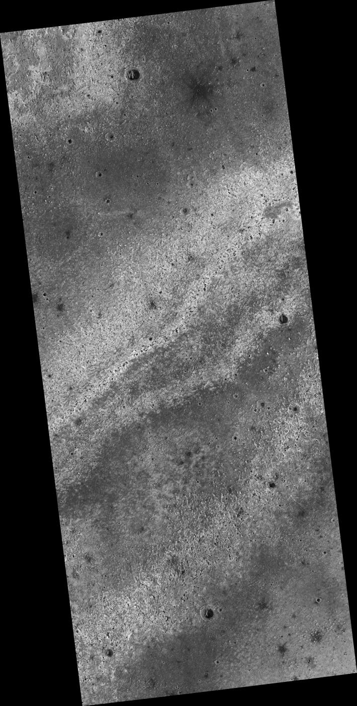
Proposed MSL Site in East Meridiani
- Click the image above for a larger view
- Full-Res JPEG (2048 x 4057) (1.3 MB)
- Full-Res TIFF (2048 x 4057) (8.3 MB)
Caption:
Click on image for larger version
This HiRISE image ( PSP_003326_1800 ) of proposed landing site for the Mars Science Laboratory (MSL) in East Meridiani.
Observation Toolbox
Acquisition date:
4 April 2007
Local Mars time:
3:33 PM
Degrees latitude (centered):
0.0°
Degrees longitude (East):
3.6°
Range to target site:
273.6 km (171.0 miles)
Original image scale range:
27.4 cm/pixel (with 1 x 1 binning) so objects ~82 cm across are resolved
Map-projected scale:
25 cm/pixel and north is up
Map-projection:
EQUIRECTANGULAR
Emission angle:
9.4°
Phase angle:
64.0°
Solar incidence angle:
55°, with the Sun about 35° above the horizon
Solar longitude:
217.8 °, Northern Autumn
Background Info:
NASA's Jet Propulsion Laboratory, a division of the California Institute of Technology in Pasadena, manages the Mars Reconnaissance Orbiter for NASA's Science Mission Directorate, Washington. Lockheed Martin Space Systems, Denver, is the prime contractor for the project and built the spacecraft. The High Resolution Imaging Science Experiment is operated by the University of Arizona, Tucson, and the instrument was built by Ball Aerospace and Technology Corp., Boulder, Colo.
Cataloging Keywords:
| Name | Value | Additional Values |
|---|---|---|
| Target | Mars | |
| System | ||
| Target Type | Planet | |
| Mission | Mars Reconnaissance Orbiter (MRO) | Mars Science Laboratory (MSL) |
| Instrument Host | Mars Reconnaissance Orbiter | Curiosity Rover |
| Host Type | Orbiter | Rover |
| Instrument | High Resolution Imaging Science Experiment (HiRISE) | |
| Detector | ||
| Extra Keywords | Grayscale, Infrared, Map | |
| Acquisition Date | ||
| Release Date | 2007-05-23 | |
| Date in Caption | 2007-04-04 | |
| Image Credit | NASA/JPL/Univ. of Arizona | |
| Source | photojournal.jpl.nasa.gov/catalog/PIA09707 | |
| Identifier | PIA09707 | |