
|
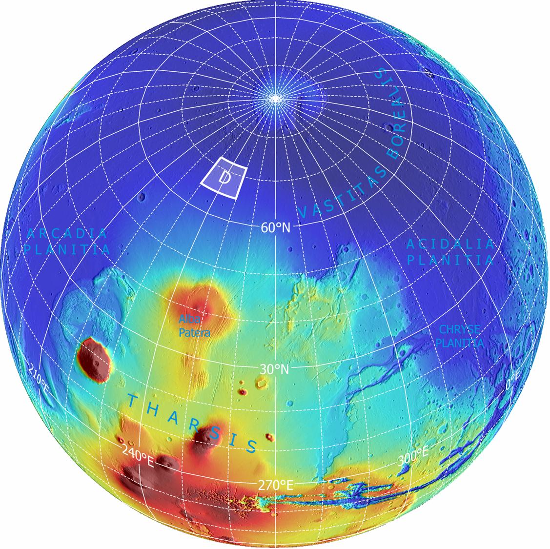
Far-Northern Destination for Phoenix Mars Lander
- Click the image above for a larger view
- Full-Res JPEG (1127 x 1125) (244.1 kB)
- Full-Res TIFF (1127 x 1125) (3.8 MB)
Caption:
The planned landing site for NASA's Phoenix Mars Lander lies at a latitude on Mars equivalent to northern Alaska on Earth. It is within the region designated "D" on this global image.
This is an orthographic projection with color-coded elevation contours and shaded relief based on data from the Mars Orbiter Laser Altimeter on NASA's Mars Global Surveyor orbiter. Total vertical relief is about 28 kilometers (17 miles) from the top of the highest volcano (red) to the northern lowlands (blue). North pole is where the longitude lines converge.
Background Info:
Photojournal Note: As planned, the Phoenix lander, which landed May 25, 2008 23:53 UTC, ended communications in November 2008, about six months after landing, when its solar panels ceased operating in the dark Martian winter.
Cataloging Keywords:
| Name | Value | Additional Values |
|---|---|---|
| Target | Mars | |
| System | ||
| Target Type | Planet | |
| Mission | Mars Global Surveyor (MGS) | Phoenix |
| Instrument Host | Mars Global Surveyor | Phoenix Lander |
| Host Type | Orbiter | Lander |
| Instrument | Mars Orbiter Laser Altimeter (MOLA) | |
| Detector | ||
| Extra Keywords | Color, Volcano | |
| Acquisition Date | ||
| Release Date | 2007-08-02 | |
| Date in Caption | ||
| Image Credit | NASA/JPL-Caltech/Washington Univ. St. Louis/Univ. of Arizona | |
| Source | photojournal.jpl.nasa.gov/catalog/PIA09944 | |
| Identifier | PIA09944 | |