|
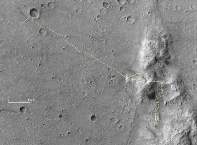
Spirit’s Traverse, Sols 1 to 1,386
- Click the image above for a larger view
- Full-Res JPEG (3688 x 2720) (2.1 MB)
- Full-Res TIFF (3688 x 2720) (30.1 MB)
Caption:
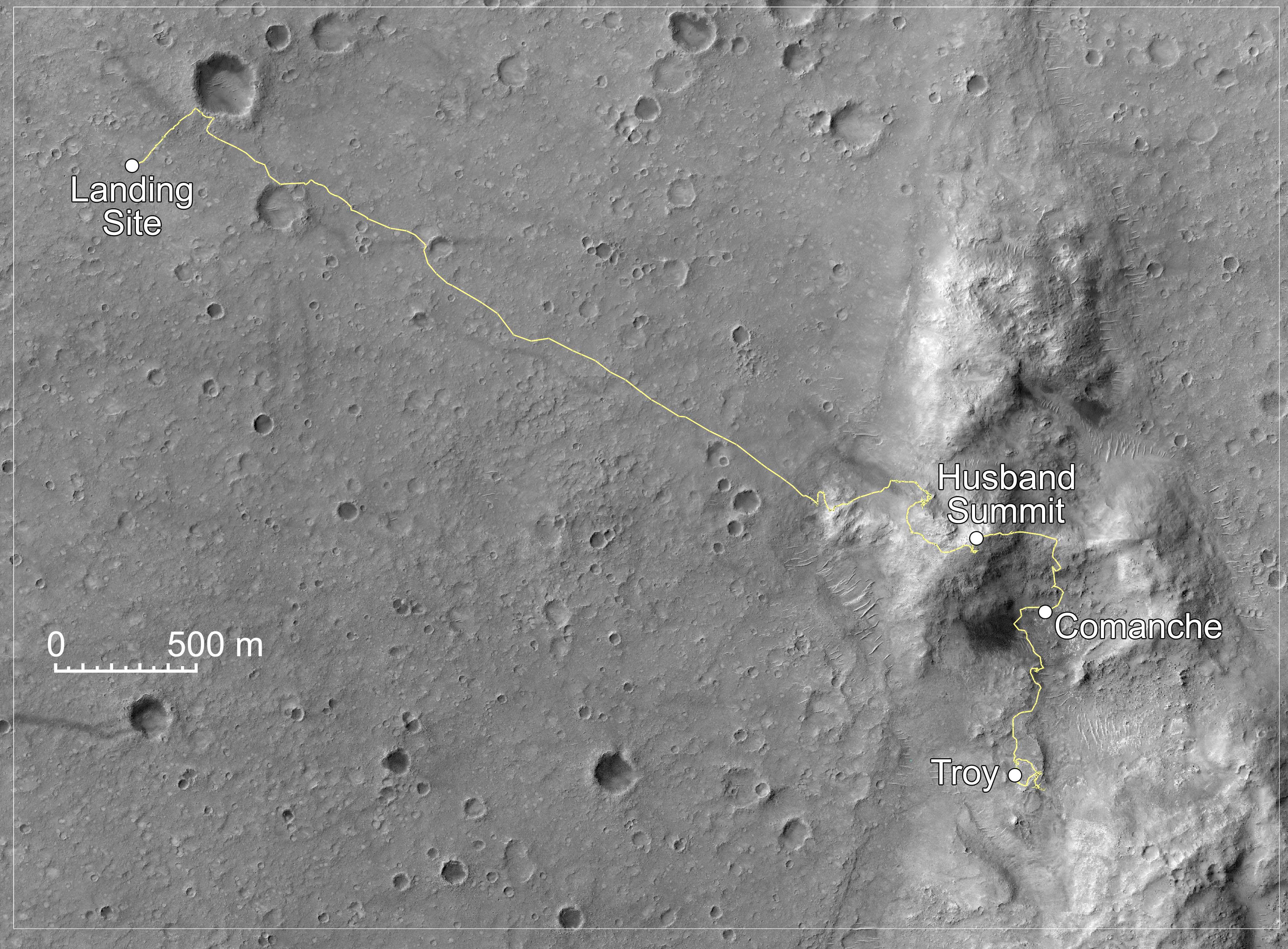
Annotated Version
Click on the image for the larger version
NASA's Mars Exploration Rover Spirit was crossing northward on a low plateau called "Home Plate" on the 1,386th Martian day, or sol, (Nov. 26, 2007) of Spirit's time on Mars. By that time, nearly 47 months into a mission originally planned to last three months, Spirit had driven 7,435 meters (4.62 miles). From its landing site near the northwest corner of this map, Spirit crossed a plain to reach the Columbia Hills, climbed over the summit of Husband Hill, and descended into the "Inner Basin" of the range, near the southeast corner of the map.
For this map, the yellow line indicating Spirit's route has been overlaid onto a portion of an image taken by the High Resolution Imaging Science Experiment on NASA's Mars Reconnaissance Orbiter on Nov. 22, 2006, That image is catalogued as PSP_001513_1655 (see also PIA01897 ). The scale bar on the map is 500 meters (1,640 feet) long. North is up.
Cataloging Keywords:
| Name | Value | Additional Values |
|---|---|---|
| Target | Mars | |
| System | ||
| Target Type | Planet | |
| Mission | Mars Exploration Rover (MER) | Mars Reconnaissance Orbiter (MRO) |
| Instrument Host | Mars Reconnaissance Orbiter | Spirit (MER-A) |
| Host Type | Orbiter | Rover |
| Instrument | High Resolution Imaging Science Experiment (HiRISE) | |
| Detector | ||
| Extra Keywords | Color, Map | |
| Acquisition Date | ||
| Release Date | 2007-12-10 | |
| Date in Caption | 2006-11-22 | 2007-11-26 |
| Image Credit | NASA/JPL-Caltech/UA/Cornell/NM Museum of Natural History and Science | |
| Source | photojournal.jpl.nasa.gov/catalog/PIA10126 | |
| Identifier | PIA10126 | |