skip to navigation
|
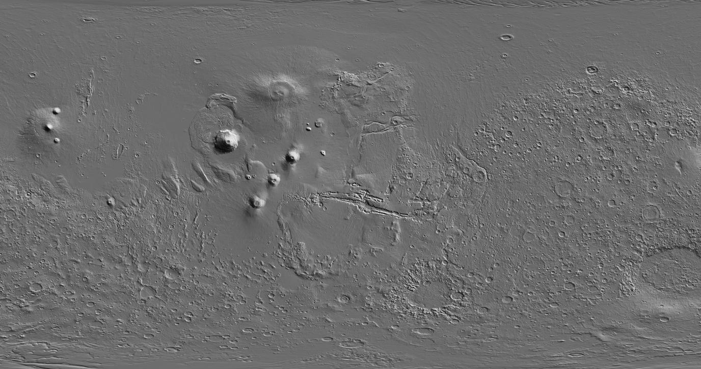
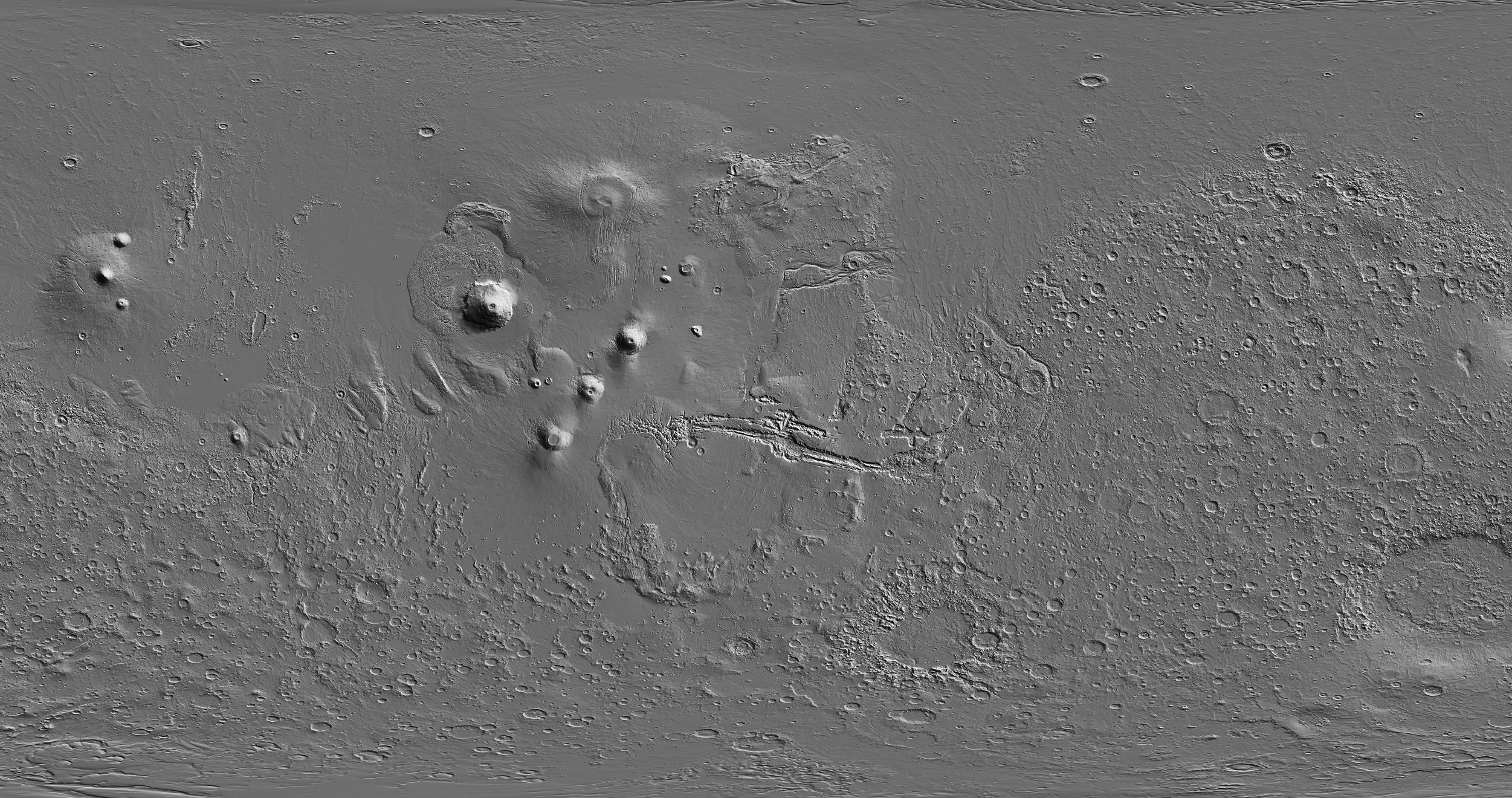
Global View of Mars Topography
- Click the image above for a larger view
- Full-Res JPEG (2502 x 1320) (791.3 kB)
- Full-Res TIFF (2502 x 1320) (3.3 MB)
Caption:
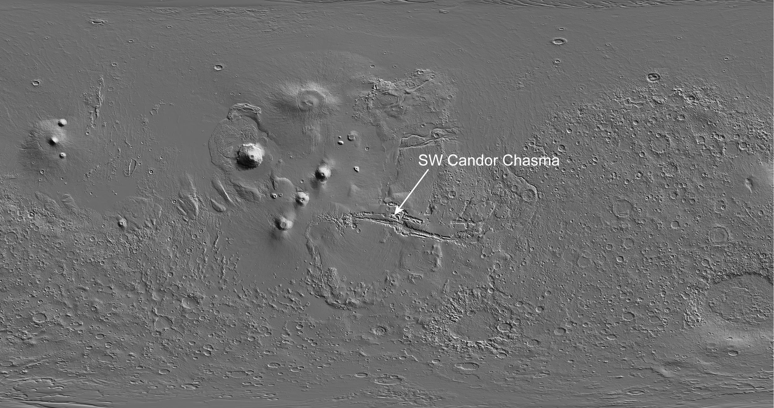
Annotated Version
This global map of Mars is based on topographical information collected by the Mars Orbiter Laser Altimeter instrument on NASA's Mars Global Surveyor orbiter. Illumination is from the upper right. The image width is approximately 18,000 kilometers (11,185 miles). Candor Chasma forms part of the large Martian canyon system named Valles Marineris. The location of Southwest Candor Chasma is indicated in the annotated version.
Cataloging Keywords:
| Name | Value | Additional Values |
|---|---|---|
| Target | Mars | |
| System | ||
| Target Type | Planet | |
| Mission | Mars Global Surveyor (MGS) | Mariner |
| Instrument Host | Mars Global Surveyor | |
| Host Type | Orbiter | Flyby Spacecraft |
| Instrument | Mars Orbiter Laser Altimeter (MOLA) | |
| Detector | ||
| Extra Keywords | Grayscale, Map | |
| Acquisition Date | ||
| Release Date | 2007-12-11 | |
| Date in Caption | ||
| Image Credit | NASA/JPL-Caltech | |
| Source | photojournal.jpl.nasa.gov/catalog/PIA10132 | |
| Identifier | PIA10132 | |