
|
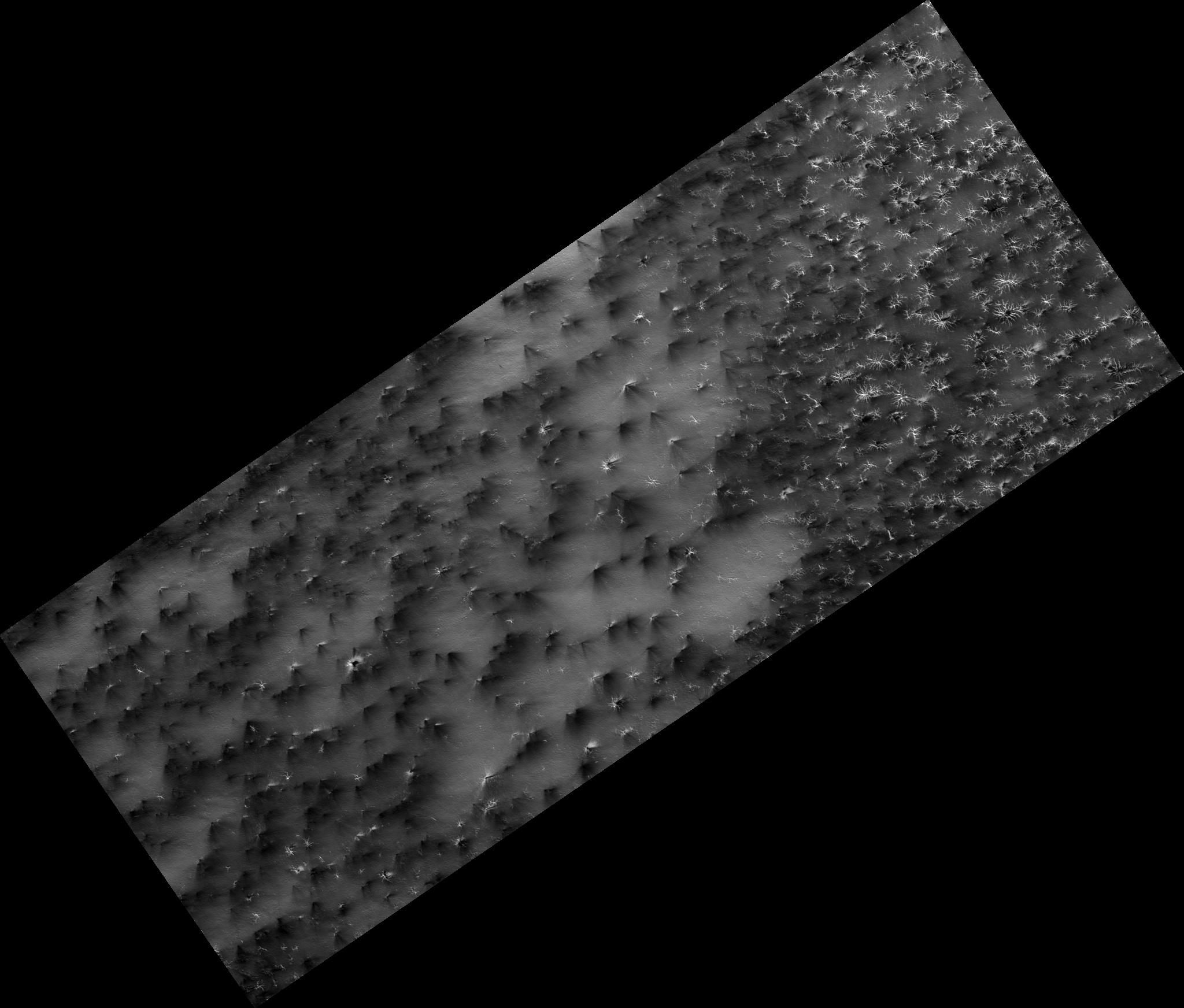
Science in Motion: Isolated Araneiform Topography
- Click the image above for a larger view
- Full-Res JPEG (2048 x 1744) (237.7 kB)
- Full-Res TIFF (2048 x 1744) (3.6 MB)
Caption:
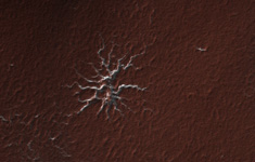
Figure 1
Have you ever found that to describe something you had to go to the dictionary and search for just the right word?
The south polar terrain is so full of unearthly features that we had to visit Mr. Webster to find a suitable term. "Araneiform" means "spider-like." These are channels that are carved in the surface by carbon dioxide gas. We do not have this process on Earth.
The channels are somewhat radially organized (figure 1) and widen and deepen as they converge. In the past we've just refered to them as "spiders." "Isolated araneiform topography" means that our features look like spiders that are not in contact with each other.
Observation Geometry
Image
PSP_003087_0930
was taken by the High Resolution Imaging Science Experiment (HiRISE) camera onboard the Mars Reconnaissance Orbiter spacecraft on 24-Mar-2007. The complete image is centered at -87.1 degrees latitude, 126.3 degrees East longitude. The range to the target site was 244.4 km (152.8 miles). At this distance the image scale is 24.5 cm/pixel (with 1 x 1 binning) so objects ~73 cm across are resolved. The image shown here has been map-projected to 25 cm/pixel . The image was taken at a local Mars time of 08:22 PM and the scene is illuminated from the west with a solar incidence angle of 81 degrees, thus the sun was about 9 degrees above the horizon. At a solar longitude of 206.4 degrees, the season on Mars is Northern Autumn.
Background Info:
NASA's Jet Propulsion Laboratory, a division of the California Institute of Technology in Pasadena, manages the Mars Reconnaissance Orbiter for NASA's Science Mission Directorate, Washington. Lockheed Martin Space Systems, Denver, is the prime contractor for the project and built the spacecraft. The High Resolution Imaging Science Experiment is operated by the University of Arizona, Tucson, and the instrument was built by Ball Aerospace and Technology Corp., Boulder, Colo.
Cataloging Keywords:
| Name | Value | Additional Values |
|---|---|---|
| Target | Mars | |
| System | ||
| Target Type | Planet | |
| Mission | Mars Reconnaissance Orbiter (MRO) | |
| Instrument Host | Mars Reconnaissance Orbiter | |
| Host Type | Orbiter | |
| Instrument | High Resolution Imaging Science Experiment (HiRISE) | |
| Detector | ||
| Extra Keywords | Grayscale, Map | |
| Acquisition Date | ||
| Release Date | 2007-12-11 | |
| Date in Caption | ||
| Image Credit | NASA/JPL-Caltech/University of Arizona | |
| Source | photojournal.jpl.nasa.gov/catalog/PIA10143 | |
| Identifier | PIA10143 | |