
|
Phoenix on Target
- Click the image above for a larger view
- Full-Res JPEG (1198 x 893) (128.7 kB)
- Full-Res TIFF (1198 x 893) (3.2 MB)
Caption:
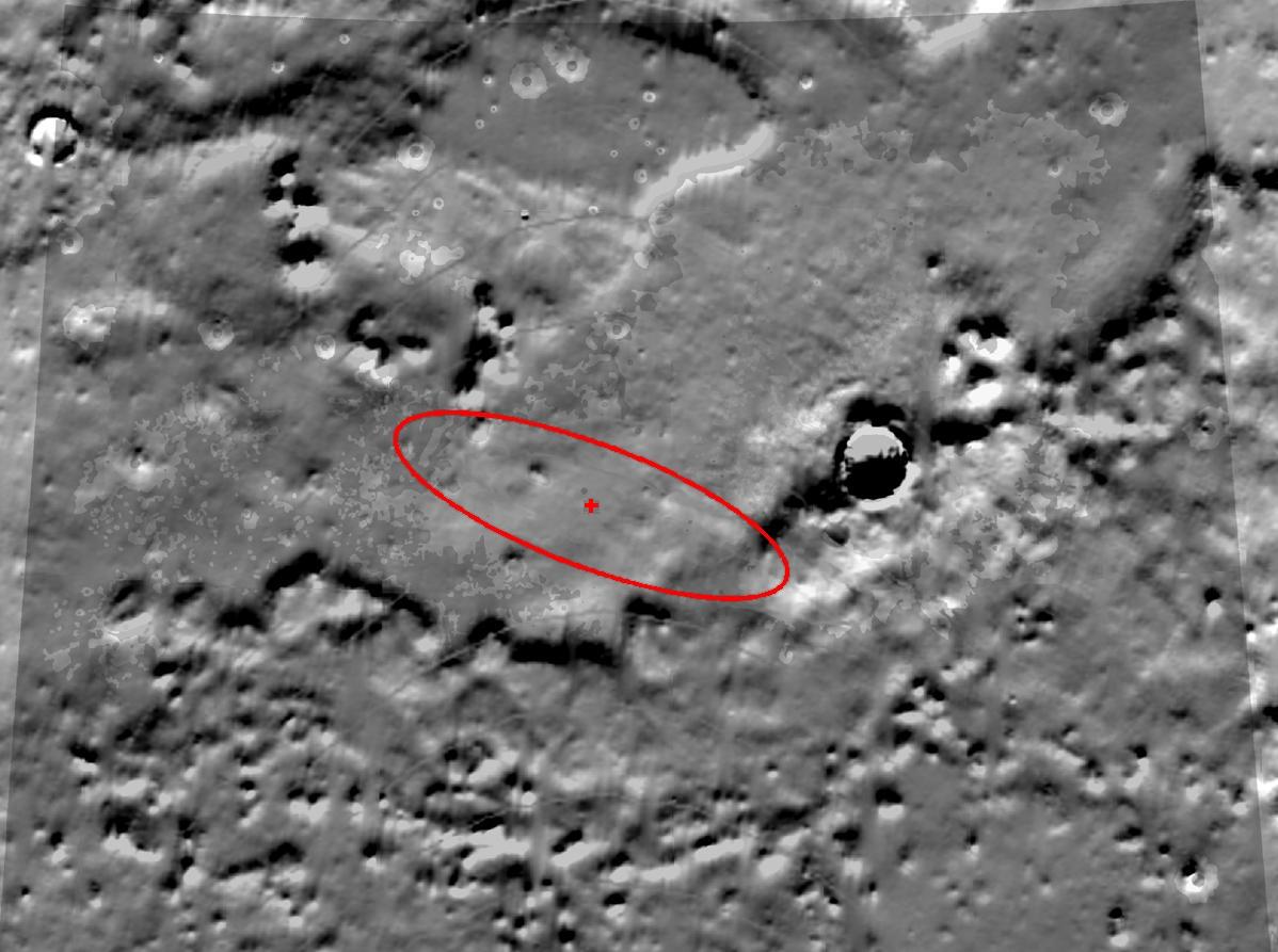
This topography map illustrates where NASA's Phoenix Mars Lander is targeted to land on May 25, 2008, based on expectations as of noon pacific time (3 p.m. eastern time), May 24, 2008.
Phoenix is most likely to land at the cross-shaped target at the center of the red ellipse and least likely to land at the ellipse's edges. The ellipse is positioned over the northern arctic plains of Mars, and is approximately 70 kilometers (44 miles) long.
The topography data was taken by NASA's Mars Global Surveyor. It shows exaggerated differences in the height of the terrain.
Background Info:
The Phoenix Mission is led by the University of Arizona, Tucson, on behalf of NASA. Project management of the mission is by NASA's Jet Propulsion Laboratory, Pasadena, Calif. Spacecraft development is by Lockheed Martin Space Systems, Denver.
Photojournal Note: As planned, the Phoenix lander, which landed May 25, 2008 23:53 UTC, ended communications in November 2008, about six months after landing, when its solar panels ceased operating in the dark Martian winter.
Cataloging Keywords:
| Name | Value | Additional Values |
|---|---|---|
| Target | Mars | |
| System | ||
| Target Type | Planet | |
| Mission | Phoenix | Mars Global Surveyor (MGS) |
| Instrument Host | Phoenix Lander | Mars Global Surveyor |
| Host Type | Lander | Orbiter |
| Instrument | ||
| Detector | ||
| Extra Keywords | Color, Map | |
| Acquisition Date | ||
| Release Date | 2008-05-24 | |
| Date in Caption | 2008-05-24 | 2008-05-25 |
| Image Credit | NASA/JPL-Caltech/University of Arizona | |
| Source | photojournal.jpl.nasa.gov/catalog/PIA10677 | |
| Identifier | PIA10677 | |