|
Arctic Landscape Within Reach
- Click the image above for a larger view
- Full-Res JPEG (1024 x 1024) (269.1 kB)
- Full-Res TIFF (1024 x 1024) (1.1 MB)
Caption:
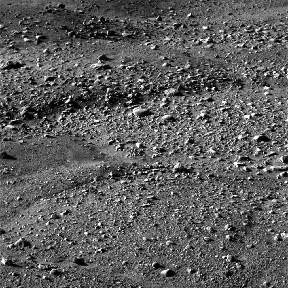
This image, one of the first captured by NASA's Phoenix Mars Lander, shows flat ground strewn with tiny pebbles and marked by small-scale polygonal cracking, a pattern seen widely in Martian high latitudes and also observed in permafrost terrains on Earth. The polygonal cracking is believed to have resulted from seasonal contraction and expansion of surface ice.
Phoenix touched down on the Red Planet at 4:53 p.m. Pacific Time (7:53 p.m. Eastern Time), May 25, 2008, in an arctic region called Vastitas Borealis, at 68 degrees north latitude, 234 degrees east longitude.
This image was acquired at the Phoenix landing site by the Surface Stereo Imager on day 1 of the mission on the surface of Mars, or Sol 0, after the May 25, 2008, landing.
Background Info:
The Phoenix Mission is led by the University of Arizona, Tucson, on behalf of NASA. Project management of the mission is by NASA's Jet Propulsion Laboratory, Pasadena, Calif. Spacecraft development is by Lockheed Martin Space Systems, Denver.
Photojournal Note: As planned, the Phoenix lander, which landed May 25, 2008 23:53 UTC, ended communications in November 2008, about six months after landing, when its solar panels ceased operating in the dark Martian winter.
Cataloging Keywords:
| Name | Value | Additional Values |
|---|---|---|
| Target | Mars | |
| System | ||
| Target Type | Planet | |
| Mission | Phoenix | |
| Instrument Host | Phoenix Lander | |
| Host Type | Lander | |
| Instrument | Solid-State Imaging (SSI) | |
| Detector | ||
| Extra Keywords | Grayscale | |
| Acquisition Date | ||
| Release Date | 2008-05-26 | |
| Date in Caption | 2008-05-25 | |
| Image Credit | NASA/JPL-Caltech/University of Arizona | |
| Source | photojournal.jpl.nasa.gov/catalog/PIA10684 | |
| Identifier | PIA10684 | |