|
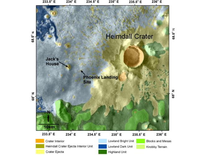
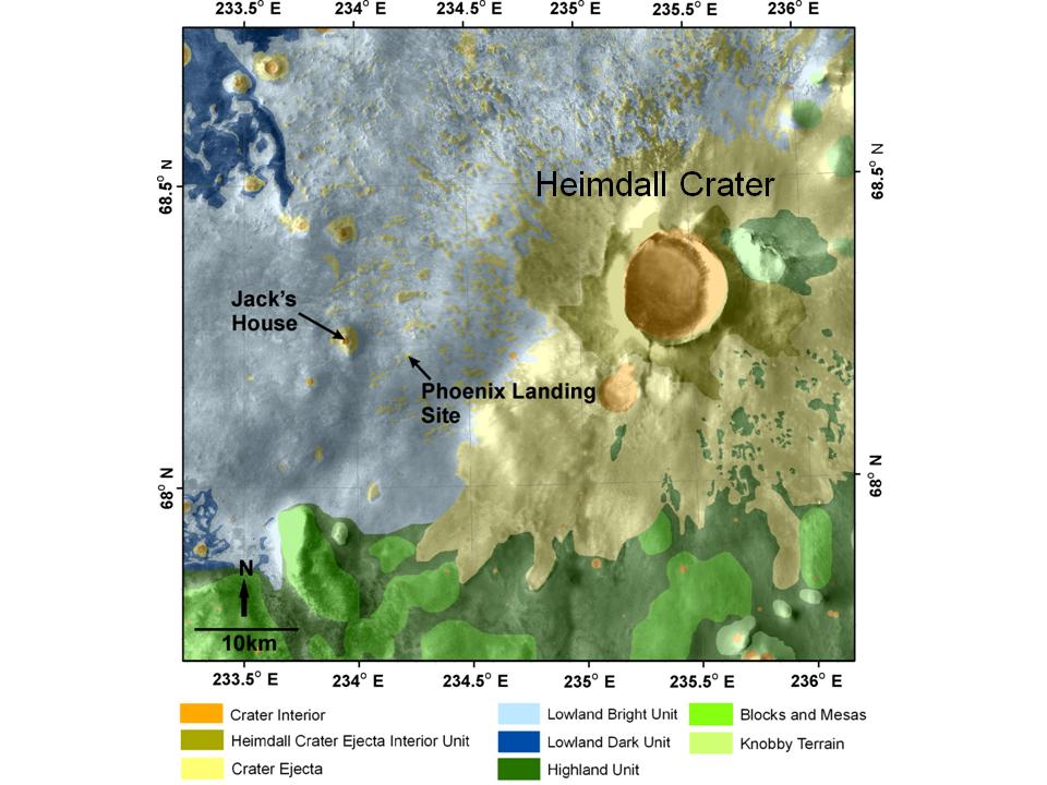
Geomorphic Map of Region Around Phoenix Mars Lander
- Click the image above for a larger view
- Full-Res JPEG (960 x 720) (92.3 kB)
- Full-Res TIFF (960 x 720) (2.1 MB)
Caption:
This map shows a color-coded interpretation of geomorphic units—categories based on surface textures and contours—in the region where NASA's Phoenix Mars Lander has studied an arctic Martian plain. It covers an area about 65 kilometers by 65 kilometers (40 miles by 40 miles).
Background Info:
The Phoenix Mission is led by the University of Arizona, Tucson, on behalf of NASA. Project management of the mission is by NASA's Jet Propulsion Laboratory, Pasadena, Calif. Spacecraft development is by Lockheed Martin Space Systems, Denver.
Photojournal Note: As planned, the Phoenix lander, which landed May 25, 2008 23:53 UTC, ended communications in November 2008, about six months after landing, when its solar panels ceased operating in the dark Martian winter.
Cataloging Keywords:
| Name | Value | Additional Values |
|---|---|---|
| Target | Mars | |
| System | ||
| Target Type | Planet | |
| Mission | Phoenix | |
| Instrument Host | Phoenix Lander | |
| Host Type | Lander | |
| Instrument | ||
| Detector | ||
| Extra Keywords | Color, Map | |
| Acquisition Date | ||
| Release Date | 2008-12-15 | |
| Date in Caption | ||
| Image Credit | NASA/JPL/University of Arizona | |
| Source | photojournal.jpl.nasa.gov/catalog/PIA11712 | |
| Identifier | PIA11712 | |