|
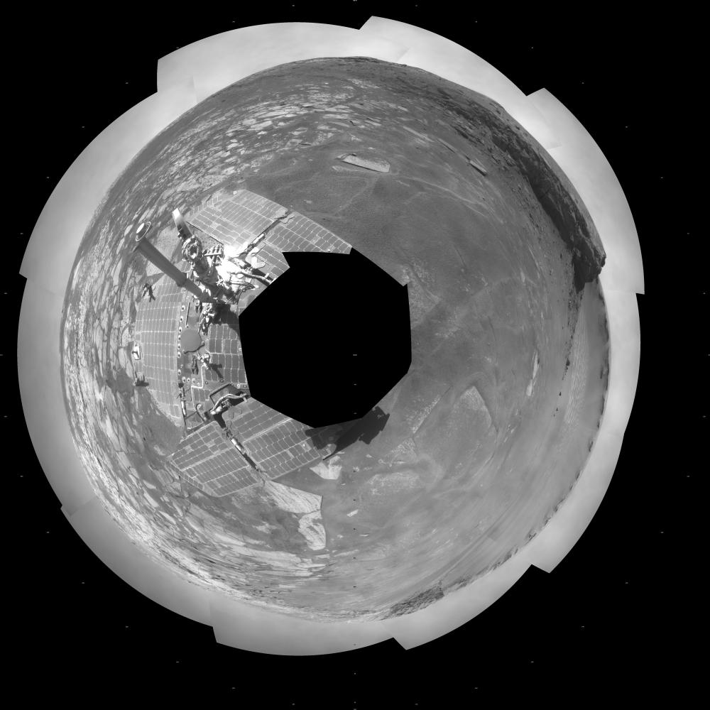
Opportunity View During Exploration in ‘Duck Bay,’ Sols 1506-1510 (Polar)
- Click the image above for a larger view
- Full-Res JPEG (5245 x 5245) (1.8 MB)
- Full-Res TIFF (5245 x 5245) (27.6 MB)
Caption:
NASA Mars Exploration Rover Opportunity used its navigation camera to take the images combined into this full-circle view of the rover's surroundings on the 1,506th through 1,510th Martian days, or sols, of Opportunity's mission on Mars (April 19-23, 2008). North is at the top.
This view is presented as a polar projection with geometric seam correction.
The site is within an alcove called "Duck Bay" in the western portion of Victoria Crater. Victoria Crater is about 800 meters (half a mile) wide. Opportunity had descended into the crater at the top of Duck Bay 7 months earlier. By the time the rover acquired this view, it had examined rock layers inside the rim.
Opportunity was headed for a closer look at the base of a promontory called "Cape Verde," the cliff at about the 2-o'clock position of this image, before leaving Victoria. The face of Cape Verde is about 6 meters (20 feet) tall. Just clockwise from Cape Verde is the main bowl of Victoria Crater, with sand dunes at the bottom. A promontory called "Cabo Frio," at the southern side of Duck Bay, stands near the 6-o'clock position of the image.
Cataloging Keywords:
| Name | Value | Additional Values |
|---|---|---|
| Target | Mars | |
| System | ||
| Target Type | Planet | |
| Mission | Mars Exploration Rover (MER) | |
| Instrument Host | Opportunity (MER-B) | |
| Host Type | Rover | |
| Instrument | Navigation Camera (Navcam) | |
| Detector | ||
| Extra Keywords | Crater, Dune, Grayscale | |
| Acquisition Date | ||
| Release Date | 2009-02-03 | |
| Date in Caption | ||
| Image Credit | NASA/JPL-Caltech | |
| Source | photojournal.jpl.nasa.gov/catalog/PIA11786 | |
| Identifier | PIA11786 | |