
|
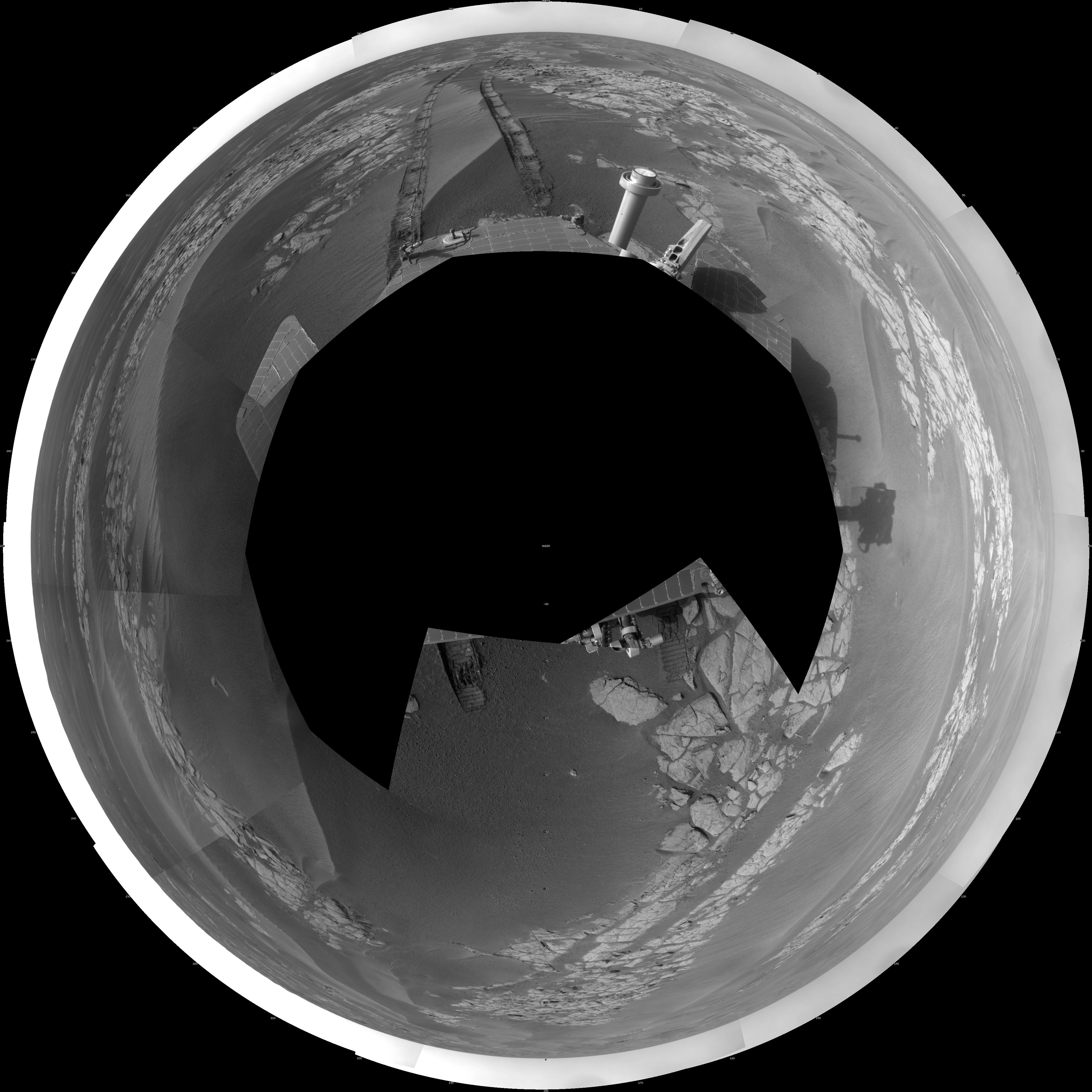
Opportunity’s View After Long Drive on Sol 1770 (Polar)
- Click the image above for a larger view
- Full-Res JPEG (4097 x 4097) (1.1 MB)
- Full-Res TIFF (4097 x 4097) (16.8 MB)
Caption:
NASA's Mars Exploration Rover Opportunity used its navigation camera to take the images combined into this full-circle view of the rover's surroundings just after driving 104 meters (341 feet) on the 1,770th Martian day, or sol, of Opportunity's surface mission (January 15, 2009).
This view is presented as a polar projection with geometric seam correction. North is at the top.
Tracks from the drive extend northward across dark-toned sand ripples and light-toned patches of exposed bedrock in the Meridiani Planum region of Mars. For scale, the distance between the parallel wheel tracks is about 1 meter (about 40 inches).
Prior to the Sol 1770 drive, Opportunity had driven less than a meter since Sol 1713 (November 17, 2008), while it used the tools on its robotic arm first to examine a meteorite called "Santorini" during weeks of restricted communication while the sun was nearly in line between Mars and Earth, then to examine bedrock and soil targets near Santorini.
The rover's position after the Sol 1770 drive was about 1.1 kilometer (two-thirds of a mile) south southwest of Victoria Crater. Cumulative odometry was 13.72 kilometers (8.53 miles) since landing in January 2004, including 1.94 kilometers (1.21 miles) since climbing out of Victoria Crater on the west side of the crater on Sol 1634 (August 28, 2008).
Cataloging Keywords:
| Name | Value | Additional Values |
|---|---|---|
| Target | Mars | |
| System | ||
| Target Type | Planet | |
| Mission | Mars Exploration Rover (MER) | |
| Instrument Host | Opportunity (MER-B) | |
| Host Type | Rover | |
| Instrument | Navigation Camera (Navcam) | |
| Detector | ||
| Extra Keywords | Crater, Grayscale | |
| Acquisition Date | ||
| Release Date | 2009-02-04 | |
| Date in Caption | 2008-08-28 | 2008-11-17, 2009-01-15 |
| Image Credit | NASA/JPL-Caltech | |
| Source | photojournal.jpl.nasa.gov/catalog/PIA11790 | |
| Identifier | PIA11790 | |