|
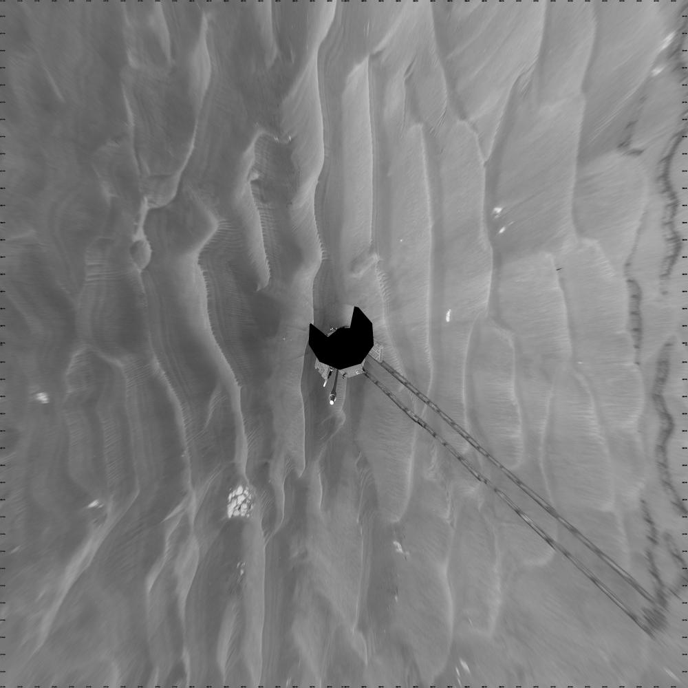
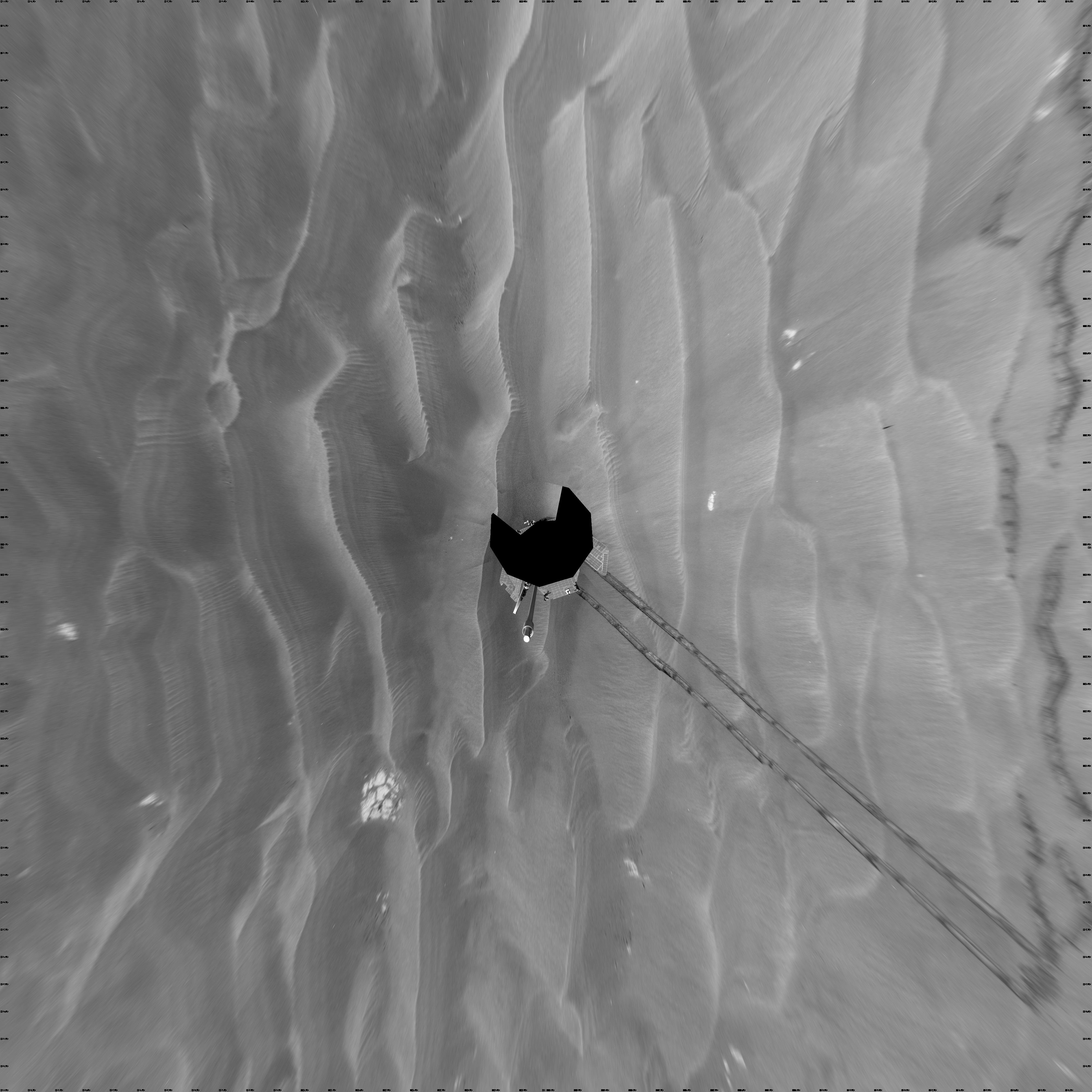
Opportunity’s Surroundings After Sol 1820 Drive (Vertical)
- Click the image above for a larger view
- Full-Res JPEG (4000 x 4000) (944.5 kB)
- Full-Res TIFF (4000 x 4000) (16.0 MB)
Caption:
NASA's Mars Exploration Rover Opportunity used its navigation camera to take the images combined into this full-circle view of the rover's surroundings during the 1,820th to 1,822nd Martian days, or sols, of Opportunity's surface mission (March 7 to 9, 2009).
This view is presented as a vertical projection with geometric seam correction. North is at the top.
The rover had driven 20.6 meters toward the northwest on Sol 1820 before beginning to take the frames in this view. Tracks from that drive recede southwestward. For scale, the distance between the parallel wheel tracks is about 1 meter (about 40 inches).
The terrain in this portion of Mars' Meridiani Planum region includes dark-toned sand ripples and small exposures of lighter-toned bedrock.
Cataloging Keywords:
| Name | Value | Additional Values |
|---|---|---|
| Target | Mars | |
| System | ||
| Target Type | Planet | |
| Mission | Mars Exploration Rover (MER) | |
| Instrument Host | Opportunity (MER-B) | |
| Host Type | Rover | |
| Instrument | Navigation Camera (Navcam) | |
| Detector | ||
| Extra Keywords | Grayscale | |
| Acquisition Date | ||
| Release Date | 2009-03-23 | |
| Date in Caption | ||
| Image Credit | NASA/JPL-Caltech | |
| Source | photojournal.jpl.nasa.gov/catalog/PIA11840 | |
| Identifier | PIA11840 | |