
|
Composite View from Phoenix Lander
- Click the image above for a larger view
- Full-Res JPEG (4500 x 6000) (3.3 MB)
- Full-Res TIFF (4500 x 6000) (81.0 MB)
Caption:
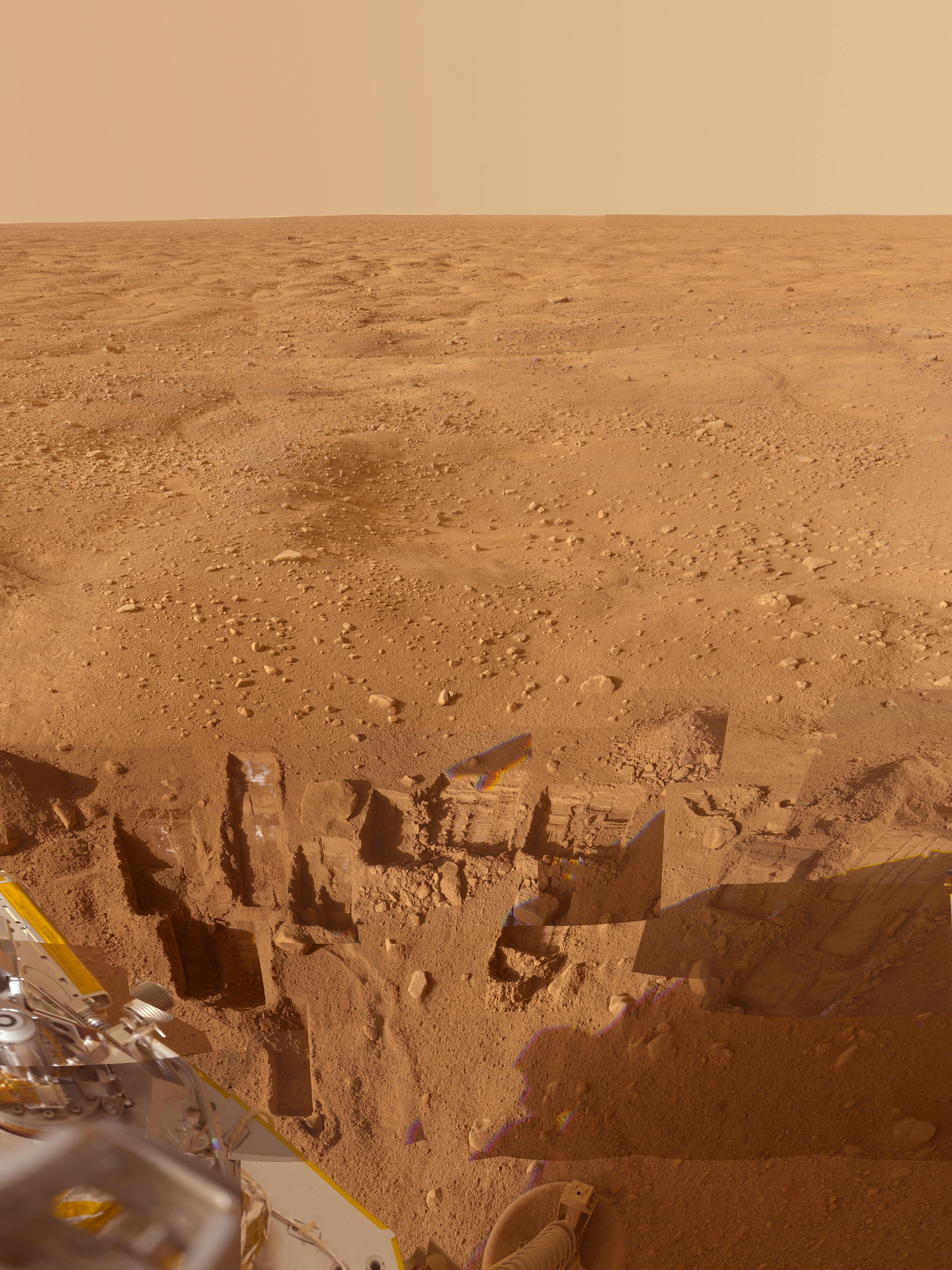
This mosaic of images from the Surface Stereo Imager camera on NASA's Phoenix Mars Lander shows several trenches dug by Phoenix, plus a corner of the spacecraft's deck and the Martian arctic plain stretching to the horizon.
The footpad at the bottom center is about 1 meter (3 feet) below the spacecraft deck seen at the lower left. Overlaid images show trenches dug to either nearly pure water ice or ice-cemented soil. Analyses of samples taken from these trenches give clues to the history of the region.
This approximately true color view combines images taken on several dates during the five months Phoenix studied its surroundings after landing on May 25, 2008.
Background Info:
The Phoenix Mission was led by the University of Arizona, Tucson, on behalf of NASA. Project management of the mission was by NASA's Jet Propulsion Laboratory, Pasadena, Calif. Spacecraft development was by Lockheed Martin Space Systems, Denver.
Photojournal Note: As planned, the Phoenix lander, which landed May 25, 2008 23:53 UTC, ended communications in November 2008, about six months after landing, when its solar panels ceased operating in the dark Martian winter.
Cataloging Keywords:
| Name | Value | Additional Values |
|---|---|---|
| Target | Mars | |
| System | ||
| Target Type | Planet | |
| Mission | Phoenix | |
| Instrument Host | Phoenix Lander | |
| Host Type | Lander | |
| Instrument | Solid-State Imaging (SSI) | |
| Detector | ||
| Extra Keywords | Color, Water | |
| Acquisition Date | ||
| Release Date | 2009-07-02 | |
| Date in Caption | 2008-05-25 | |
| Image Credit | NASA/JPL-Caltech/University of Arizona/Texas A&M University | |
| Source | photojournal.jpl.nasa.gov/catalog/PIA12105 | |
| Identifier | PIA12105 | |