
|
Adjusted Local Topography Map of Spirit’s Surroundings
- Click the image above for a larger view
- Full-Res JPEG (1068 x 865) (239.3 kB)
- Full-Res TIFF (1068 x 865) (2.8 MB)
Caption:
Click on image for larger annotated image
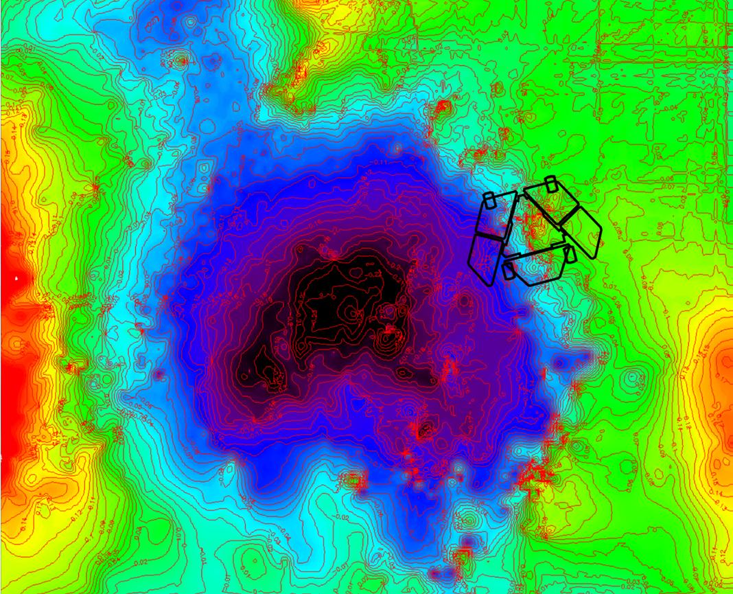
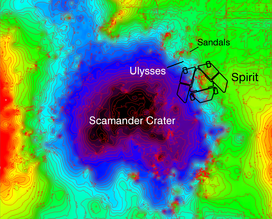
A depression called "Scamander Crater," about 8 meters (26 feet) wide and 25 centimeters (10 inches) deep, dominates the terrain near NASA's Mars Exploration Rover Spirit in this map that emphasizes local topography by removing the regional tilt to the northwest.
The total relief indicated by the color differences is about half a meter (20 inches) from the higher ground (color coded red) to the lower ground (color coded black). The map covers an area 12 meters (39 feet) wide from west to east. North is to the top.
The topographic information was generated from stereo image data using exposures taken by Spirit's navigation camera during the 1,870th Martian day, or sol, of the rover's mission on Mars (April 7, 2009). At that time, Spirit had not yet reached the rover location indicated on the map. The indicated position is at a site called "Troy," where Spirit became embedded by the end of April and remained for more than six months. From its embedded position, the rover used its robotic arm to examine the patch of bright soil it had exposed, called "Ulysses."
The map indicates that Spirit is situated with its left wheels within the crater and right wheels outside the crater. Rover-team scientists hypothesize that the left wheels broke through a thin, sulfate-rich crust and encountered underlying loose sulfate sands that fill the crater.
Cataloging Keywords:
| Name | Value | Additional Values |
|---|---|---|
| Target | Mars | |
| System | ||
| Target Type | Planet | |
| Mission | Mars Exploration Rover (MER) | |
| Instrument Host | Spirit (MER-A) | |
| Host Type | Rover | |
| Instrument | ||
| Detector | ||
| Extra Keywords | Color, Crater, Map | |
| Acquisition Date | ||
| Release Date | 2009-11-12 | |
| Date in Caption | 2009-04-07 | |
| Image Credit | NASA/JPL-Caltech/Ohio State University | |
| Source | photojournal.jpl.nasa.gov/catalog/PIA12353 | |
| Identifier | PIA12353 | |