
|
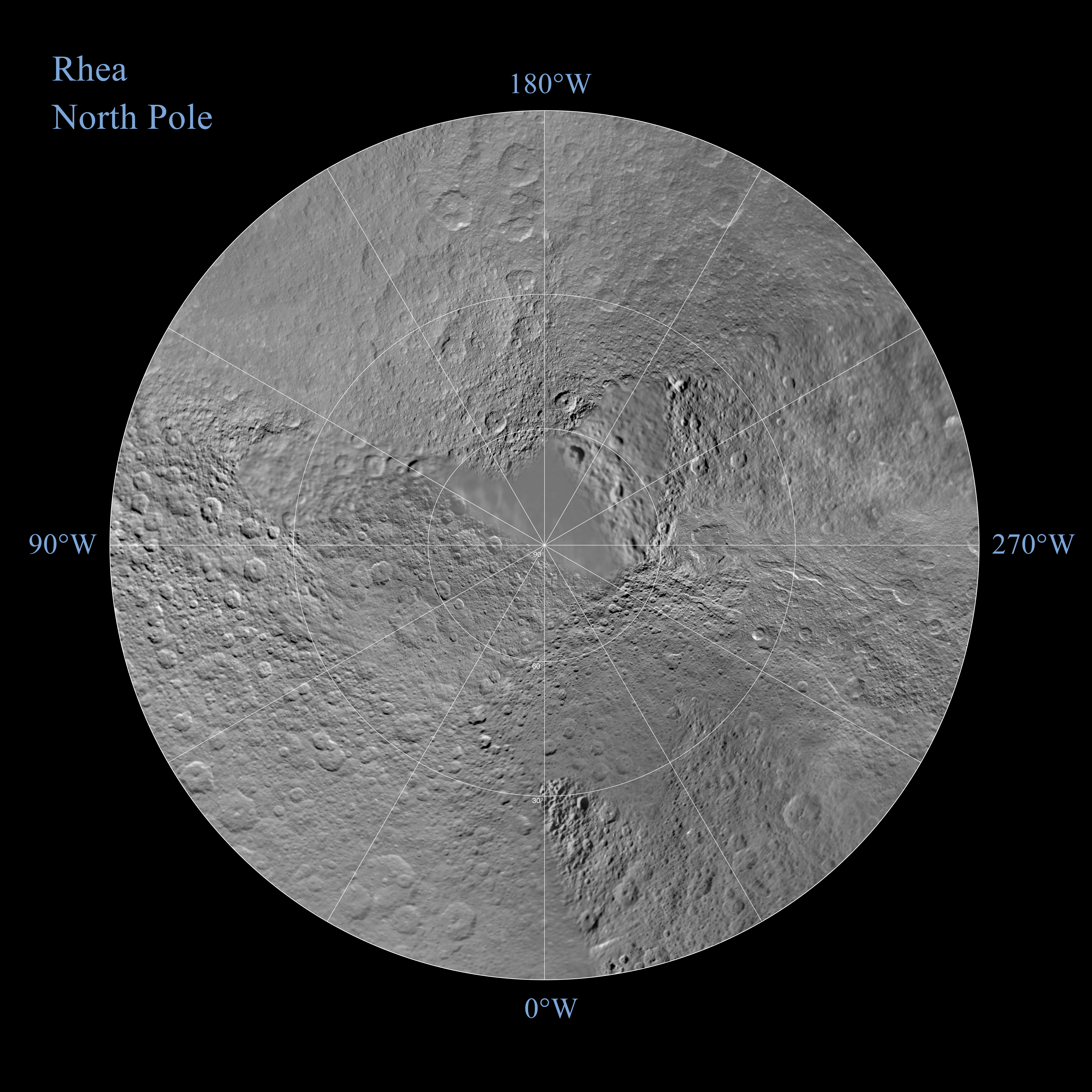
Rhea North Polar Map - November 2009
- Click the image above for a larger view
- Full-Res JPEG (7334 x 7334) (3.3 MB)
- Full-Res TIFF (7334 x 7334) (53.9 MB)
Caption:
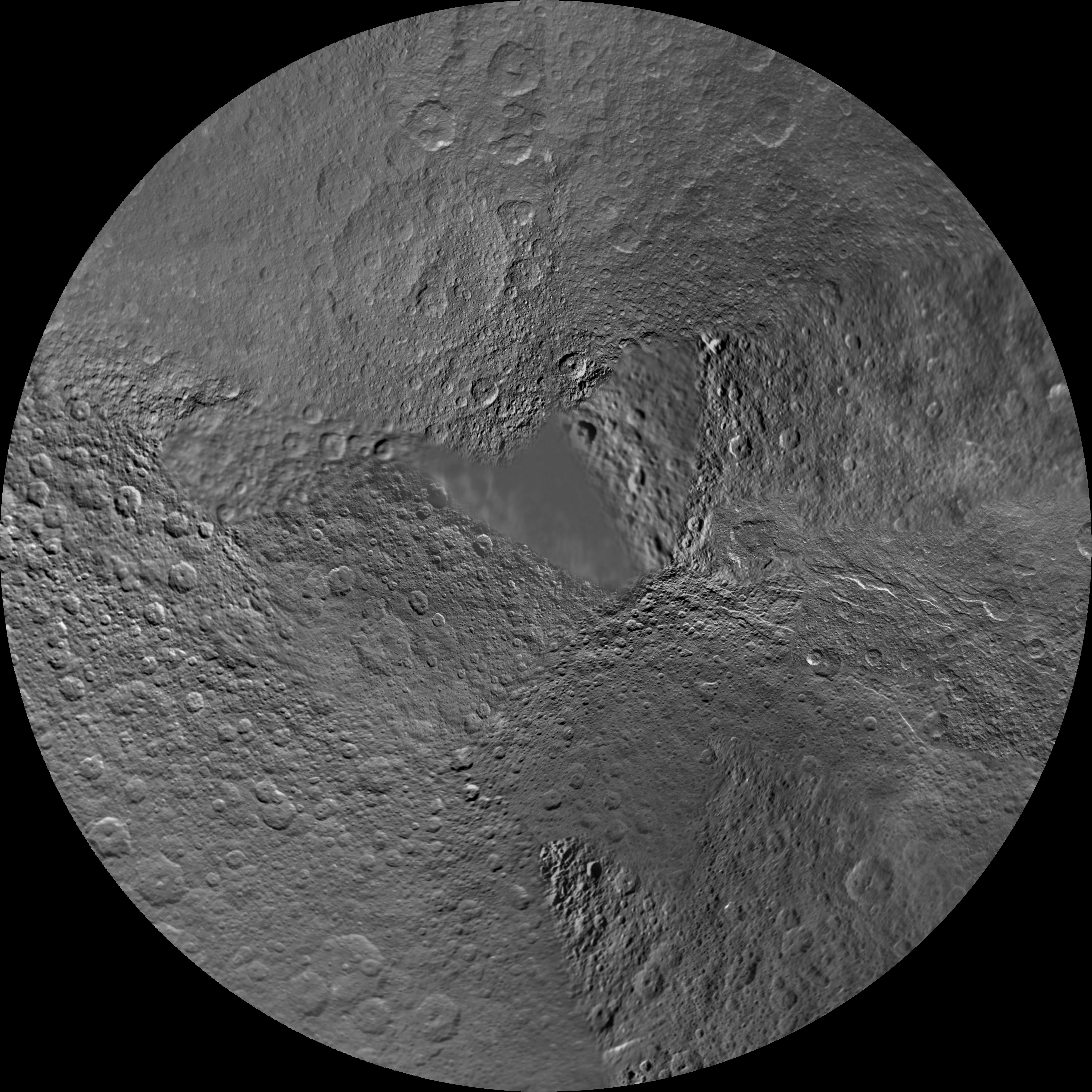
Annotated image
Click on the image for larger version
The northern hemisphere of Saturn's moon Rhea is seen in this polar stereographic map, mosaicked from the best-available images obtained by NASA's Cassini and Voyager spacecraft.
This map is an update to the version released in February 2010 (see PIA12562 ). The title of the older version ("Rhea Polar Maps - February 2010") denotes the month the map was released, not when the data in the maps were collected. The title of this new version reflects when the most recent data used in the map were captured. The newest data were used to improve coverage north of the equator between about 250 degrees west longitude and 300 degrees west longitude.
Six Voyager images fill in gaps in Cassini's coverage of the moon's north pole.
The map is centered on the north pole, and surface coverage extends to the equator. Grid lines show latitude and longitude in 30-degree increments. The scale in the full-size versions of these maps is 417 meters (1,400 feet) per pixel. The mean radius of Rhea used for projection of these maps is 764.1 kilometers (474.8 miles).
Background Info:
The Cassini-Huygens mission is a cooperative project of NASA, the European Space Agency and the Italian Space Agency. The Jet Propulsion Laboratory, a division of the California Institute of Technology in Pasadena, manages the mission for NASA's Science Mission Directorate in Washington. The Cassini orbiter and its two onboard cameras were designed, developed and assembled at JPL. The imaging team is based at the Space Science Institute, Boulder, Colo.
For more information about the Cassini-Huygens mission visit http://saturn.jpl.nasa.gov/ . The Cassini imaging team homepage is at http://ciclops.org .
Cataloging Keywords:
| Name | Value | Additional Values |
|---|---|---|
| Target | Rhea | |
| System | Saturn | |
| Target Type | Satellite | |
| Mission | Cassini-Huygens | Voyager |
| Instrument Host | Cassini Orbiter | |
| Host Type | Orbiter | Flyby Spacecraft |
| Instrument | Imaging Science Subsystem (ISS) | |
| Detector | ||
| Extra Keywords | Grayscale, Map | |
| Acquisition Date | ||
| Release Date | 2010-12-21 | |
| Date in Caption | ||
| Image Credit | NASA/JPL/Space Science Institute | |
| Source | photojournal.jpl.nasa.gov/catalog/PIA12804 | |
| Identifier | PIA12804 | |