|
Monitoring of Polar Avalanche Region
- Click the image above for a larger view
- Full-Res JPEG (2560 x 1920) (577.5 kB)
- Full-Res TIFF (2560 x 1920) (14.8 MB)
Caption:
Click on the image for larger version
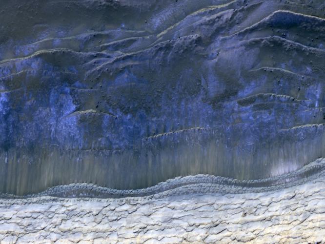
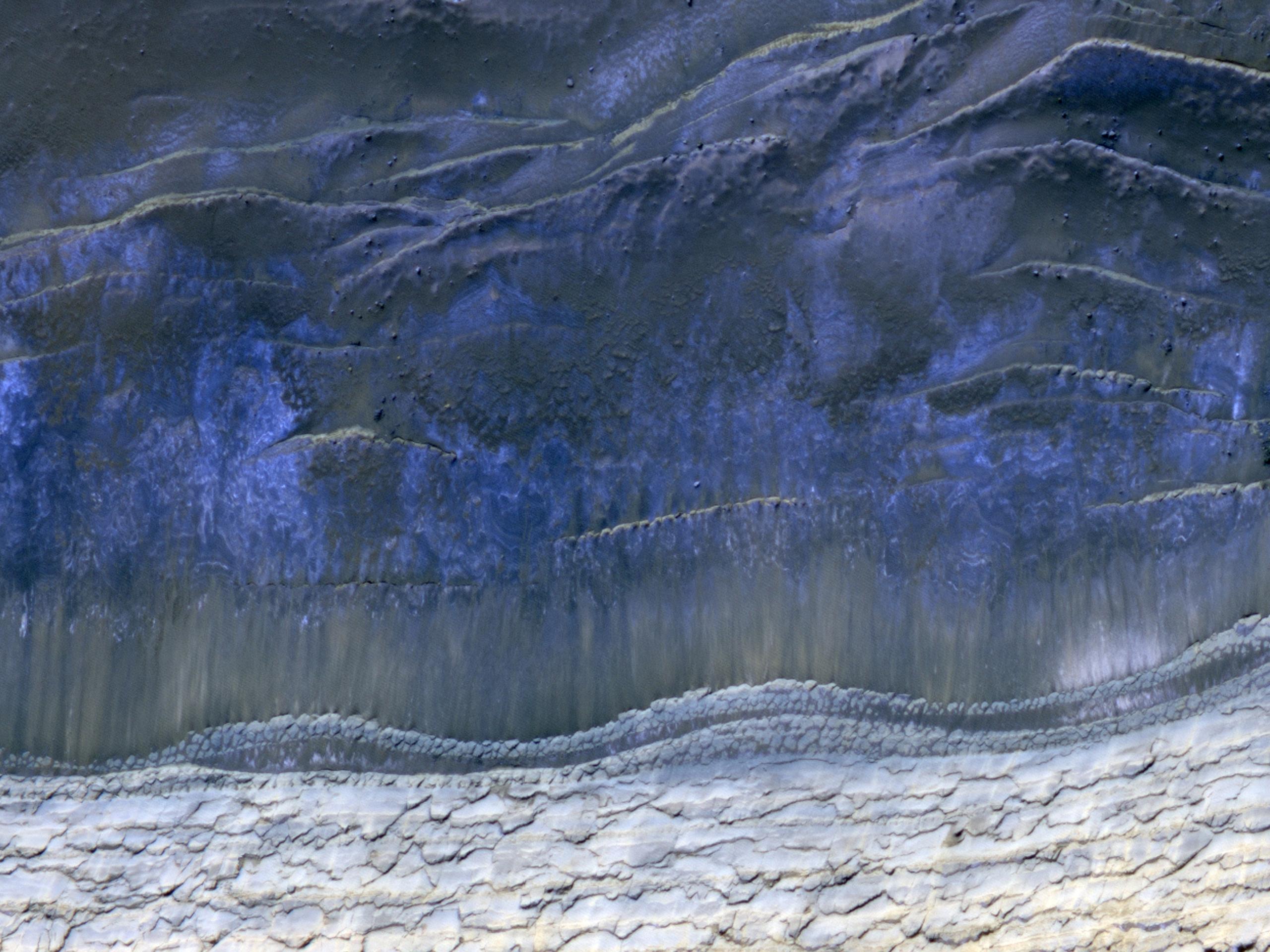
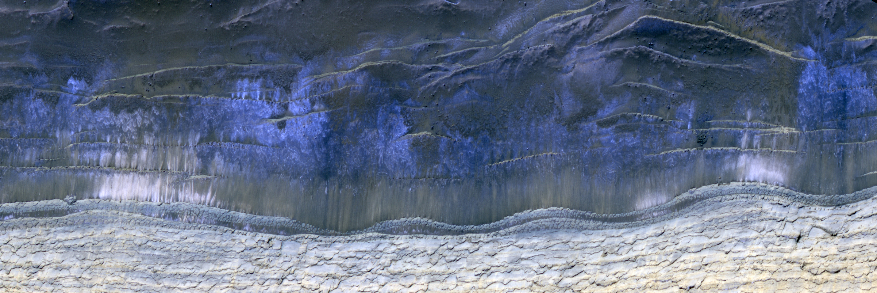
This HiRISE image shows the scarp that demarcates the boundary between layered deposits covering the north polar region and the lower surrounding terrain, which includes sand dunes.
This image was taken in the northern hemisphere Martian spring, where it is still cold enough that white carbon dioxide frost covers most of the area. At about the same time in the previous Martian spring (February 2008), HiRISE caught four avalanches at this location (see PIA10245 ).
This image does not show any active avalanches, but Figure 1 above shows many avalanche deposits. Comparison of this new image with the one taken in 2008 will give an indication of activity over the last Martian year.
Background Info:
The University of Arizona, Tucson, operates the HiRISE camera, which was built by Ball Aerospace & Technologies Corp., Boulder, Colo. NASA's Jet Propulsion Laboratory, a division of the California Institute of Technology, Pasadena, manages the Mars Reconnaissance Orbiter for the NASA Science Mission Directorate, Washington. Lockheed Martin Space Systems, Denver, is the spacecraft development and integration contractor for the project and built the spacecraft.
Cataloging Keywords:
| Name | Value | Additional Values |
|---|---|---|
| Target | Mars | |
| System | ||
| Target Type | Planet | |
| Mission | Mars Reconnaissance Orbiter (MRO) | |
| Instrument Host | Mars Reconnaissance Orbiter | |
| Host Type | Orbiter | |
| Instrument | High Resolution Imaging Science Experiment (HiRISE) | |
| Detector | ||
| Extra Keywords | Color, Dune | |
| Acquisition Date | ||
| Release Date | 2010-03-03 | |
| Date in Caption | ||
| Image Credit | NASA/JPL-Caltech/University of Arizona | |
| Source | photojournal.jpl.nasa.gov/catalog/PIA12880 | |
| Identifier | PIA12880 | |