|
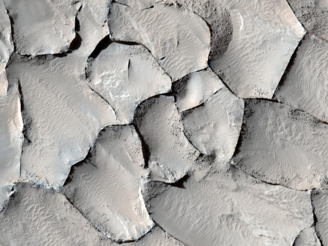
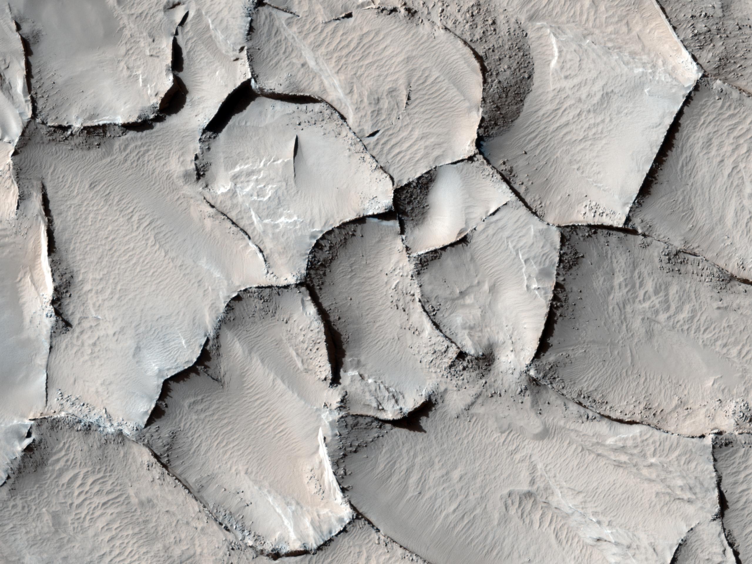
Polygonal Ridge in Gordii Dorsum Region, Mars
- Click the image above for a larger view
- Full-Res JPEG (2560 x 1920) (622.3 kB)
- Full-Res TIFF (2560 x 1920) (14.8 MB)
Caption:
This image from the Gordii Dorsum region of Mars shows a large area covered with polygonal ridges in an almost geometric pattern. The ridges may have originally been dunes that hardened through the action of an unknown process. Groundwater might have been involved.
The High Resolution Imaging Science Experiment (HiRISE) camera on NASA's Mars Reconnaissance Orbiter captured this scene on April 9, 2010. This image spans a distance of about 1 kilometer (0.6 mile) and is presented in false color, which aids in distinguishing among surface materials and textures. It is a portion of the HiRISE observation catalogued as ESP_017348_1910, an area centered at 10.8 degrees north latitude, 212.2 degrees east longitude. Other image products from this observation are available at http://hirise.lpl.arizona.edu/ESP_017348_1910 .
Background Info:
NASA's Jet Propulsion Laboratory, a division of the California Institute of Technology in Pasadena, manages the Mars Reconnaissance Orbiter for NASA's Science Mission Directorate, Washington. Lockheed Martin Space Systems, Denver, built the spacecraft. The High Resolution Imaging Science Experiment is operated by the University of Arizona, Tucson, and the instrument was built by Ball Aerospace & Technologies Corp., Boulder, Colo.
Cataloging Keywords:
| Name | Value | Additional Values |
|---|---|---|
| Target | Mars | |
| System | ||
| Target Type | Planet | |
| Mission | Mars Reconnaissance Orbiter (MRO) | |
| Instrument Host | Mars Reconnaissance Orbiter | |
| Host Type | Orbiter | |
| Instrument | High Resolution Imaging Science Experiment (HiRISE) | |
| Detector | ||
| Extra Keywords | Color, Dune, Water | |
| Acquisition Date | ||
| Release Date | 2010-06-09 | |
| Date in Caption | 2010-04-09 | |
| Image Credit | NASA/JPL-Caltech/University of Arizona | |
| Source | photojournal.jpl.nasa.gov/catalog/PIA13185 | |
| Identifier | PIA13185 | |