skip to navigation
|
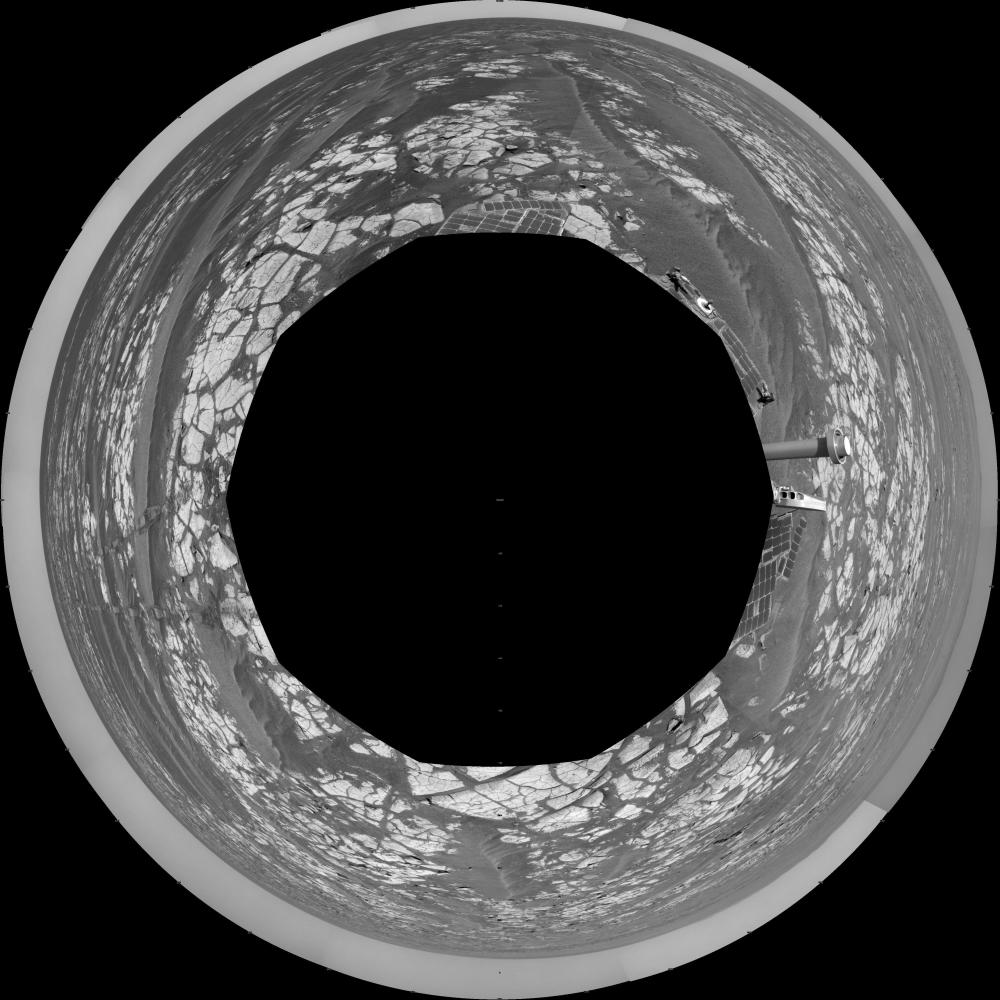
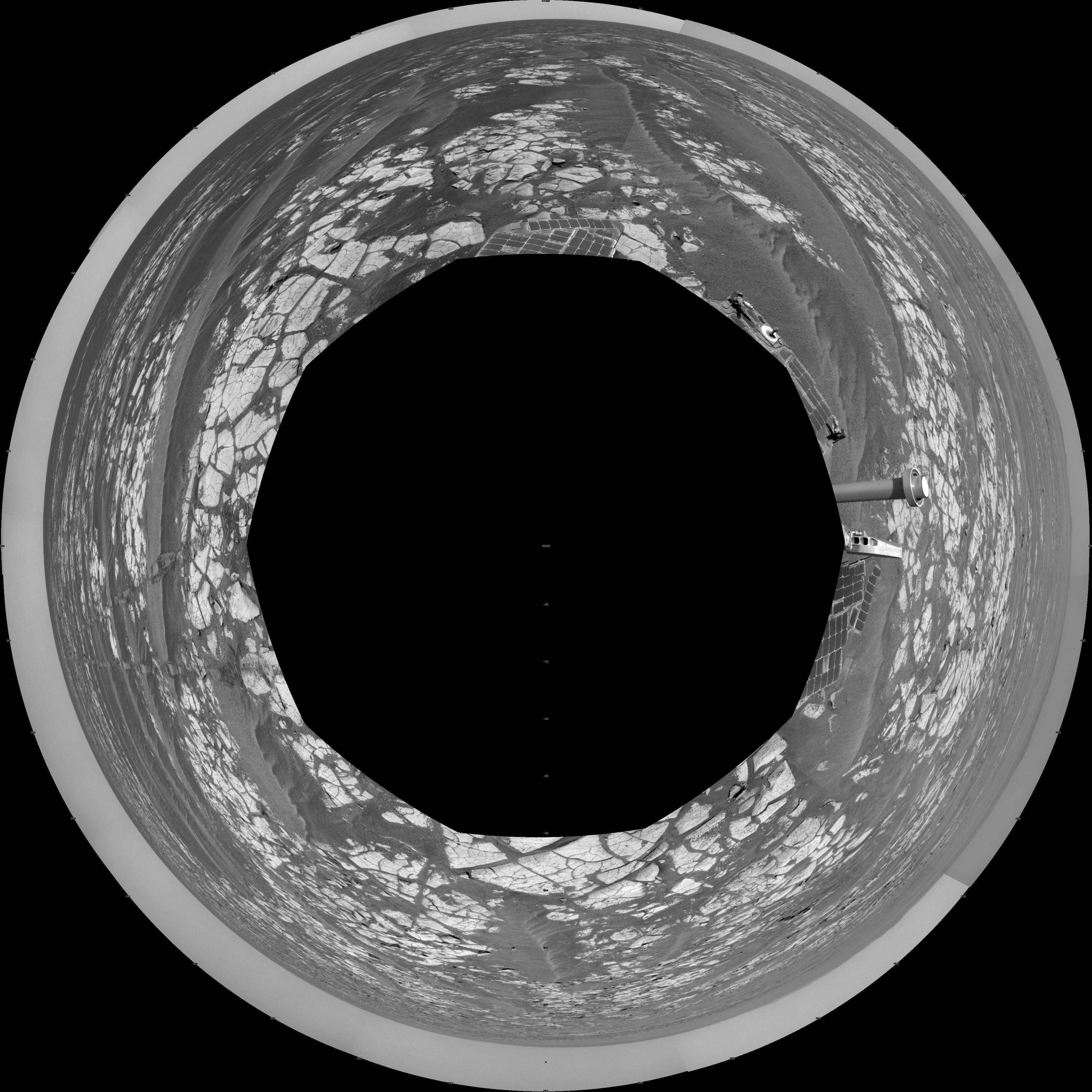
Opportunity’s Surroundings After Sol 2393 Drive (Polar)
- Click the image above for a larger view
- Full-Res JPEG (4077 x 4077) (1.5 MB)
- Full-Res TIFF (4077 x 4077) (16.6 MB)
Caption:
This mosaic of images from the navigation camera on NASA's Mars Exploration Rover Opportunity shows surroundings of the rover's location following an 100.7-meter (330-foot) drive during the 2,393rd Martian day, or sol, of Opportunity's mission on Mars (Oct. 17, 2010). North is at the top.
The camera took the component images for this 360-degree panorama during sols 2393 and 2394. The terrain includes light-toned bedrock and darker ripples of wind-blown sand. For scale, the distance between the parallel wheel tracks in the right half of the image is about 1 meter (about 40 inches).
This view is presented as a polar projection.
Cataloging Keywords:
| Name | Value | Additional Values |
|---|---|---|
| Target | Mars | |
| System | ||
| Target Type | Planet | |
| Mission | Mars Exploration Rover (MER) | |
| Instrument Host | Opportunity (MER-B) | |
| Host Type | Rover | |
| Instrument | Navigation Camera (Navcam) | |
| Detector | ||
| Extra Keywords | Grayscale | |
| Acquisition Date | ||
| Release Date | 2010-11-12 | |
| Date in Caption | 2010-10-17 | |
| Image Credit | NASA/JPL-Caltech | |
| Source | photojournal.jpl.nasa.gov/catalog/PIA13590 | |
| Identifier | PIA13590 | |