|
Mercury’s Vast Expanses of Smooth Plains
- Click the image above for a larger view
- Full-Res JPEG (3000 x 2993) (1.1 MB)
- Full-Res TIFF (3000 x 2993) (9.0 MB)
Caption:
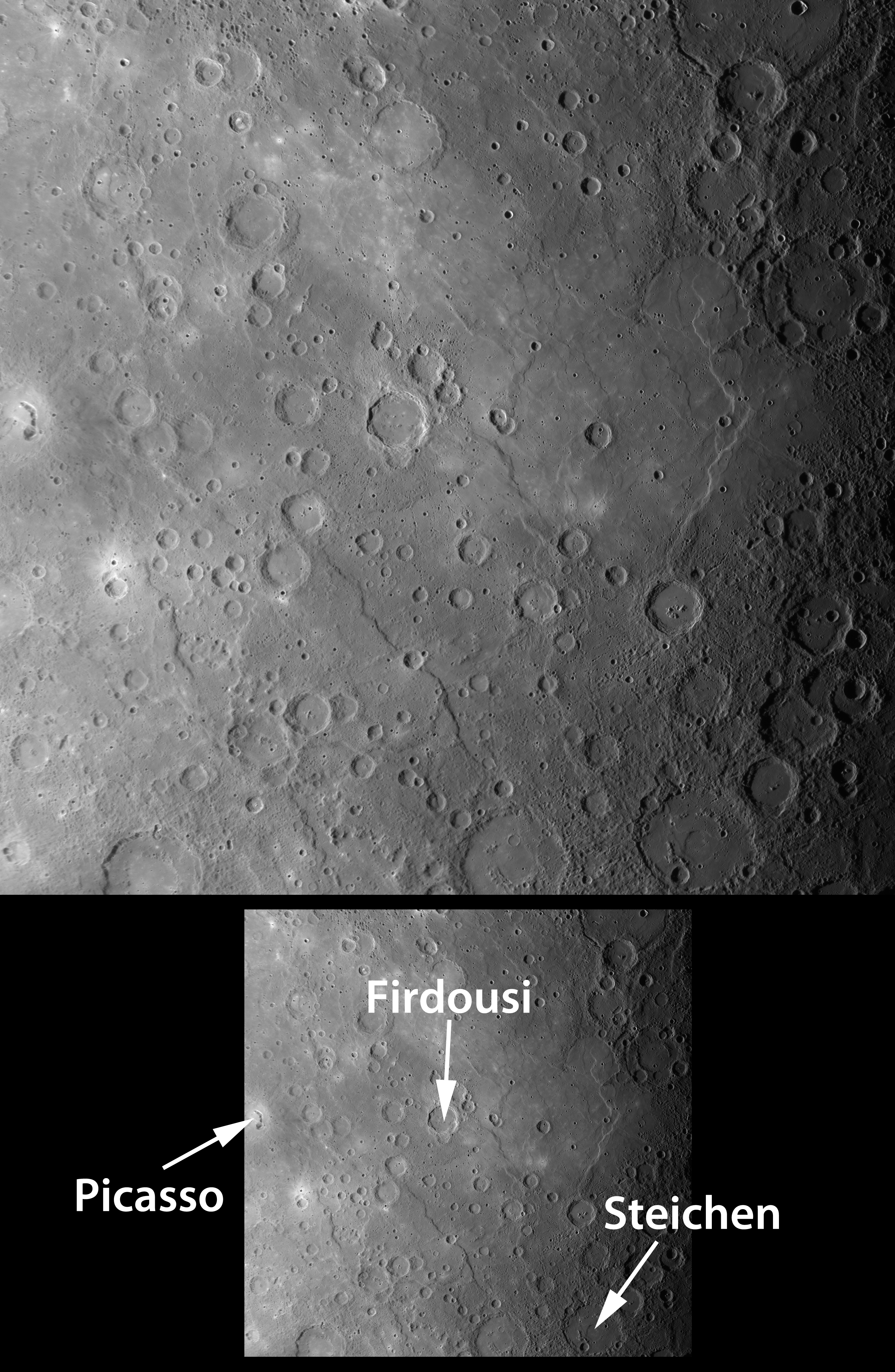
Click on the image for larger annotated version
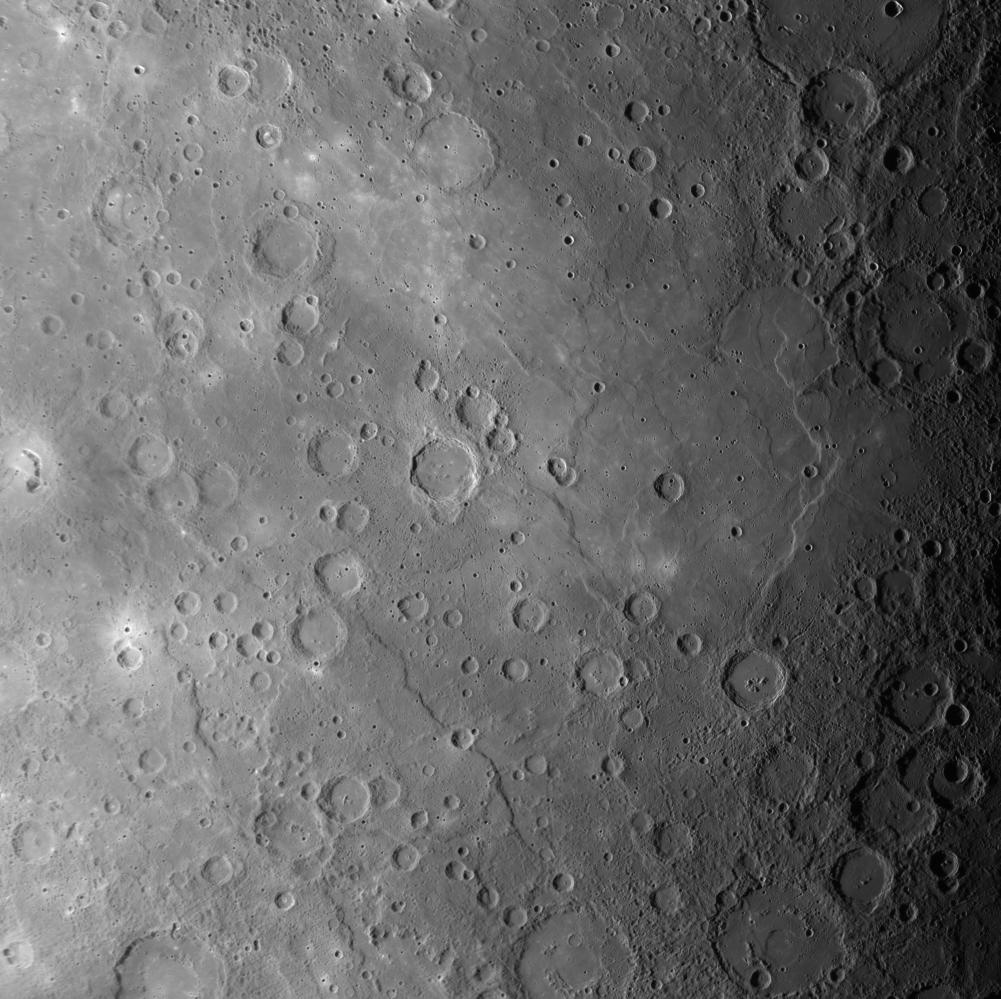
This scene, a mosaic of images acquired as MESSENGER approached Mercury for its third flyby of the planet, shows a large expanse of smooth plains near the center of the image. Most smooth plains are believed to have formed by lavas that flooded Mercury's surface . In this view, craters are visible that have been nearly filled with lava, leaving only traces of their circular rims. Curving scarps (cliffs) and "wrinkle ridges" can also be seen running mostly from top to bottom in the image. The density of impact craters on the smooth plains is less than on the heavily cratered terrain visible in the upper right and lower right corners of this image. The presence of fewer impact craters per unit area means that the volcanic smooth plains are younger than the battered cratered terrain. During orbital observations beginning in 2011, MESSENGER will gather high-resolution and color imaging data to map the global extent of Mercury's volcanic smooth plains, gaining clues to the composition of the plains and unraveling the history of volcanism on the Solar System's innermost planet.
The named craters Picasso , Firdousi , and Steichen are visible in this scene. Click on their links to read more about each of these craters.
Date Acquired:
September 29, 2009
Instrument:
Narrow Angle Camera (NAC) of the Mercury Dual Imaging System (MDIS)
Scale:
The bottom edge of this image is approximately 1450 kilometers (900 miles) across
Background Info:
These images are from MESSENGER, a NASA Discovery mission to conduct the first orbital study of the innermost planet, Mercury. For information regarding the use of images, see the MESSENGER image use policy .
Cataloging Keywords:
| Name | Value | Additional Values |
|---|---|---|
| Target | Mercury | |
| System | ||
| Target Type | Planet | |
| Mission | MESSENGER | |
| Instrument Host | MESSENGER | |
| Host Type | Orbiter | |
| Instrument | Mercury Dual Imaging System (MDIS) | |
| Detector | Narrow Angle Camera (NAC) | |
| Extra Keywords | Crater, Grayscale, Impact, Map, Volcano | |
| Acquisition Date | ||
| Release Date | 2010-11-23 | |
| Date in Caption | 2009-09-29 | |
| Image Credit | NASA/Johns Hopkins University Applied Physics Laboratory/Carnegie Institution of Washington | |
| Source | photojournal.jpl.nasa.gov/catalog/PIA13676 | |
| Identifier | PIA13676 | |