skip to navigation
|
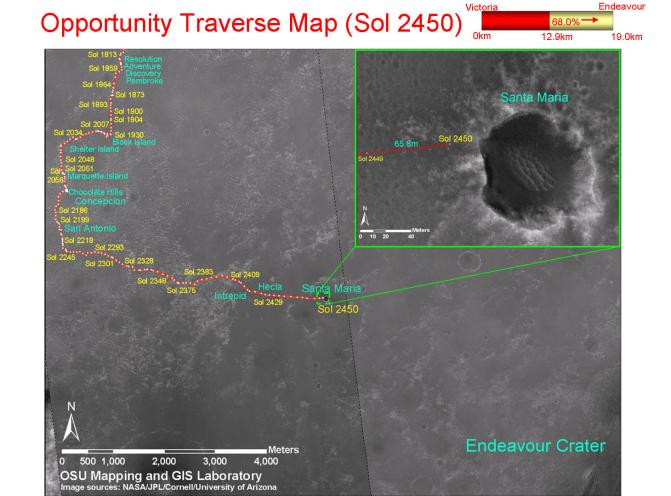
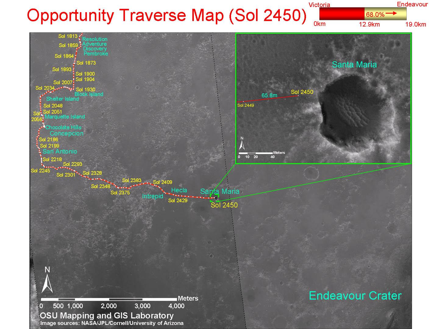
Opportunity Traverse Map, Sol 2450
- Click the image above for a larger view
- Full-Res JPEG (1460 x 1080) (178.0 kB)
- Full-Res TIFF (1460 x 1080) (4.7 MB)
Caption:
This map shows the path that NASA's Mars Exploration Rover Opportunity followed from the 1,813th Martian day, or sol, of its work on Mars (Feb. 28, 2009) to Sol 2450 (Dec. 15, 2010). On Sol 2450, Opportunity approached a crater informally named "Santa Maria," which is about 90 meters (295 feet) in diameter.
The base map is imagery from the Context Camera on NASA's Mars Reconnaissance Orbiter.
Background Info:
Opportunity completed its three-month prime mission in April 2004.
Cataloging Keywords:
| Name | Value | Additional Values |
|---|---|---|
| Target | Mars | |
| System | ||
| Target Type | Planet | |
| Mission | Mars Exploration Rover (MER) | Mars Reconnaissance Orbiter (MRO) |
| Instrument Host | Mars Reconnaissance Orbiter | Opportunity (MER-B), Spirit (MER-A) |
| Host Type | Orbiter | Rover |
| Instrument | Context Camera (CTX) | |
| Detector | ||
| Extra Keywords | Color, Crater, Map | |
| Acquisition Date | ||
| Release Date | 2010-12-17 | |
| Date in Caption | 2009-02-28 | 2010-12-15 |
| Image Credit | NASA/JPL-Caltech/MSSS/Cornell/Ohio State Univ. | |
| Source | photojournal.jpl.nasa.gov/catalog/PIA13731 | |
| Identifier | PIA13731 | |