Mounds in a Melt Pond
Caption:
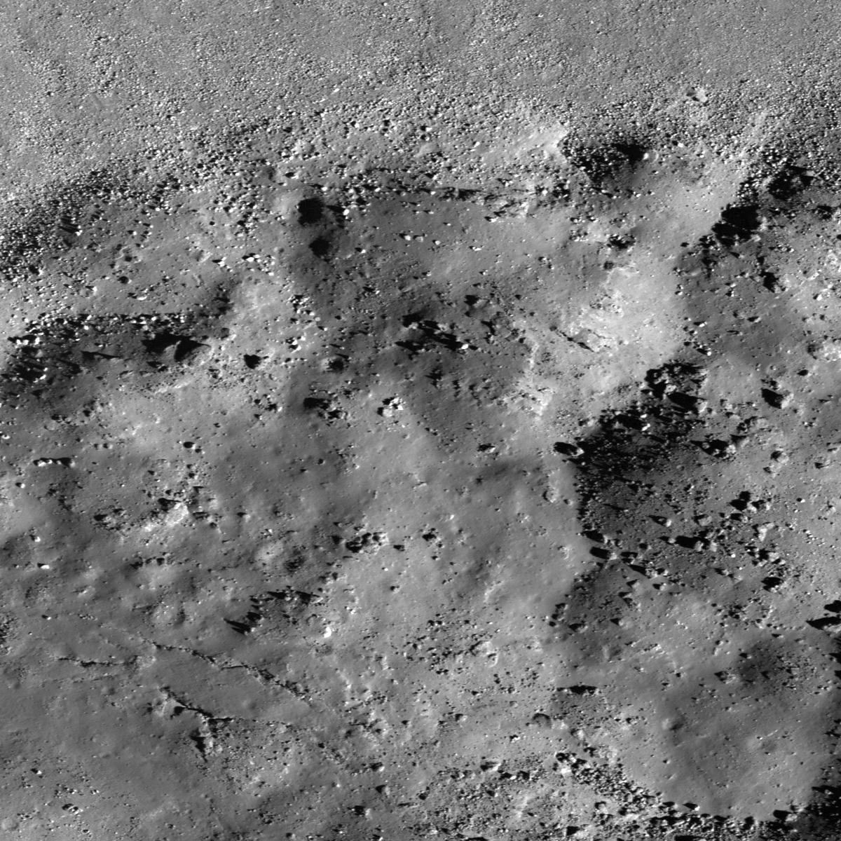
Bottom of Laplace A crater cavity. LROC NAC M129466485R, 0.80 m/pixel, image width is about 960 meters. Sunlight is from lower-right side, incidence angle is 66°.
This image from NASA's Lunar Reconnaissance Orbiter (LRO) reveals the bottom of Laplace A crater, specifically the north edge of its impact melt pond. The upper side of this image corresponds to the lower part of crater wall, covered by lots of boulders. The surface of this melt pond consists of dozens of low mounds, possibly due to deformation of the pond surface after partial solidification. Perhaps rebound of the crater floor caused the level of molten material beneath the crust to rise and create small breakouts to the surface. There is also a cone shaped depression near these mounds. It may have formed as magma drained out from below?
|
|
Click on image for larger version
|
|
|
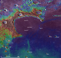
Context map around Laplace A crater. Image center location is 42.57°N, -29.73°E. LROC WAC 100 m/pix mono-chrome global mosaic overlayed by WAC color DTM 500 m/px. Blue long box at the image center corresponds to the footprint of today's featured NAC image
|
|
Background Info:
NASA's Goddard Space Flight Center built and manages the mission for the Exploration Systems Mission Directorate at NASA Headquarters in Washington. The Lunar Reconnaissance Orbiter Camera was designed to acquire data for landing site certification and to conduct polar illumination studies and global mapping. Operated by Arizona State University, LROC consists of a pair of narrow-angle cameras (NAC) and a single wide-angle camera (WAC). The mission is expected to return over 70 terabytes of image data.
Cataloging Keywords:
| Name |
Value |
Additional Values |
| Target |
Moon |
|
| System |
Earth |
|
| Target Type |
Satellite |
|
| Mission |
Lunar Reconnaissance Orbiter (LRO) |
|
| Instrument Host |
Lunar Reconnaissance Orbiter |
|
| Host Type |
Orbiter |
|
| Instrument |
Lunar Reconnaissance Orbiter Camera (NAC) |
|
| Detector |
|
Narrow Angle Camera (NAC), Wide Angle Camera (WAC) |
| Extra Keywords |
Crater, Grayscale, Impact, Map |
| Acquisition Date |
|
| Release Date |
2011-02-24 |
| Date in Caption |
|
|
| Image Credit |
NASA/GSFC/Arizona State University |
| Source |
photojournal.jpl.nasa.gov/catalog/PIA14013 |
| Identifier |
PIA14013 |

