|
Opportunity Traverses Through 2,700 Martian Days
- Click the image above for a larger view
- Full-Res JPEG (5664 x 7979) (6.8 MB)
- Full-Res TIFF (5664 x 7979) (45.3 MB)
Caption:
Annotated version
Click on the image for larger view
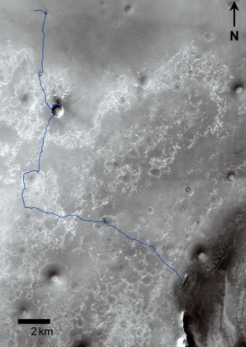
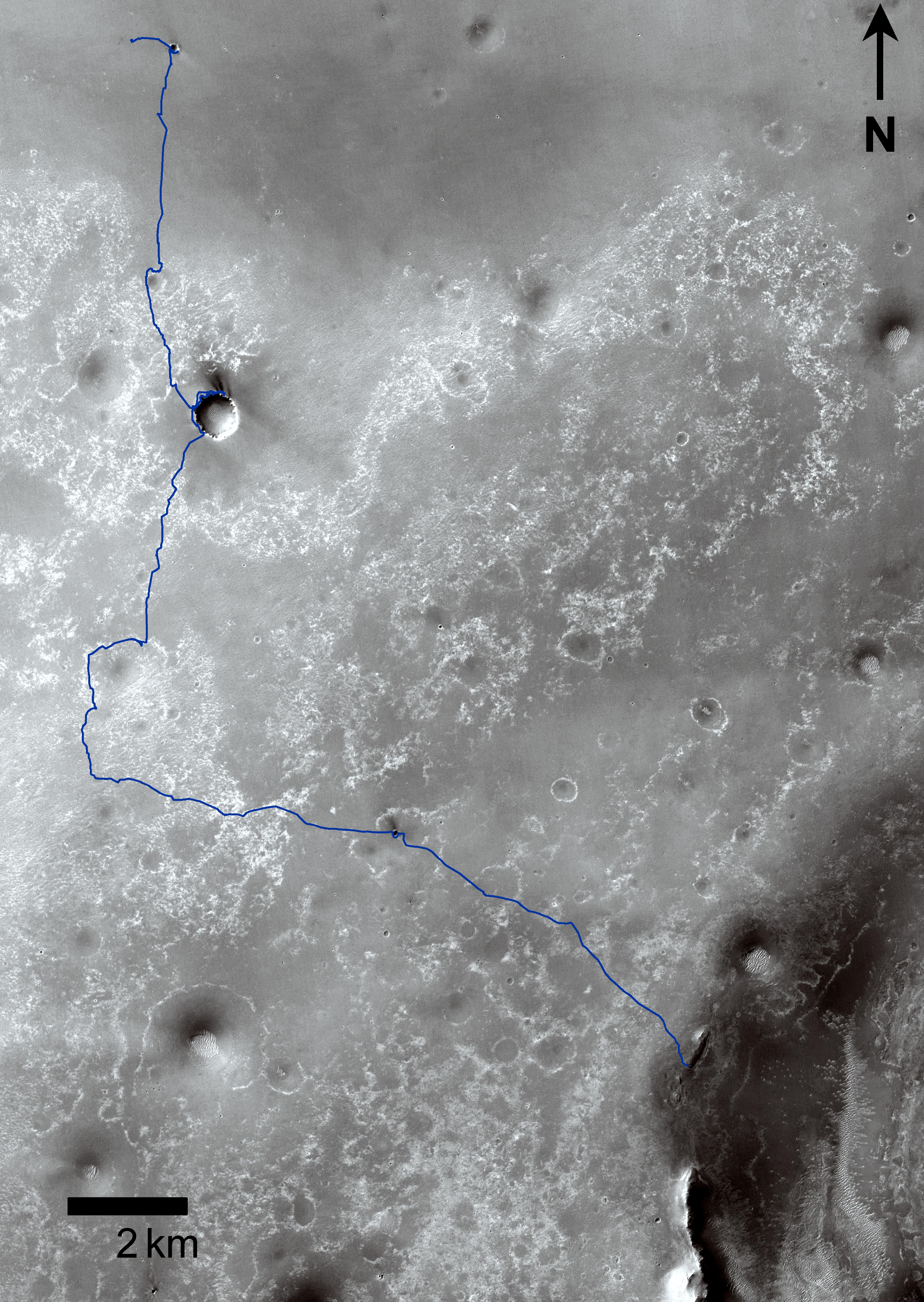
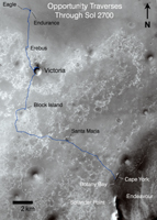
This map shows the 20.8-mile (33.5-kilometer) route driven by NASA's Mars Exploration Rover Opportunity from the site of its landing, inside Eagle crater at the upper left, to its location more than 91 months later, on the Cape York section of the rim of Endeavour crater.
The blue line covers traverses through the 2,700th Martian day, or sol, of Opportunity's work on Mars (Aug. 29, 2011). The base image for the map is a mosaic of images taken by the Context Camera on NASA's Mars Reconnaissance Orbiter. Endurance, Erebus, Victoria, and Santa Maria are craters examined by Opportunity. Block Island is an iron meteorite discovered during a traverse. The scale bar is 2 kilometers (1.24 miles).
Background Info:
Opportunity completed its three-month prime missions in April 2004 and has continued operations in bonus extended missions. The Mars Reconnaissance Orbiter reached Mars in 2006, completed its prime mission in 2010, and is also working in an extended mission. NASA's Jet Propulsion Laboratory, a division of the California Institute of Technology in Pasadena, manages the Mars Exploration Rover Project and the Mars Reconnaissance Orbiter for the NASA Science Mission Directorate, Washington. Malin Space Science Systems, San Diego, built and operates the orbiter's Context Camera.
Cataloging Keywords:
| Name | Value | Additional Values |
|---|---|---|
| Target | Mars | |
| System | ||
| Target Type | Planet | |
| Mission | Mars Exploration Rover (MER) | Mars Reconnaissance Orbiter (MRO) |
| Instrument Host | Mars Reconnaissance Orbiter | Opportunity (MER-B) |
| Host Type | Orbiter | Rover |
| Instrument | Context Camera (CTX) | |
| Detector | ||
| Extra Keywords | Color, Crater, Map | |
| Acquisition Date | ||
| Release Date | 2011-09-01 | |
| Date in Caption | 2011-08-29 | |
| Image Credit | NASA/JPL-Caltech/MSSS | |
| Source | photojournal.jpl.nasa.gov/catalog/PIA14536 | |
| Identifier | PIA14536 | |